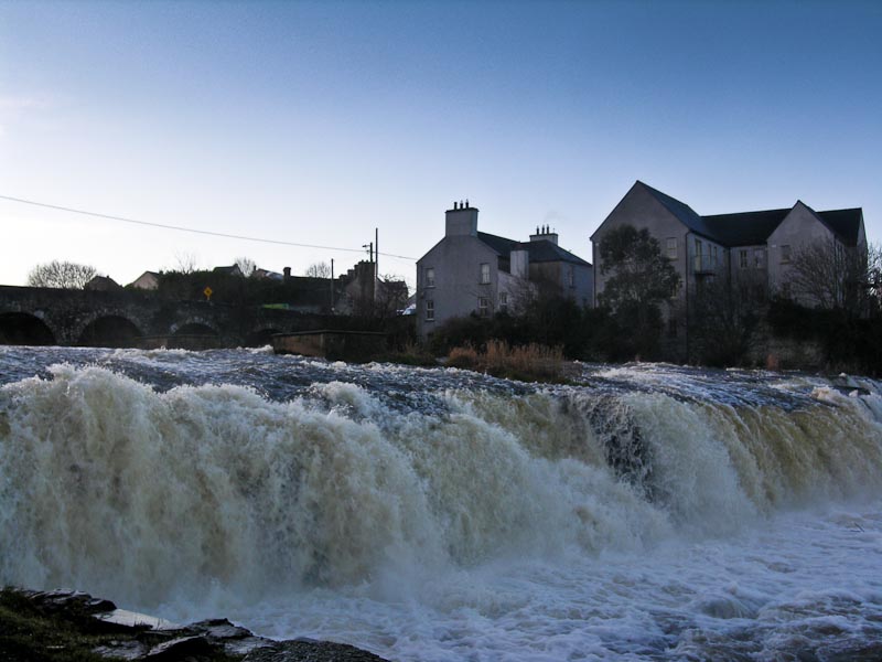
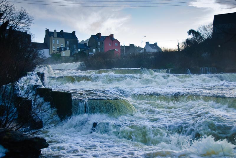
|
2002 Journal |
2004 Journal |
2005 Journal
2007 Journal
| 2011 Journal
If we've given a link to a B&B, we recommend it. It should be easy to spot
the ones we don't recommend.
Pricing given in either US dollars or Euros depending on our whim.
Exchange Rate in 2007 was 1.48 dollar to 1 Euro.
All images are the property of
Karott.com, please
respect our effort in making them available.
You can purchase some of them
here or contact us for usage information.
|
2007-2008
|
|
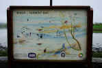
View Map
of Route. Clicking on a number on the map will take you to that location in
the journal.
View Gallery
of the best images of our 2007-8 trip.
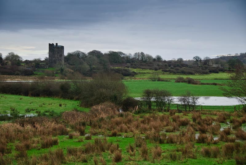
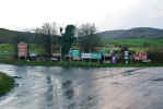
We started this trip with B&B reservations in Dublin for the
first few days, then headed down thru Avoca to Inchigeelagh. From there we
dropped down to the Sheep's Head for a night and then to Castletownbere to
stay with our friends the Harringtons. We spent Christmas and Wren's Day in
Ballyferriter and then spent a lovely night in Camp. Then off to Co. Clare
and Kilfenora. We planned to stay a week and then wander North, but weather
and Clare inspired us stay two weeks and then fly out of Shannon.
|
| Itinerary: |
|
Wednesday 12/12 - Portland,
OR to Dublin
Thursday 12/13 - 'Round
Dublin
Friday 12/14 - More 'Round
Dublin
Saturday 12/15 - 'Round
and 'Round Dublin
Sunday 12/16 - Dublin
to Avoca, Co. Wicklow
Monday 12/17 - Avoca,
Co. Wicklow to Inchigeelagh, Co. Cork
Tuesday 12/18 - Inchigeelagh,
Co. Cork
Wednesday 12/19 - Inchigeelagh,
Co. Cork
Thursday 12/20 - Inchigeelagh,
Co. Cork to Kilchrohane, Co. Cork
Friday 12/21 - Kilchrohane,
Co. Cork to Castletownbere Co. Cork
Saturday 12/22 - Castletownbere
Co. Cork
Sunday 12/23 - Castletownbere
Co. Cork to Ballyferriter, Co. Kerry
Monday 12/24 - Ballyferriter,
Co. Kerry
Tuesday 12/25 - Ballyferriter,
Co. Kerry
Wednesday 12/26 - Ballyferriter,
Co. Kerry
Thursday 12/27 - Ballyferriter,
Co. Kerry
Friday 12/28 - Ballyferriter,
Co. Kerry
|
Saturday 12/29
- Ballyferriter, Co. Kerry to Camp, Co. Kerry
Sunday 12/30 - Camp, Co. Kerry to Kilfenora,
Co. Clare
Monday 12/31 - Kilfenora, Co. Clare
Tuesday 1/1 - Kilfenora, Co. Clare
Wednesday 1/2 - Kilfenora, Co. Clare
Thursday 1/3 - Kilfenora, Co. Clare
Friday 1/4 - Kilfenora, Co. Clare
Saturday 1/5 - Kilfenora, Co. Clare
Sunday 1/6 - Kilfenora, Co. Clare
Monday 1/7 - Kilfenora, Co. Clare
Tuesday 1/8 - Kilfenora, Co. Clare
Wednesday 1/9 - Kilfenora, Co. Clare
Thursday 1/10 - Kilfenora, Co. Clare
Friday 1/11 - Kilfenora, Co. Clare to
Shannon, Co. Clare
Saturday 1/12 - Shannon, Co. Clare
Sunday 1/13 - Dallas, TX
Monday 1/14 - Portland, OR
|
|
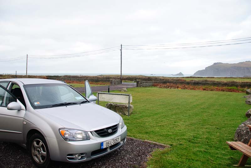
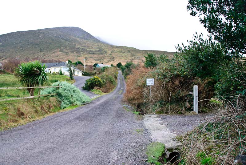
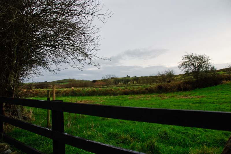
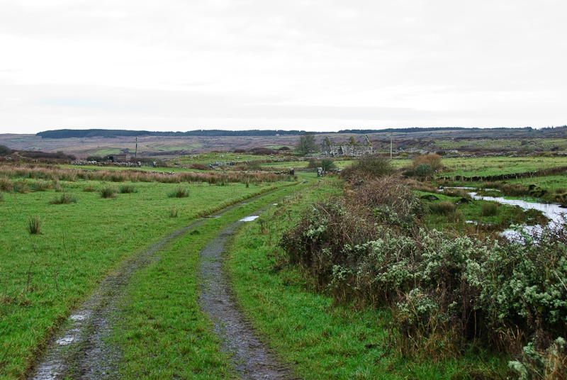
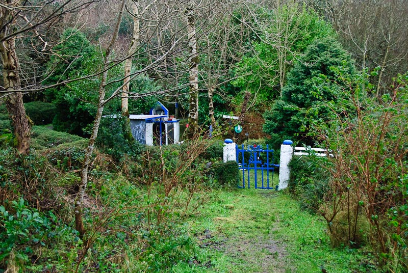
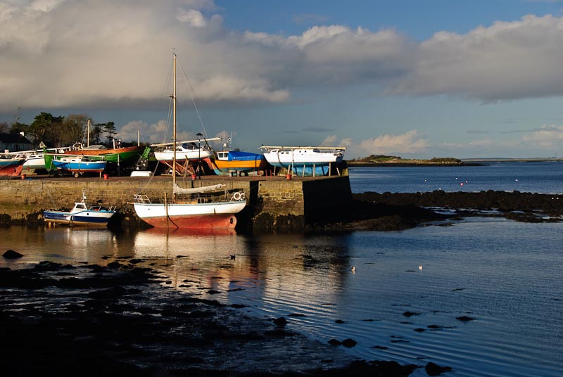
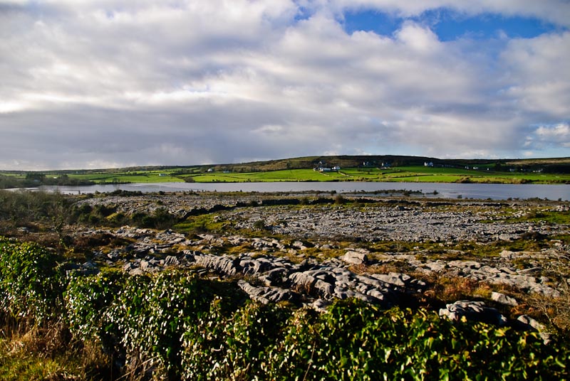
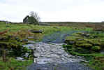
Ballyferriter, Co. Kerry to Camp, Co. Kerry
|
|
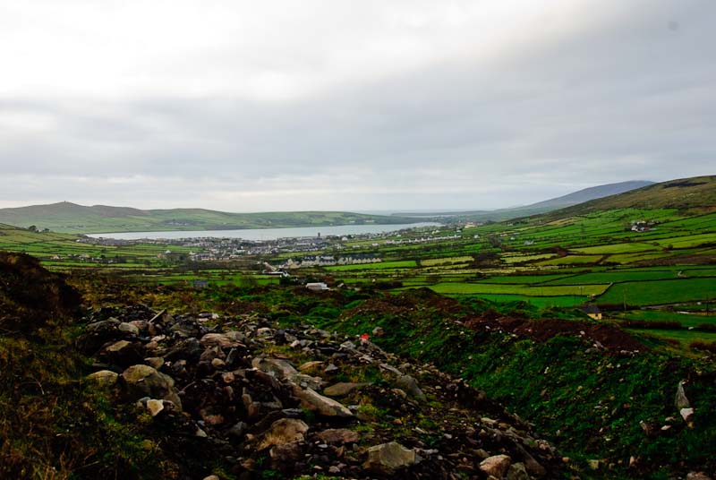
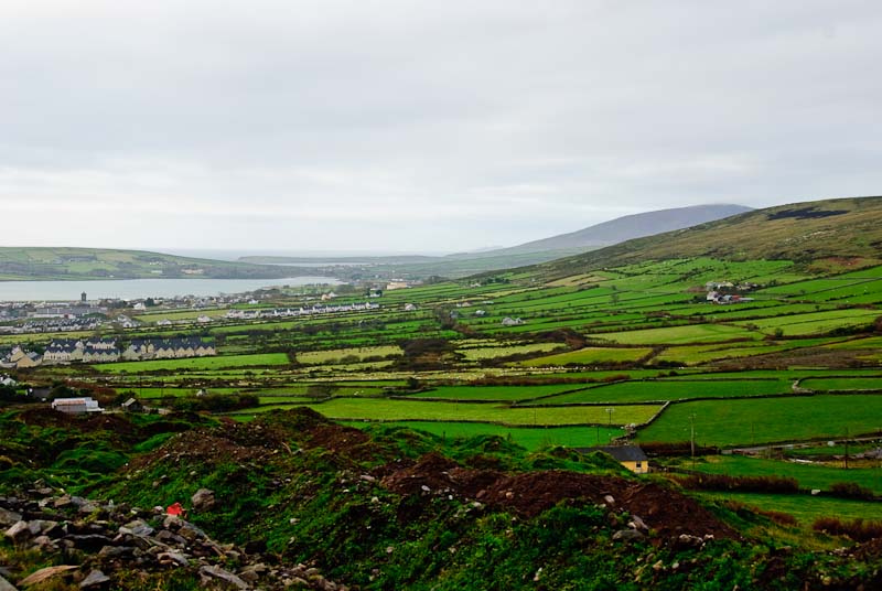
Sunday 12/30
 Time to leave the Dingle Peninsula and the
Suantra Cottages.
We packed and loaded the
car and removed all our garbage. We try and leave
the places we stay in as good or better condition than when we came, so we
spent some time cleaning up. We settled up for the electricity with Phil and
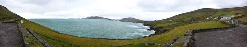
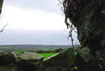
said our goodbyes. Of course we took the long route back to Dingle. We made
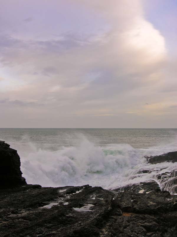
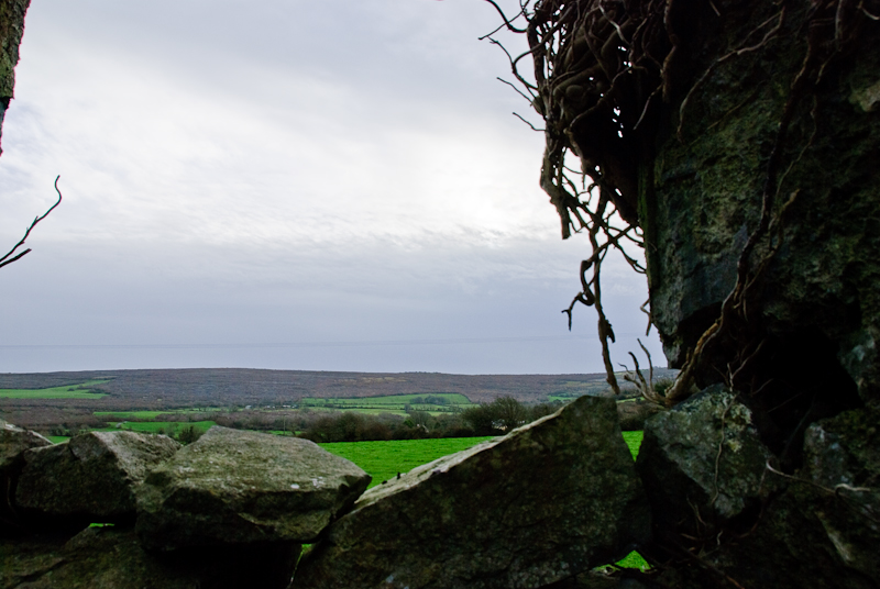
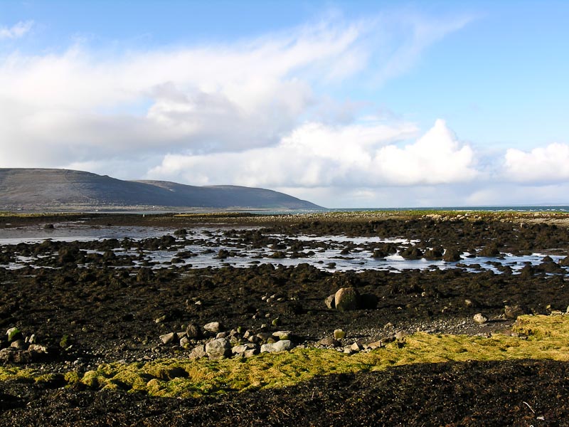
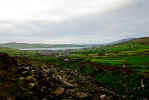
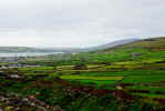
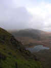
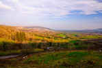
a stop once again at Cuminole North viewpoint and shot the panorama below.
The light wasn't great, but we took a few more stills and then headed further
down the road.
Time to leave the Dingle Peninsula and the
Suantra Cottages.
We packed and loaded the
car and removed all our garbage. We try and leave
the places we stay in as good or better condition than when we came, so we
spent some time cleaning up. We settled up for the electricity with Phil and
said our goodbyes. Of course we took the long route back to Dingle. We made
a stop once again at Cuminole North viewpoint and shot the panorama below.
The light wasn't great, but we took a few more stills and then headed further
down the road.

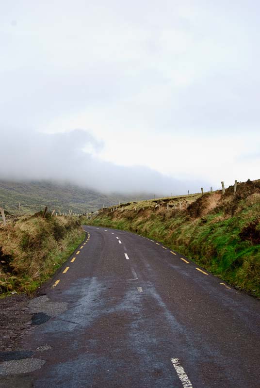
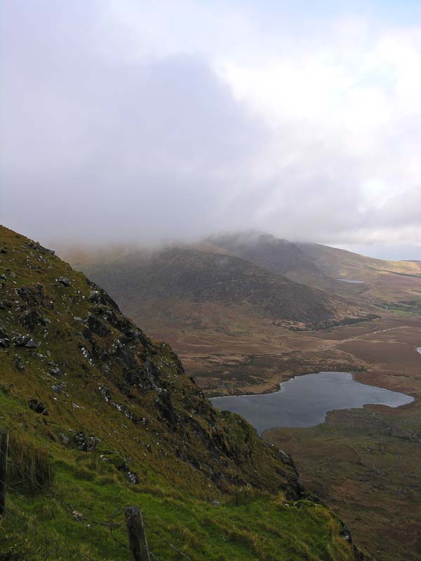
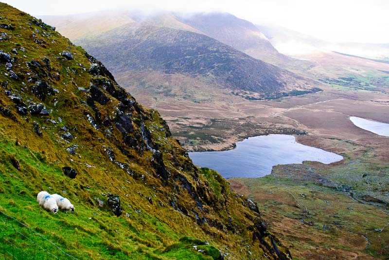
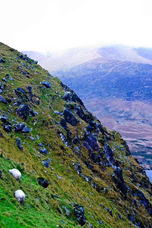
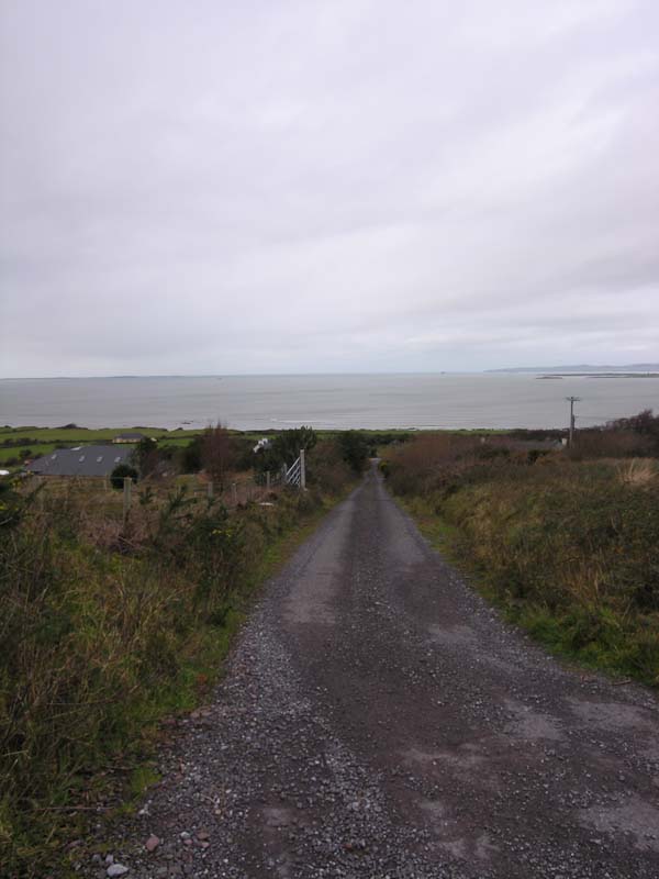
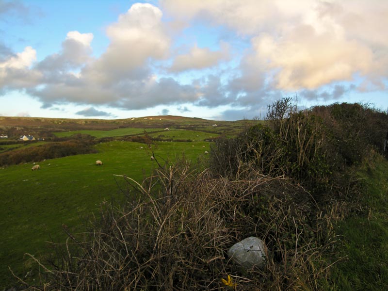
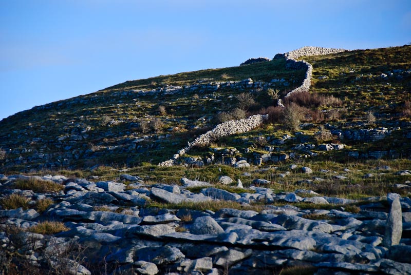
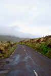
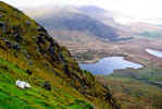
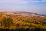
 Dingle was pretty quiet on a Sunday morning and we drove through and kept
going through town, past the Small Bridge bar and up the road towards
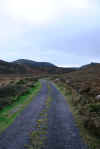
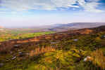
Conor Pass. The road is scenic and winds slowly upward through green hills.
Conor Pass is the highest pass in Ireland. This may not sound like much, but
the road is narrow, there is often construction and large trucks. As you rise
higher the mist and clouds get closer until you're engulfed in them. Up higher
the wind picks up and can clear things up. It is always a gamble as to visibility.
The wind wasn't as fierce this time around and you could actually stand upright,
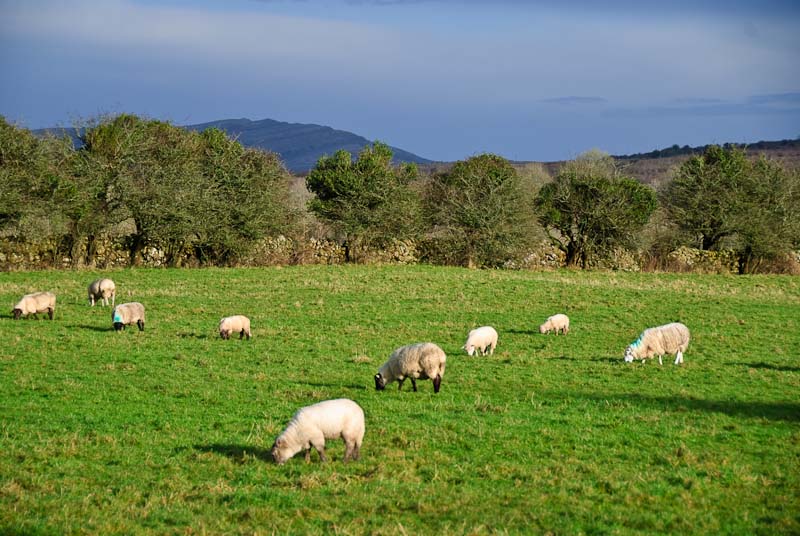
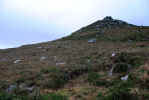
but it was cold. Sheep were clinging to a nearby hillside. I think the gorse
acted like velcro with the wool and kept them from tumbling.
Dingle was pretty quiet on a Sunday morning and we drove through and kept
going through town, past the Small Bridge bar and up the road towards
Conor Pass. The road is scenic and winds slowly upward through green hills.
Conor Pass is the highest pass in Ireland. This may not sound like much, but
the road is narrow, there is often construction and large trucks. As you rise
higher the mist and clouds get closer until you're engulfed in them. Up higher
the wind picks up and can clear things up. It is always a gamble as to visibility.
The wind wasn't as fierce this time around and you could actually stand upright,
but it was cold. Sheep were clinging to a nearby hillside. I think the gorse
acted like velcro with the wool and kept them from tumbling.
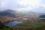
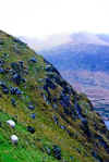

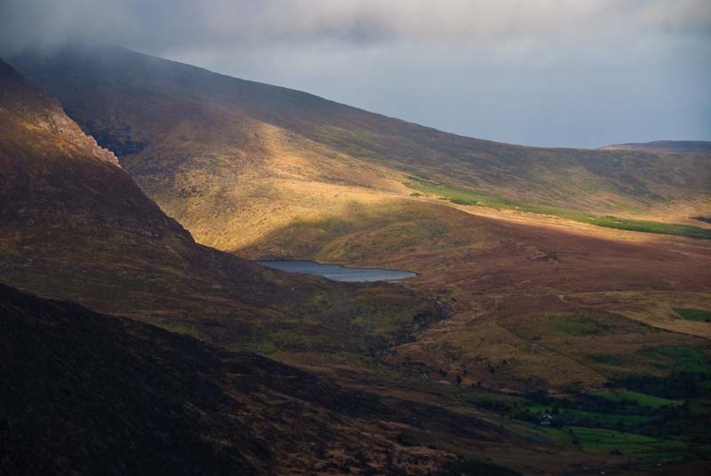
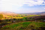
 After a few pictures from both sides of the pass, we got back in the
car,
stowed our camera gear and headed off. The other side of the pass is actually
a worse road and drive for the first half mile or so. The road narrows at
one point to a single lane with large rocks poised above. Once you get past
the waterfall (by it, not through it) the road improves and soon feels quite
comfortable as you head down into a forested area. We had been this way many
times but had not been able to explore as we were usually trying to get to
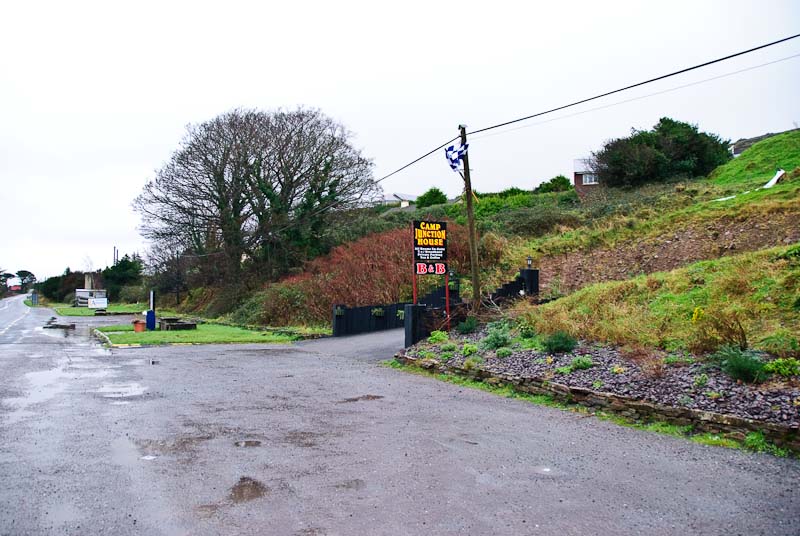
another destination quickly. This time we'd made a reservation in Camp at
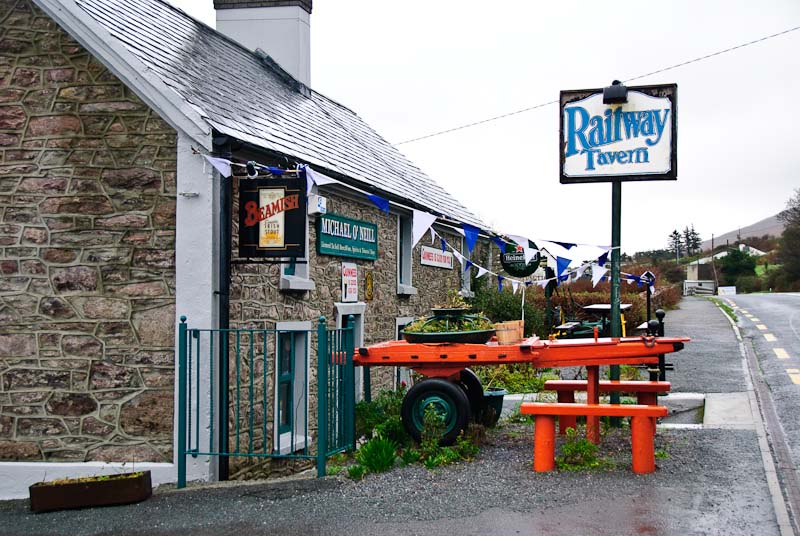
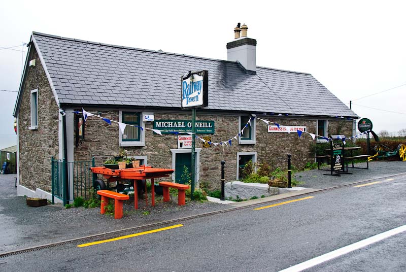
the Camp Junction House B&B
right across from Mike O'Neil's Railway Tavern. We'd stopped there each time
through, but never had been there during the evening. The place a a great
reputation for music and fun. All this gave us time to explore the immediate
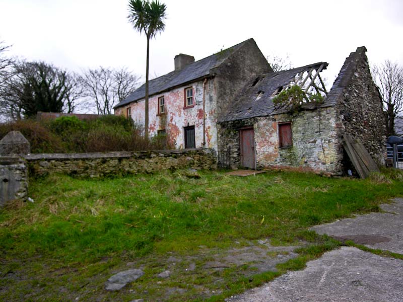
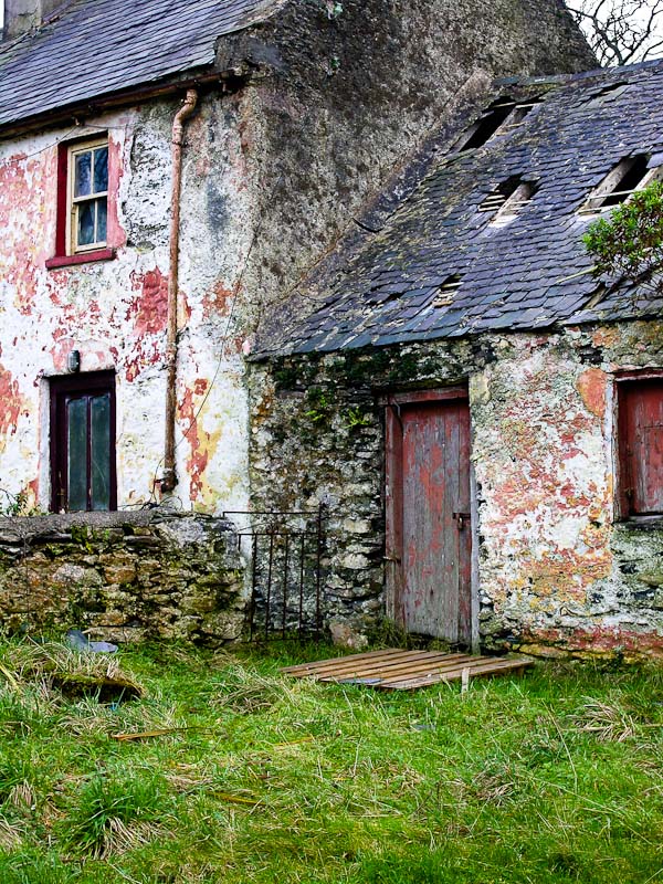
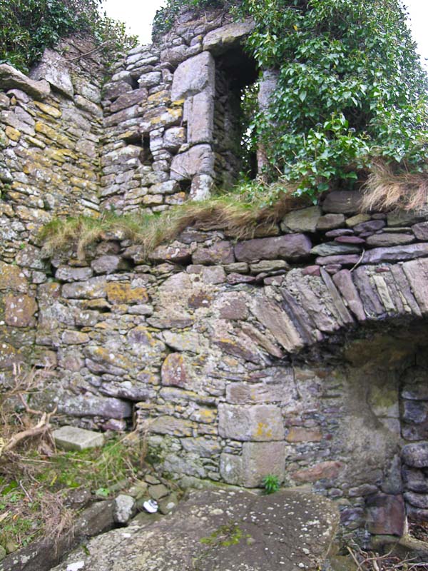
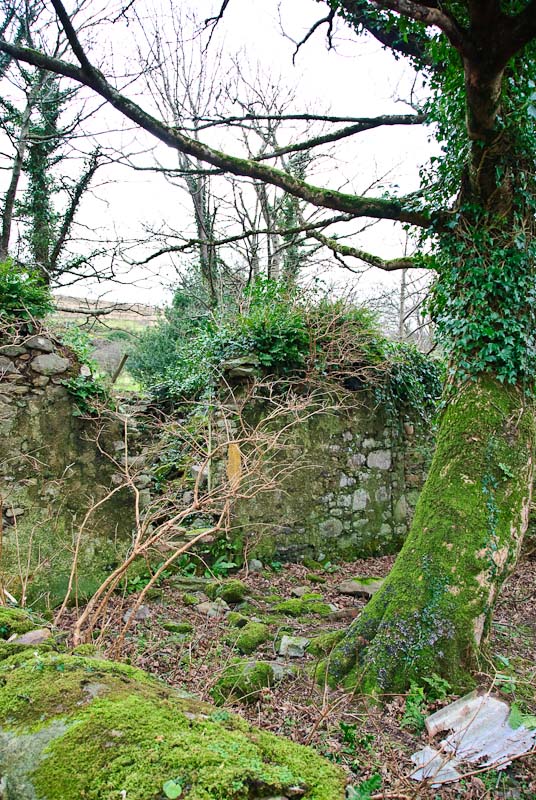
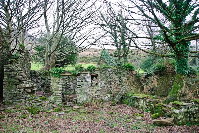
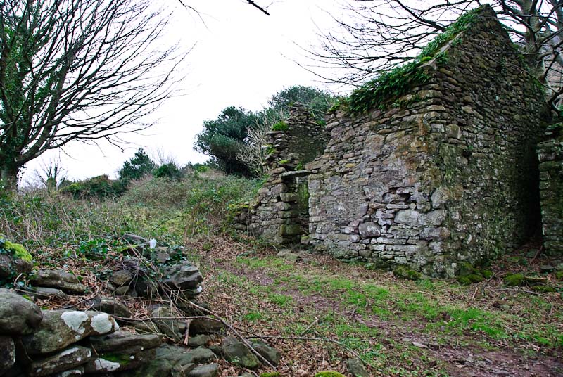
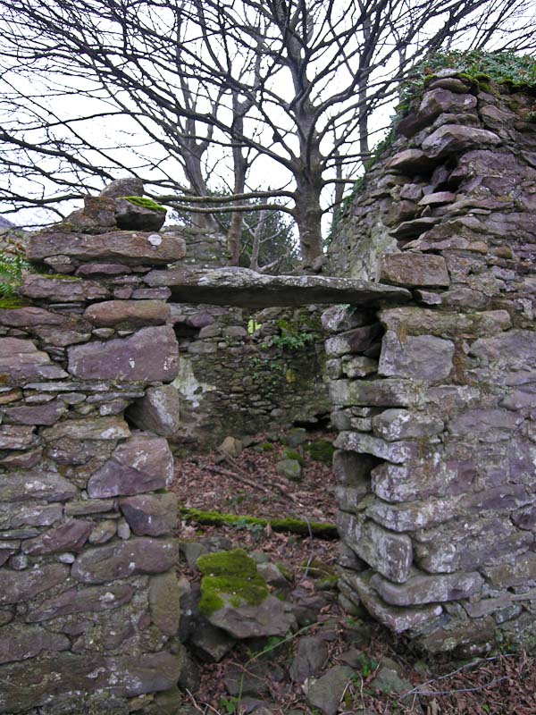
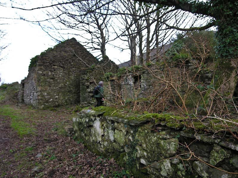
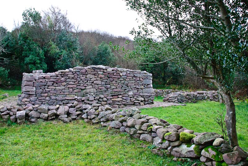
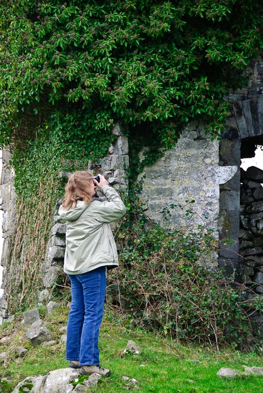
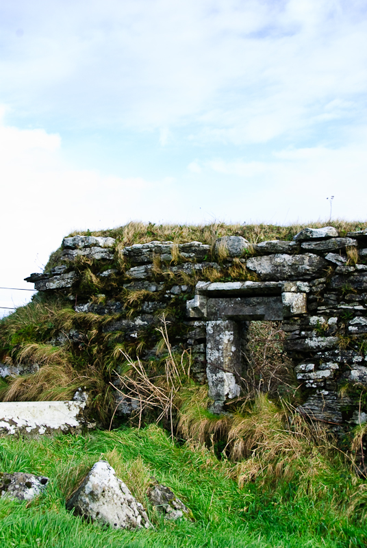
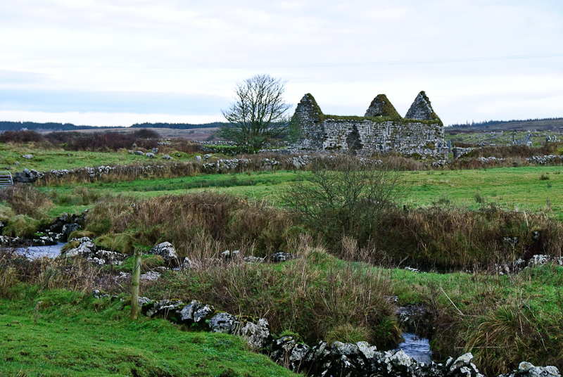
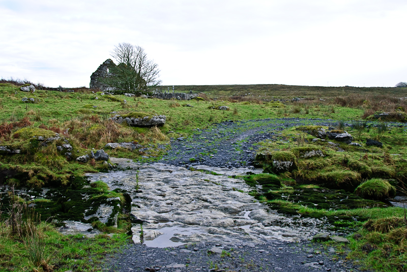
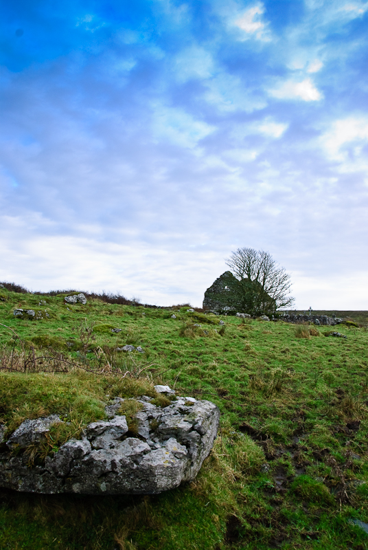
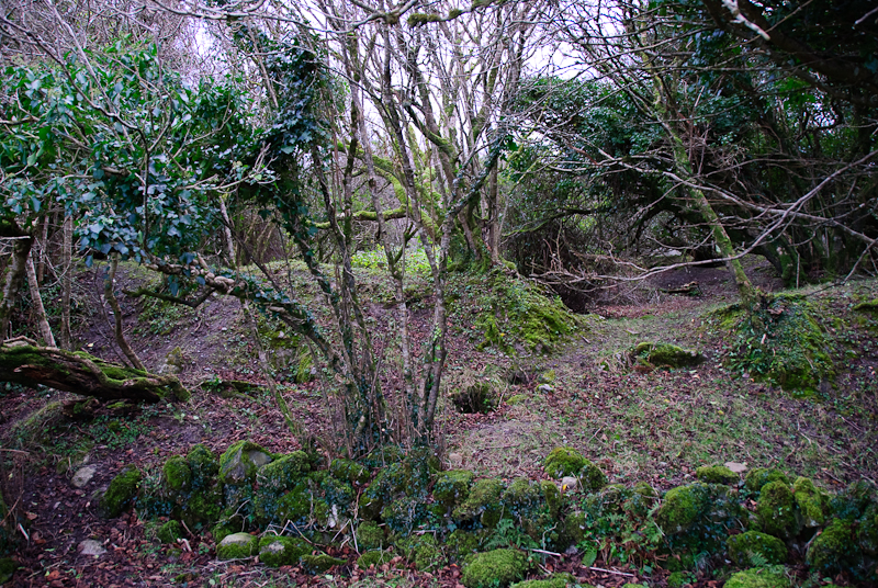
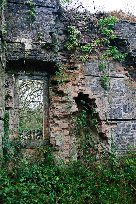
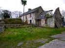
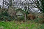
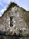
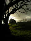
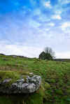
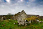
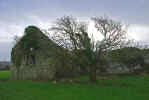
area. Along the way we saw in interesting ruined house decomposing slowly
by the side of the road. We stopped for a few pictures. We headed out somewhere
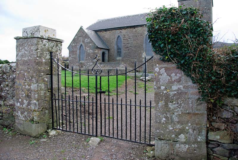
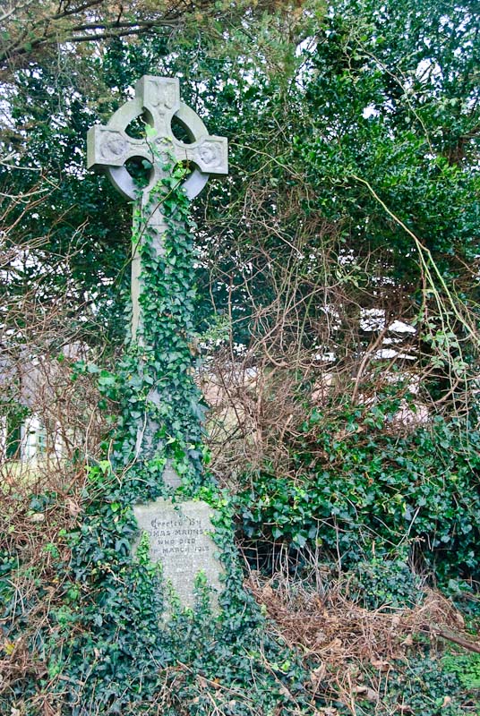
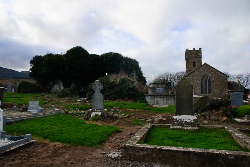
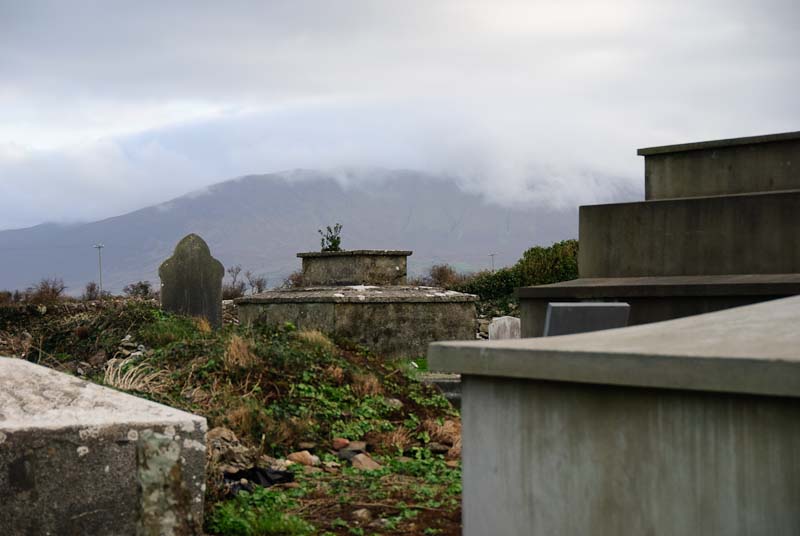
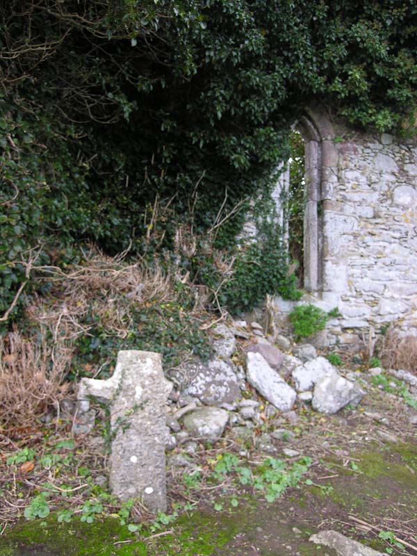
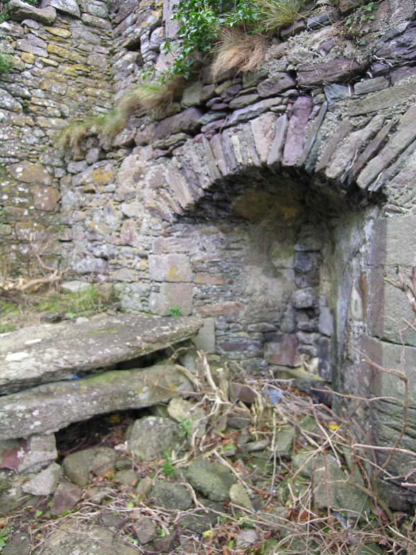
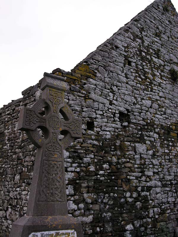
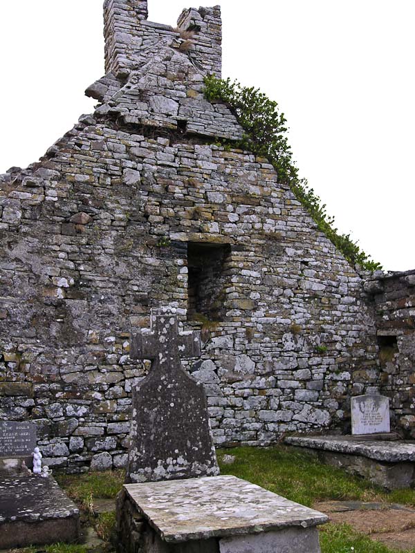
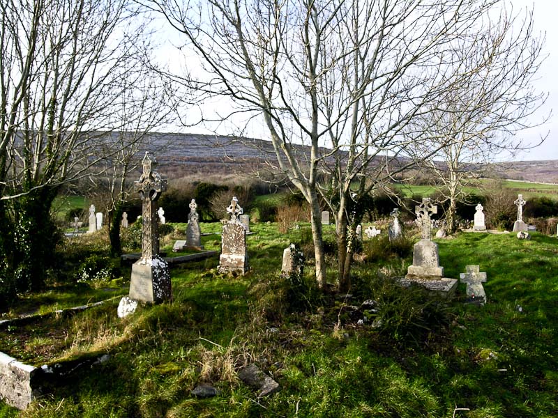
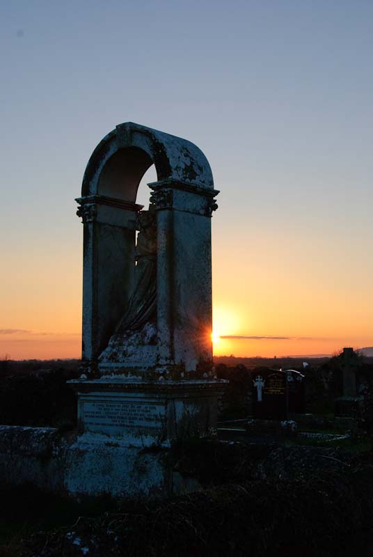
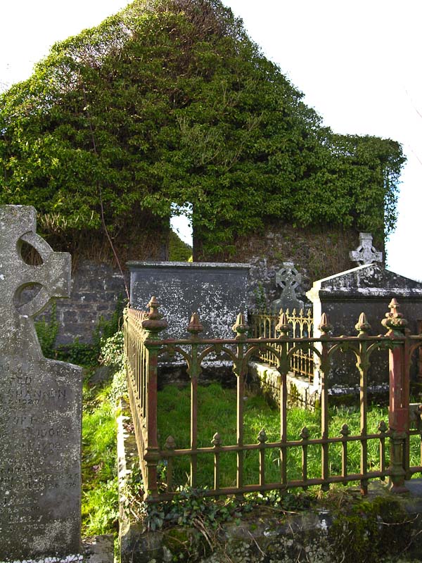
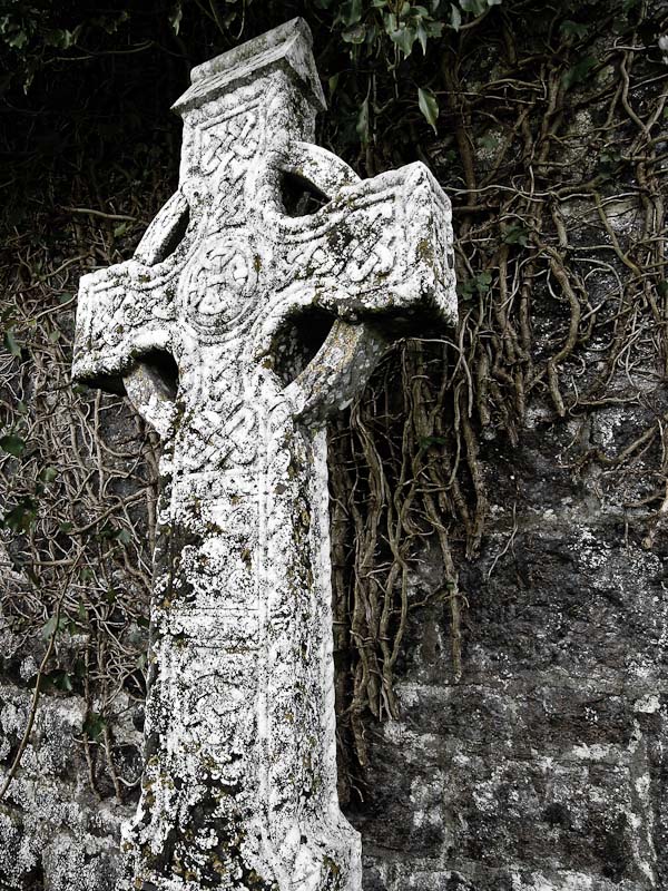
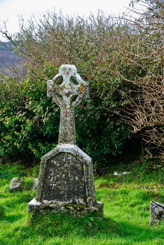
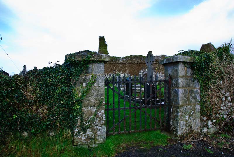
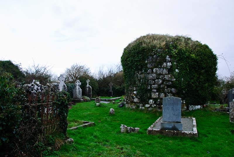
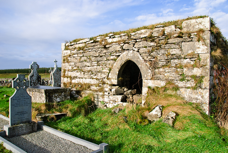
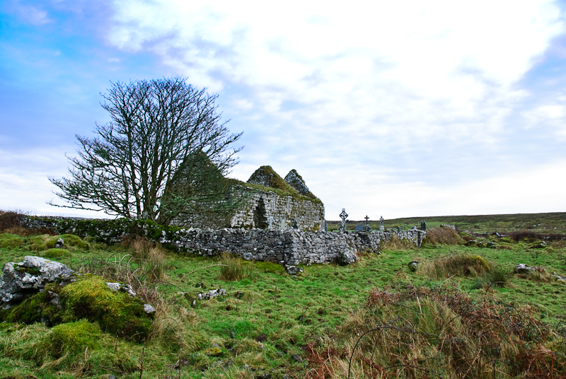
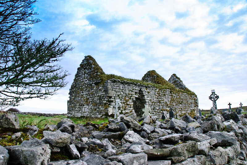
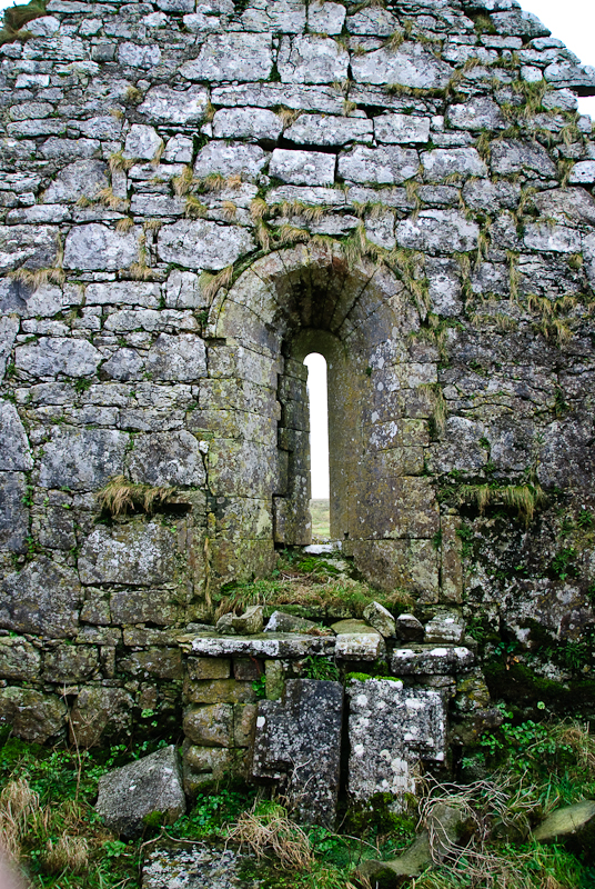
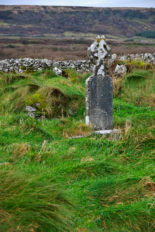
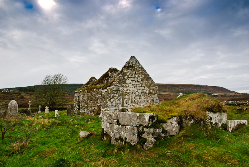
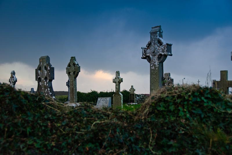
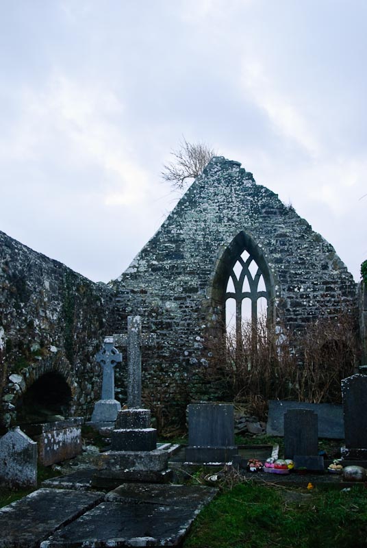
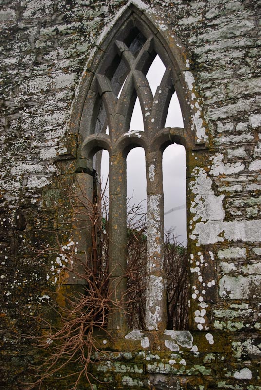
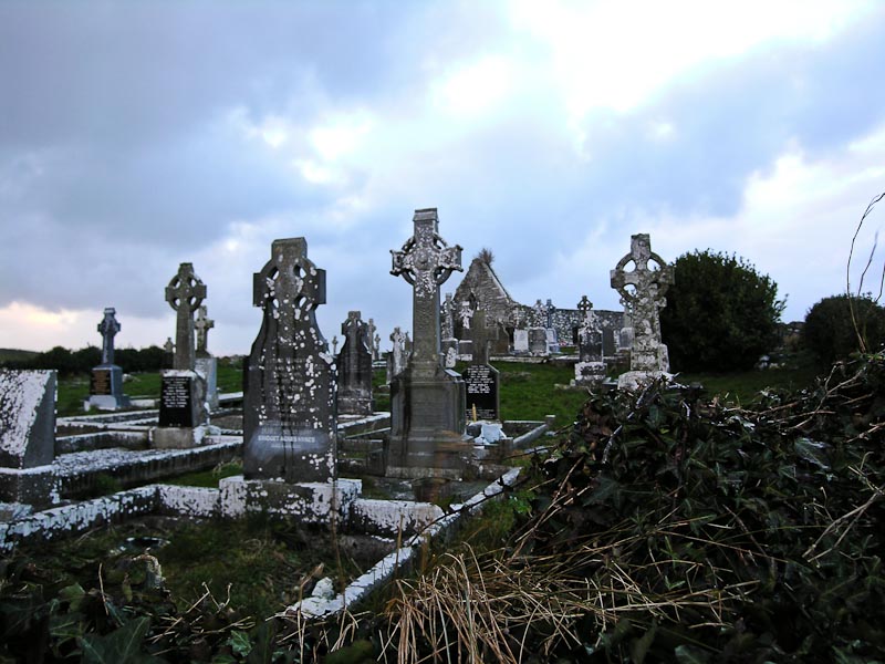
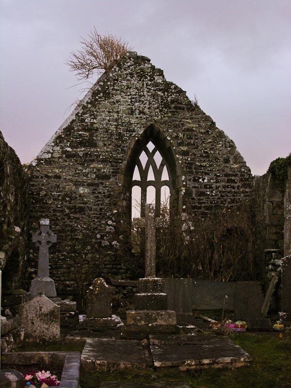
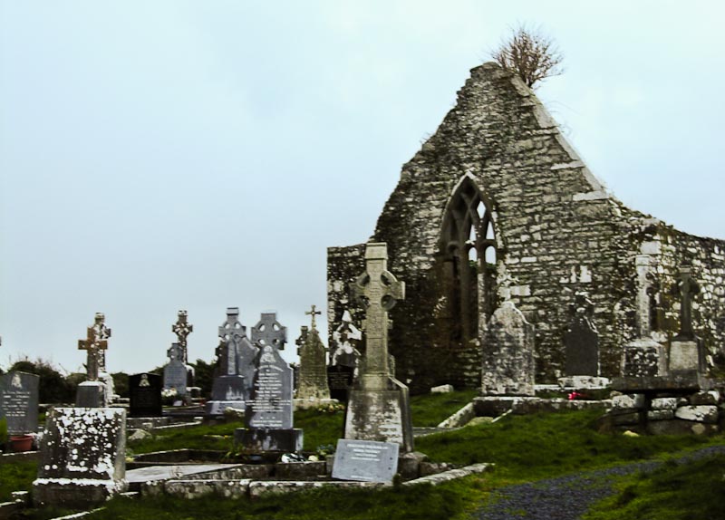
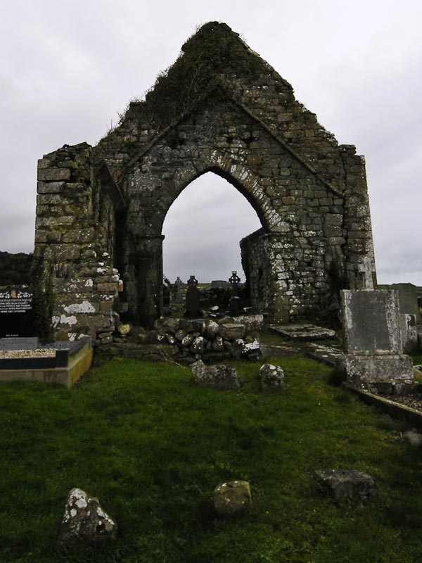
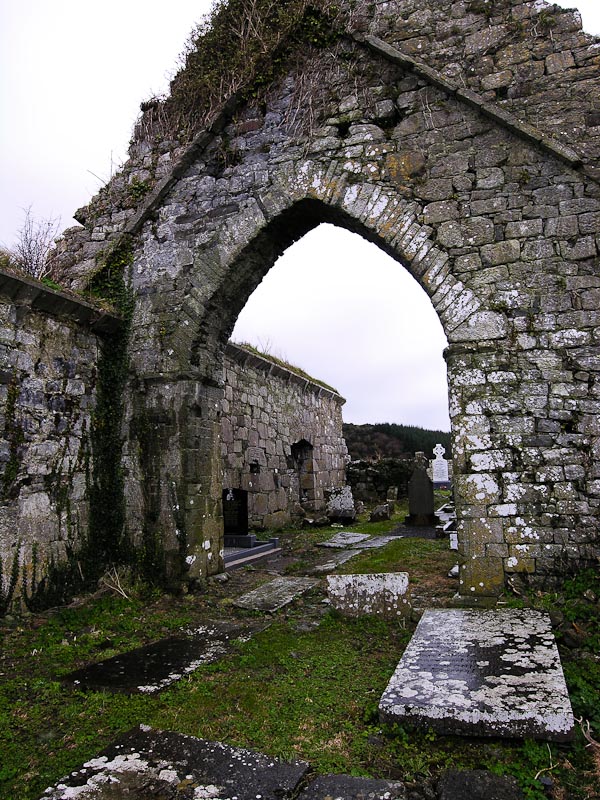
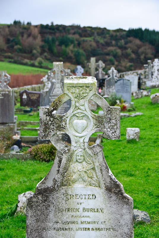
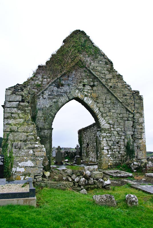
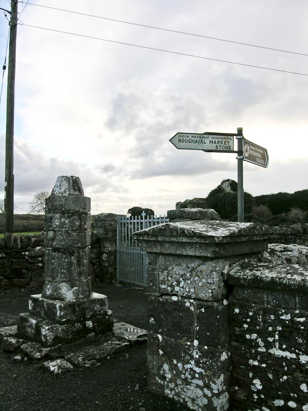
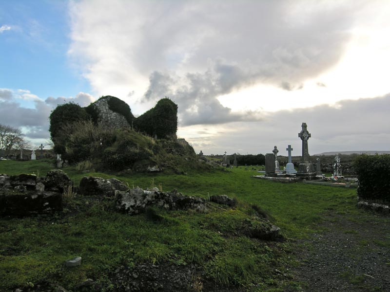
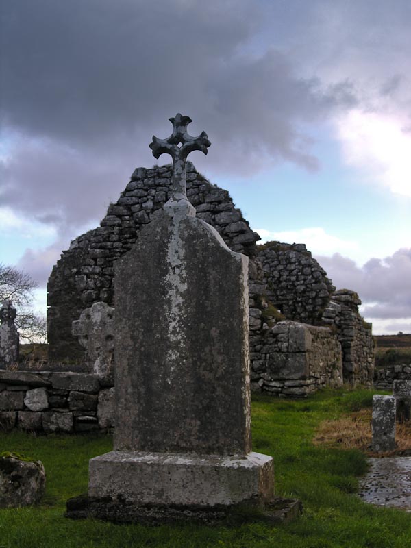
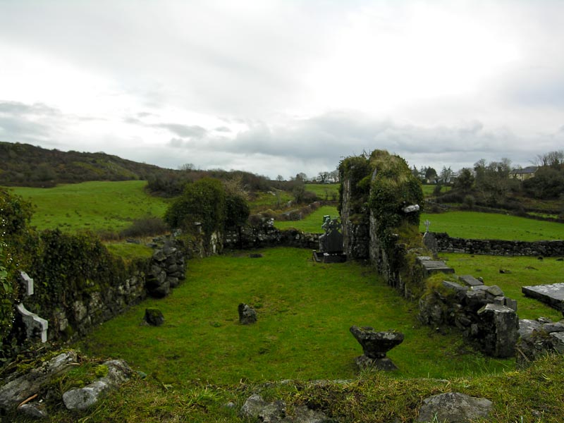
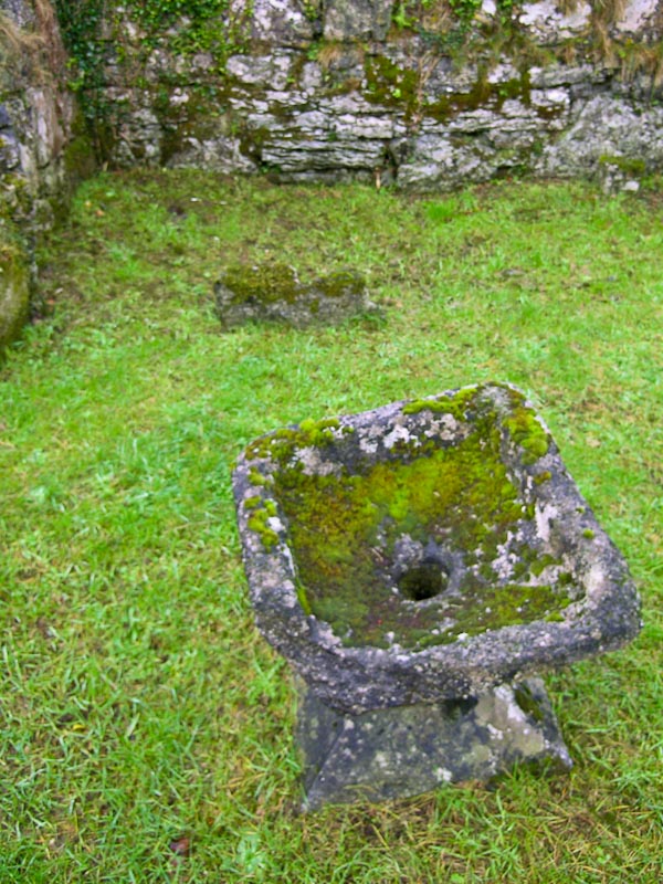
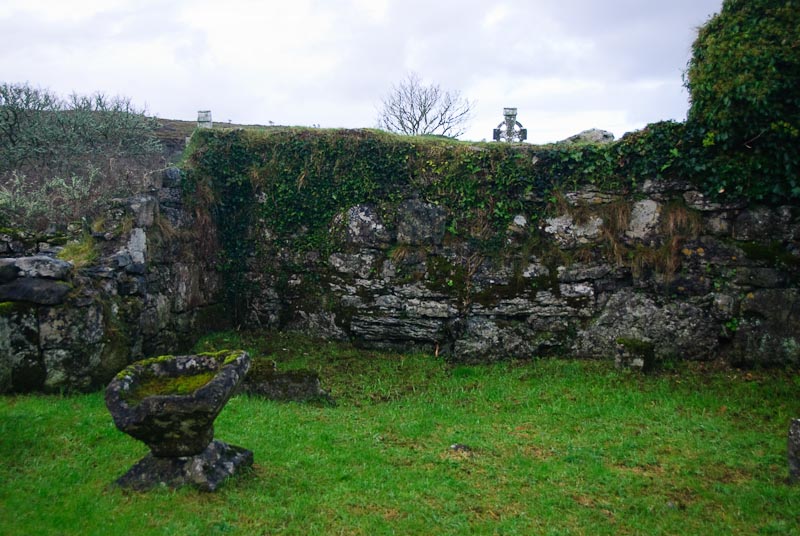
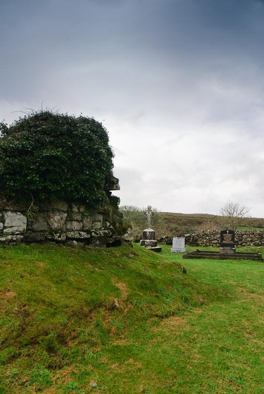
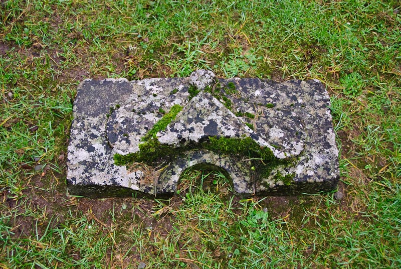
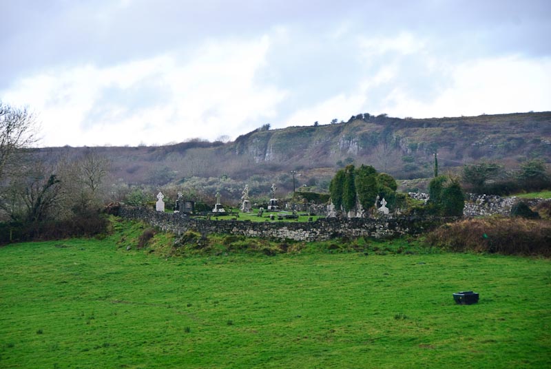
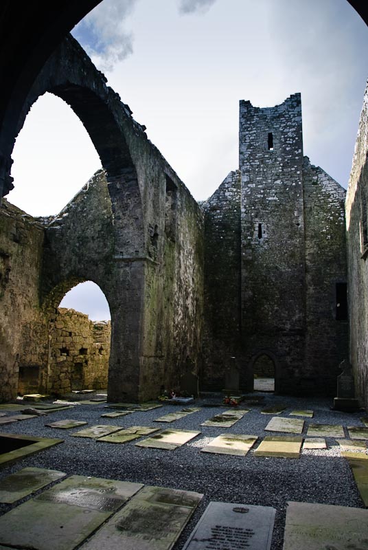
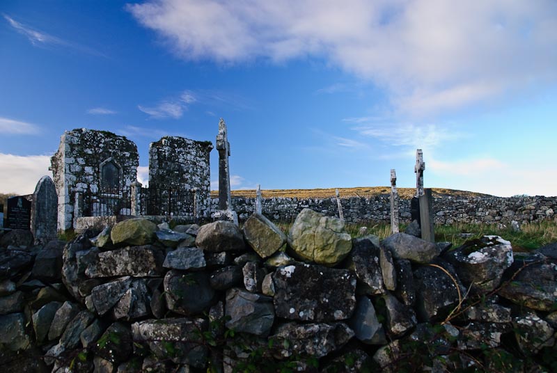
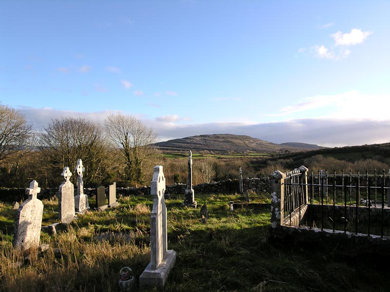
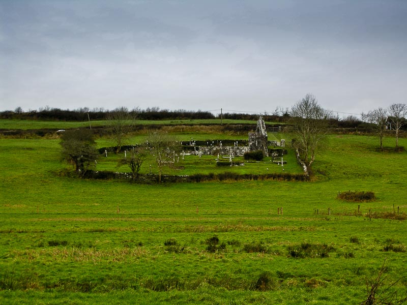
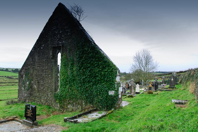
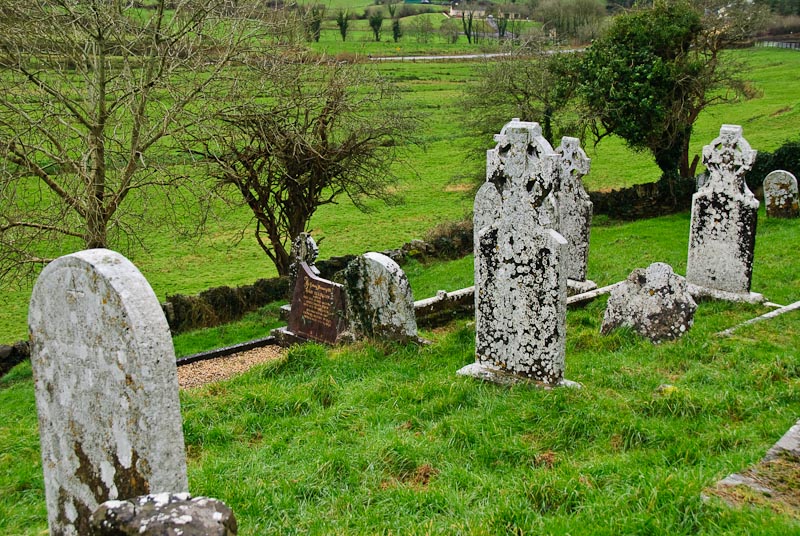
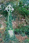
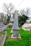
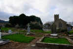
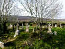
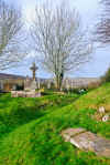
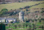
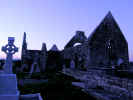
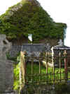
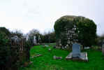
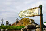
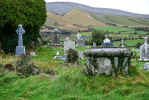
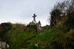
near Castlegregory and ran across the ubiquitous ruined church and graveyard
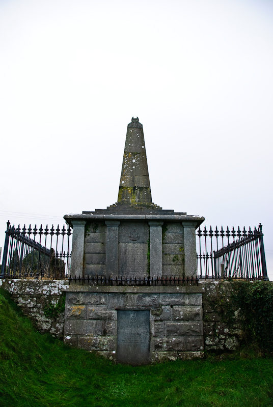
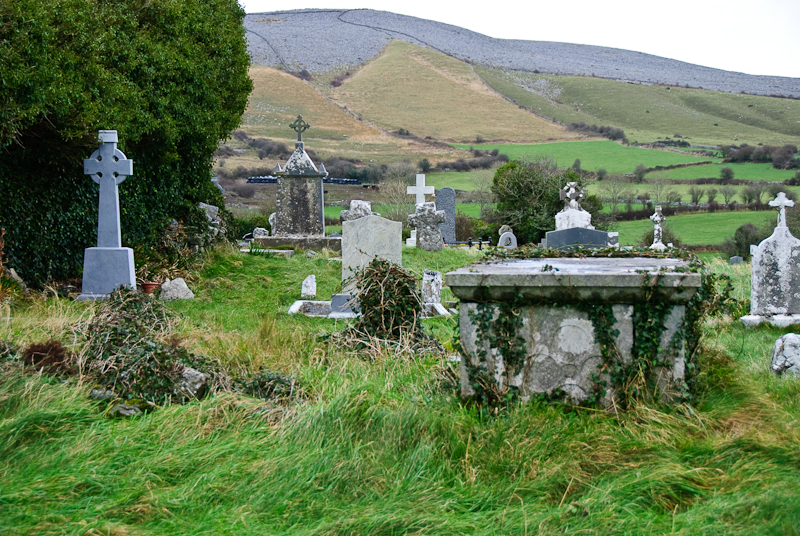
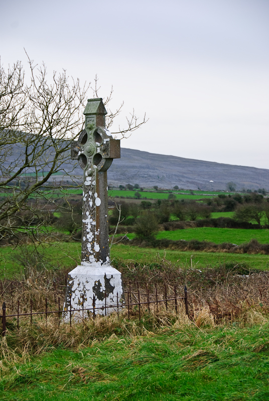
in Killiney. Of course we had to stop. We spent about an hour poking around,
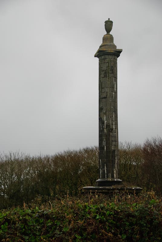
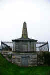
looking at the headstones and taking pictures. The graveyard contains an obelisk
memorial to the crew of the Port Yarrock, seven of which are buried in the
graveyard. The
Port Yarrock sunk in 1894 in Brandon Bay with all hands lost. The remains
of the ship's bowsprit can still be seen a low spring tides.
After a few pictures from both sides of the pass, we got back in the
car,
stowed our camera gear and headed off. The other side of the pass is actually
a worse road and drive for the first half mile or so. The road narrows at
one point to a single lane with large rocks poised above. Once you get past
the waterfall (by it, not through it) the road improves and soon feels quite
comfortable as you head down into a forested area. We had been this way many
times but had not been able to explore as we were usually trying to get to
another destination quickly. This time we'd made a reservation in Camp at
the Camp Junction House B&B
right across from Mike O'Neil's Railway Tavern. We'd stopped there each time
through, but never had been there during the evening. The place a a great
reputation for music and fun. All this gave us time to explore the immediate
area. Along the way we saw in interesting ruined house decomposing slowly
by the side of the road. We stopped for a few pictures. We headed out somewhere
near Castlegregory and ran across the ubiquitous ruined church and graveyard
in Killiney. Of course we had to stop. We spent about an hour poking around,
looking at the headstones and taking pictures. The graveyard contains an obelisk
memorial to the crew of the Port Yarrock, seven of which are buried in the
graveyard. The
Port Yarrock sunk in 1894 in Brandon Bay with all hands lost. The remains
of the ship's bowsprit can still be seen a low spring tides.

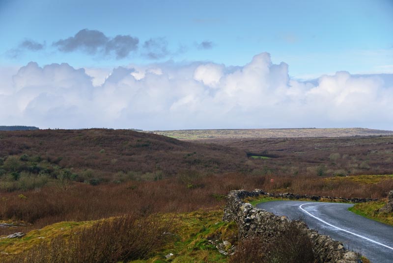
 We headed back towards Camp and as it was still early, passed through and
headed further West looking for Killelton. We wandered a bit far afield and
ended up on a remote road. Very scenic, but it tapered off to little more
than a rocky path. We ran into an old gentleman in an equally old vehicle
who assured us we were not on the right road, but couldn't tell us where Killelton
was. We retraced our steps and hit the main road and headed further West.
We had lunch at Bunawonder beach and watched a couple of kids with hurlys
on the sand.
We headed back towards Camp and as it was still early, passed through and
headed further West looking for Killelton. We wandered a bit far afield and
ended up on a remote road. Very scenic, but it tapered off to little more
than a rocky path. We ran into an old gentleman in an equally old vehicle
who assured us we were not on the right road, but couldn't tell us where Killelton
was. We retraced our steps and hit the main road and headed further West.
We had lunch at Bunawonder beach and watched a couple of kids with hurlys
on the sand.

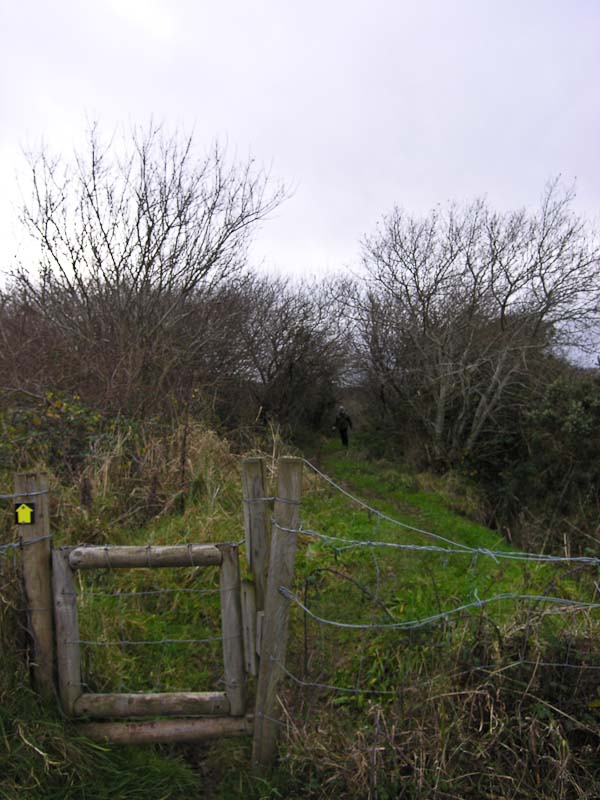
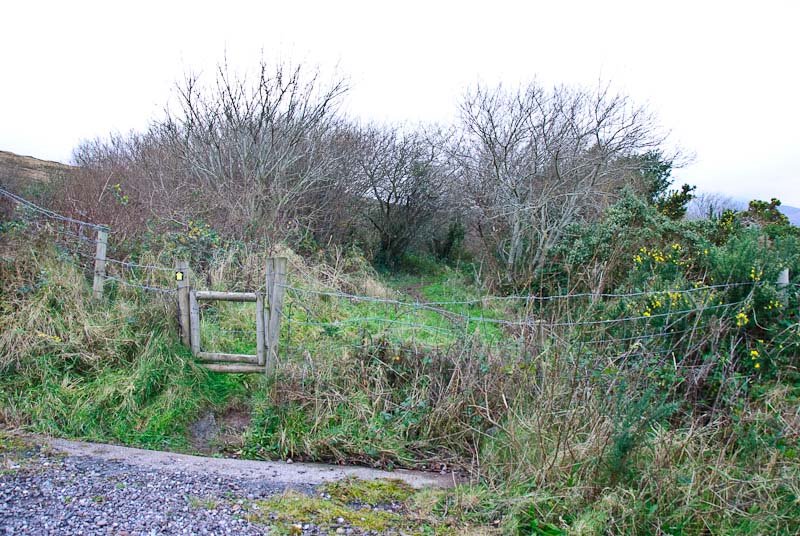
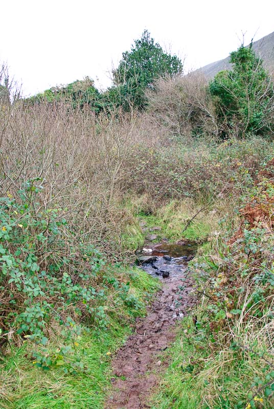
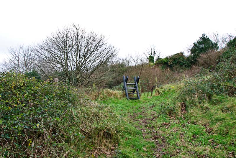
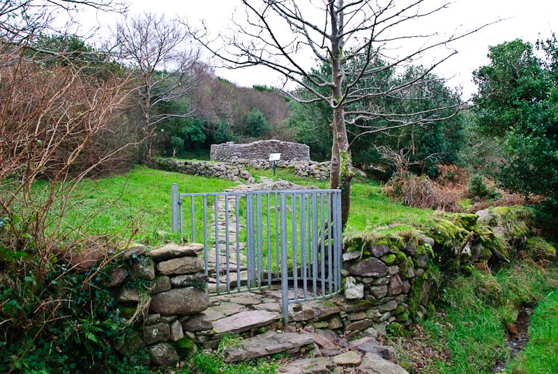
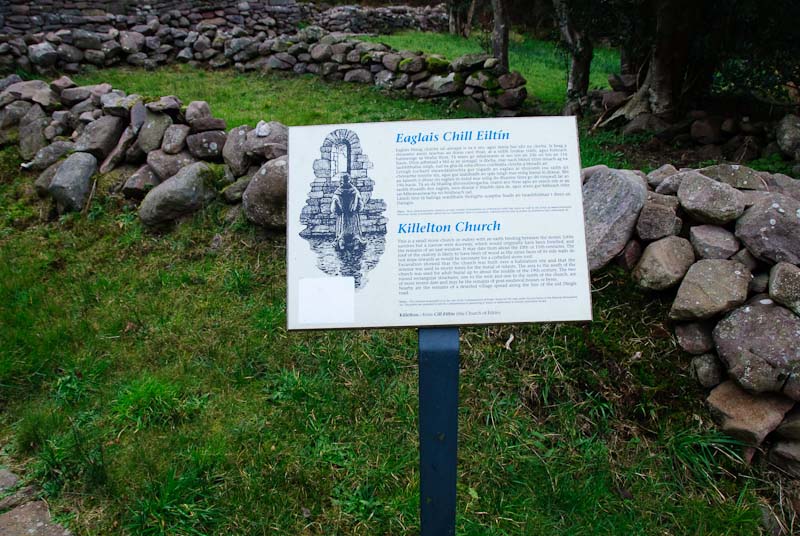
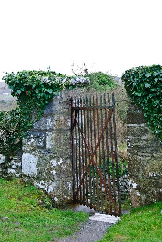
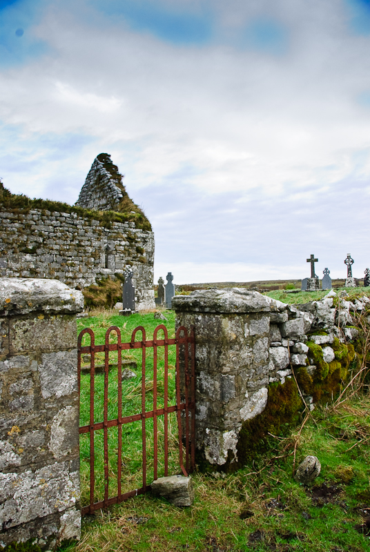
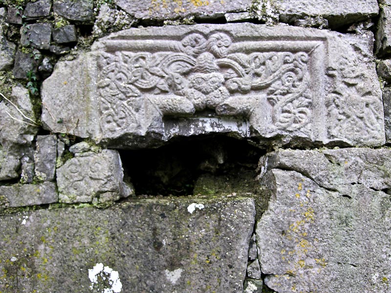
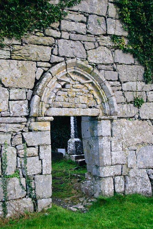
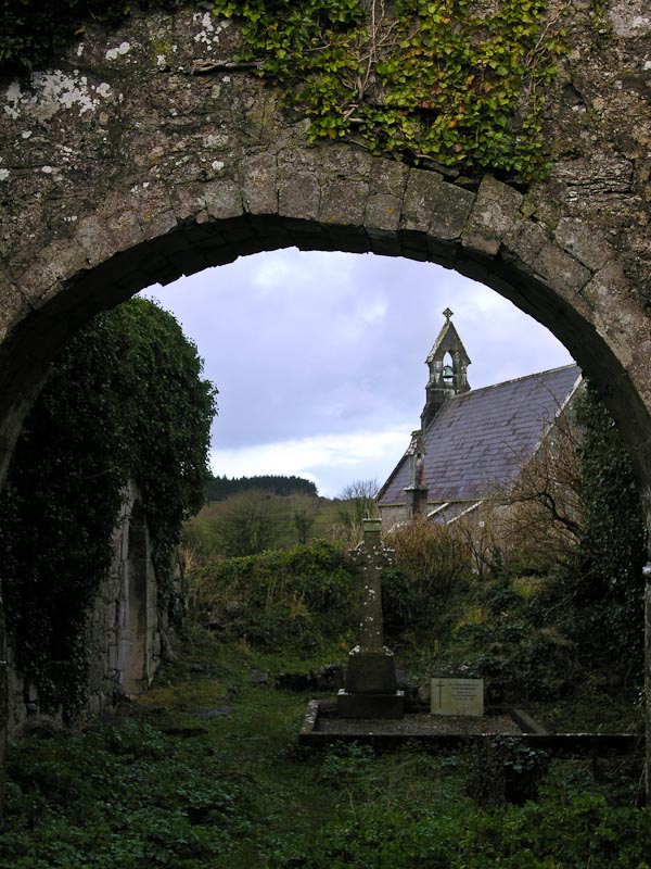
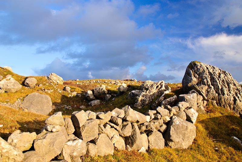
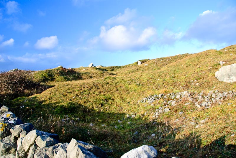
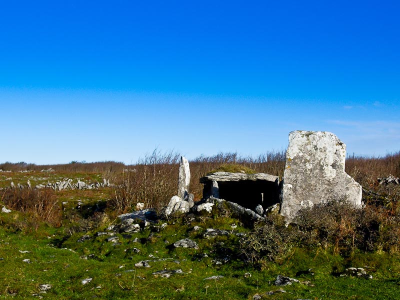
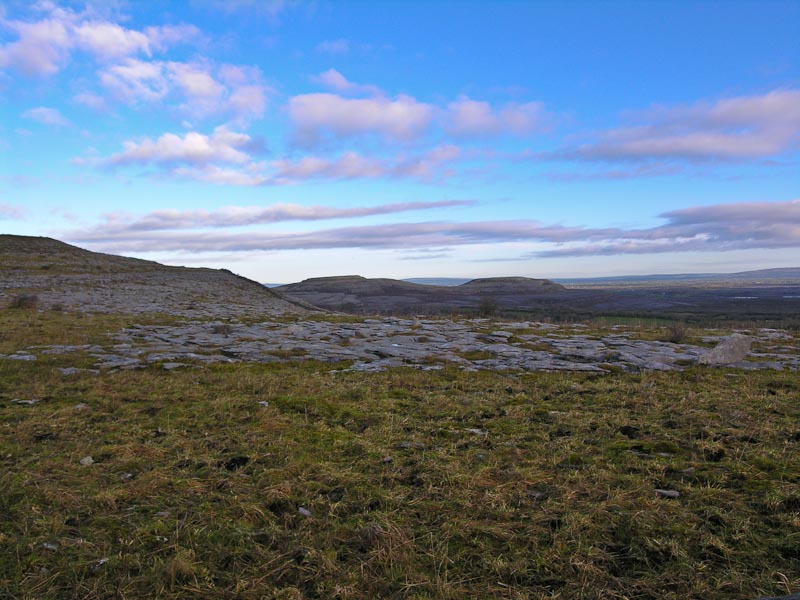
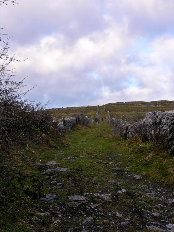
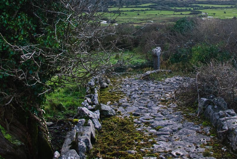
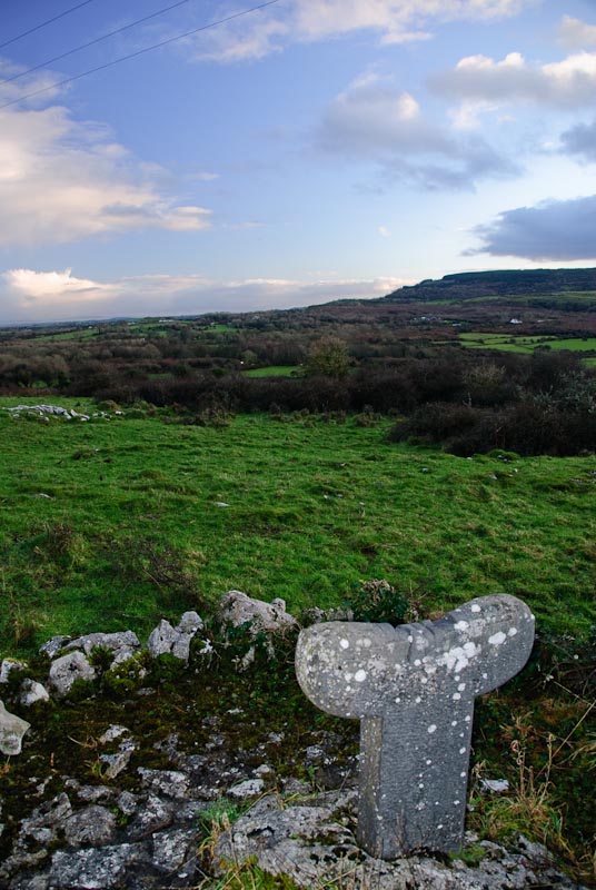
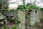
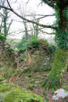
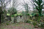
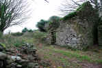
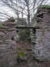
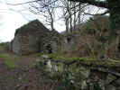
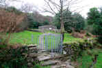
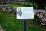
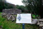
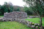
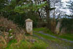
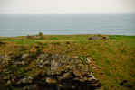
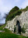
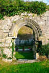
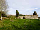
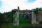
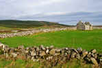
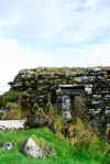
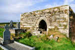
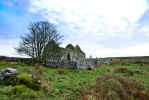
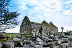
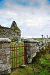
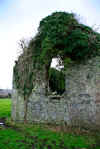
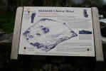
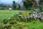
 We resumed the search for Killelton and finally found the road. Killelton
is an abandoned village along the Dingle Way. Evidently the road used to be
well traveled, but as the route changed, the village died out. There is the
remains of a monastic site in amazingly good shape and well kept and signed.
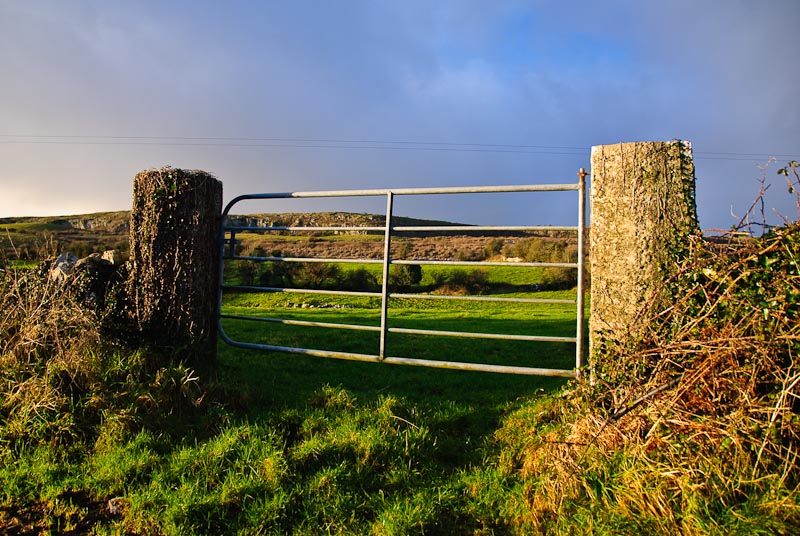
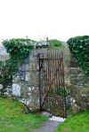
The best place to park is on the main road and walk up the hill along the
lane. At the top of the hill is a wood gate in the fence. Go through the gate
and keep going. The path is pretty rough and goes over fences, streams and
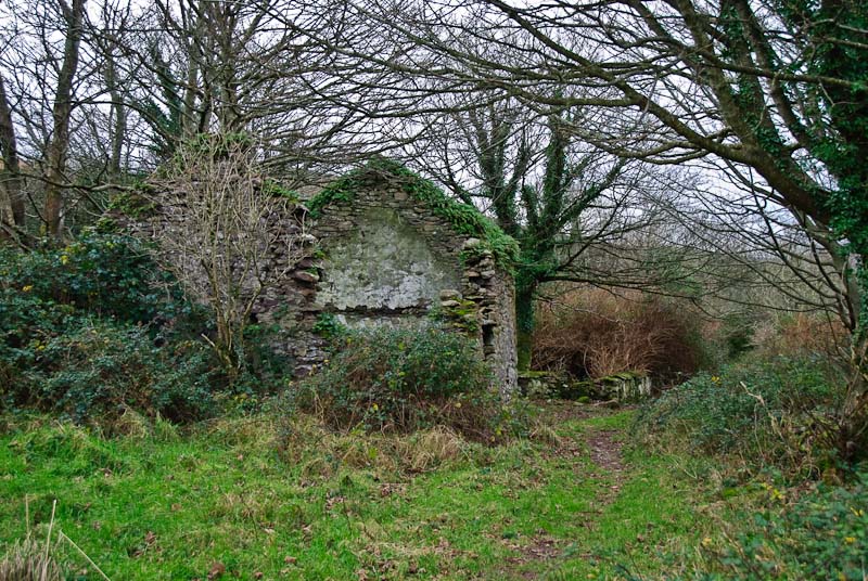
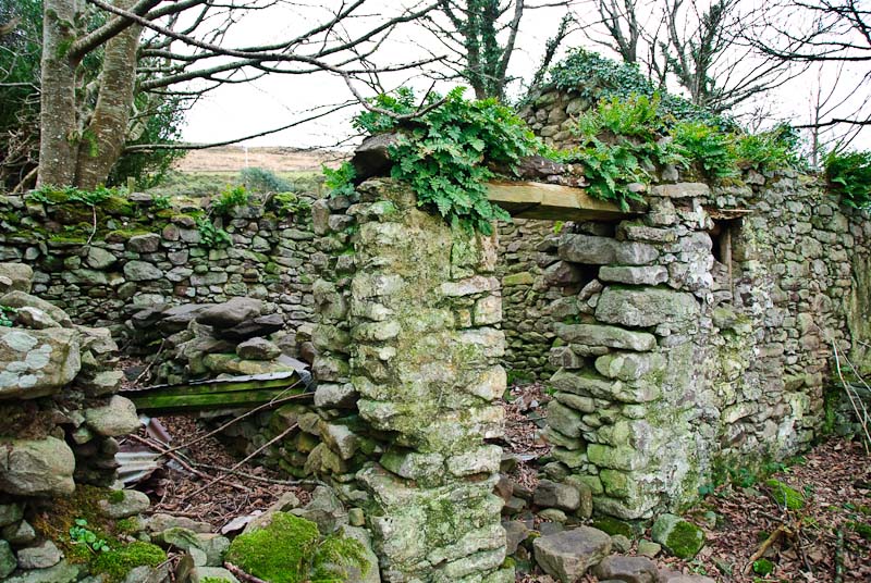
logs along the way. Eventually you'll start to see old stone buildings that
are the remains of the village. There isn't a lot to see and the ruins are
a bit unstable. While we were looking at one of the old ruins, apparently
a inn or hotel from what we could gather, a farmer appeared out of nowhere
and warned us to be careful as the walls could collapse. Nothing in the village
is marked or signed and you have to guess what the buildings may have been.
Most of the ruins are along the left side of the path, but a few are on the
right. Most of these are very overgrown and hard to get to with little reward
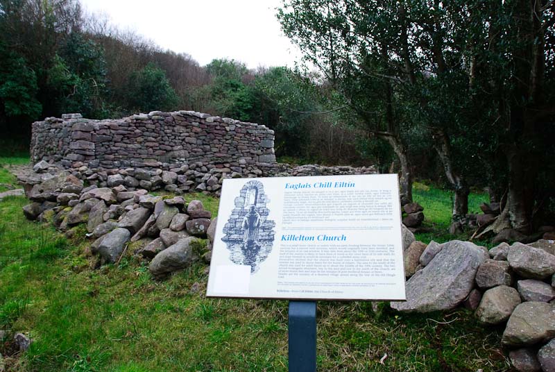
for the effort. Further down on your right is the entrance to the Killelton
church. The walls of an oratory and some walls are about all that are left.
Give yourself some time if you plan to go here. It is a good walk, but a little
rustic and don't forget, you have to walk back. This is definitely a road
less traveled but worth the effort.
We resumed the search for Killelton and finally found the road. Killelton
is an abandoned village along the Dingle Way. Evidently the road used to be
well traveled, but as the route changed, the village died out. There is the
remains of a monastic site in amazingly good shape and well kept and signed.
The best place to park is on the main road and walk up the hill along the
lane. At the top of the hill is a wood gate in the fence. Go through the gate
and keep going. The path is pretty rough and goes over fences, streams and
logs along the way. Eventually you'll start to see old stone buildings that
are the remains of the village. There isn't a lot to see and the ruins are
a bit unstable. While we were looking at one of the old ruins, apparently
a inn or hotel from what we could gather, a farmer appeared out of nowhere
and warned us to be careful as the walls could collapse. Nothing in the village
is marked or signed and you have to guess what the buildings may have been.
Most of the ruins are along the left side of the path, but a few are on the
right. Most of these are very overgrown and hard to get to with little reward
for the effort. Further down on your right is the entrance to the Killelton
church. The walls of an oratory and some walls are about all that are left.
Give yourself some time if you plan to go here. It is a good walk, but a little
rustic and don't forget, you have to walk back. This is definitely a road
less traveled but worth the effort.
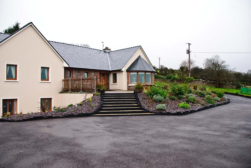
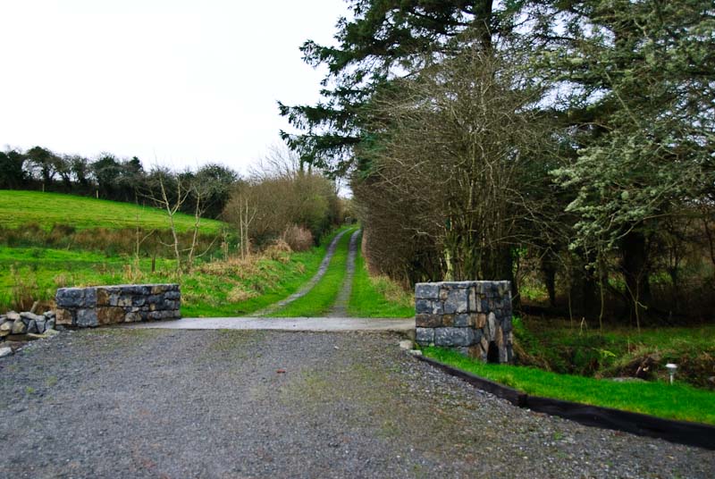
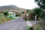
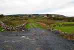
  We were now close to our check in time at
Camp Junction House B&B. We
drove up the winding driveway to a large house perched on a high spot with
a great view. The parking lot is large and probably full in the tourist season.
This time of year we were the only guests. We knocked on the door and it was
answered shortly by John Doyle. We had a great time and excellent service
from our host John Doyle, even though he was recovering from the flu. He invited
us in, showed us around and offered tea. We spent some time chatting, turns
out he and his brothers were football players for the Kerry team. He told
us that there was music that night at the Railway Tavern. He wasn't up to
going, but encouraged us to attend. We'd already planned to go, so this was
good news. The Camp Junction B&B overlooks Mike O'Neil's Railway Tavern, the
perfect place for a rollicking Irish evening of music and conversation so
we didn't have far to go. We got our room situated and headed off to look
for some dinner. This proved to be more of an effort than we'd anticipated
and in hindsight we probably should have gone the other way on the road. Most
of the small places were either closed or didn't serve food this time of year.
We eventually found the unfortunately named
Seven Hogs Restaurant. We were a little
early for dinner, so we had a Guinness and waited for about 20 minutes. Eventually
we were seated. The furniture is rustic wood, but sanded in the right spots
and the place is nice. I went for the Whisky BBQ Ribs, hoping for a bit of
wood smoke on the meat. No luck, the ribs were oven cooked. The meat was tender
and well cooked, just a little bland without the benefit of wood smoke and
caramelized sauce. The BBQ sauce wasn't bad, certainly better than many sauces
I've tried at home. Karen had some fish and said it was good as well. We had
a nice dinner and headed back down the road to the B&B to freshen up and then
off to the Railway Tavern to say hi to Mike and settle in for the evening.
We were now close to our check in time at
Camp Junction House B&B. We
drove up the winding driveway to a large house perched on a high spot with
a great view. The parking lot is large and probably full in the tourist season.
This time of year we were the only guests. We knocked on the door and it was
answered shortly by John Doyle. We had a great time and excellent service
from our host John Doyle, even though he was recovering from the flu. He invited
us in, showed us around and offered tea. We spent some time chatting, turns
out he and his brothers were football players for the Kerry team. He told
us that there was music that night at the Railway Tavern. He wasn't up to
going, but encouraged us to attend. We'd already planned to go, so this was
good news. The Camp Junction B&B overlooks Mike O'Neil's Railway Tavern, the
perfect place for a rollicking Irish evening of music and conversation so
we didn't have far to go. We got our room situated and headed off to look
for some dinner. This proved to be more of an effort than we'd anticipated
and in hindsight we probably should have gone the other way on the road. Most
of the small places were either closed or didn't serve food this time of year.
We eventually found the unfortunately named
Seven Hogs Restaurant. We were a little
early for dinner, so we had a Guinness and waited for about 20 minutes. Eventually
we were seated. The furniture is rustic wood, but sanded in the right spots
and the place is nice. I went for the Whisky BBQ Ribs, hoping for a bit of
wood smoke on the meat. No luck, the ribs were oven cooked. The meat was tender
and well cooked, just a little bland without the benefit of wood smoke and
caramelized sauce. The BBQ sauce wasn't bad, certainly better than many sauces
I've tried at home. Karen had some fish and said it was good as well. We had
a nice dinner and headed back down the road to the B&B to freshen up and then
off to the Railway Tavern to say hi to Mike and settle in for the evening.
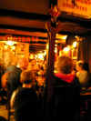
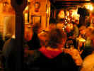
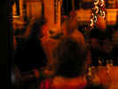
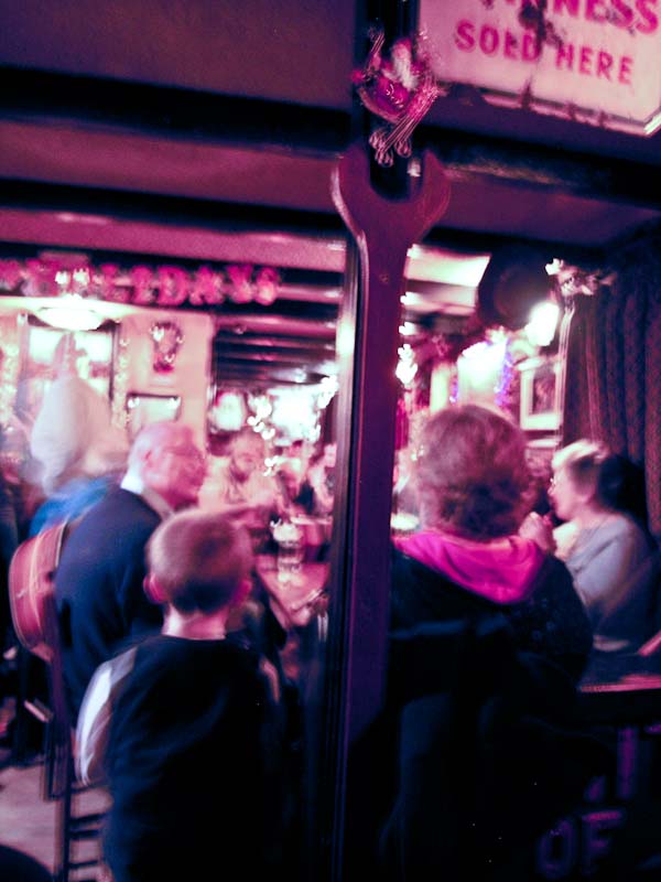
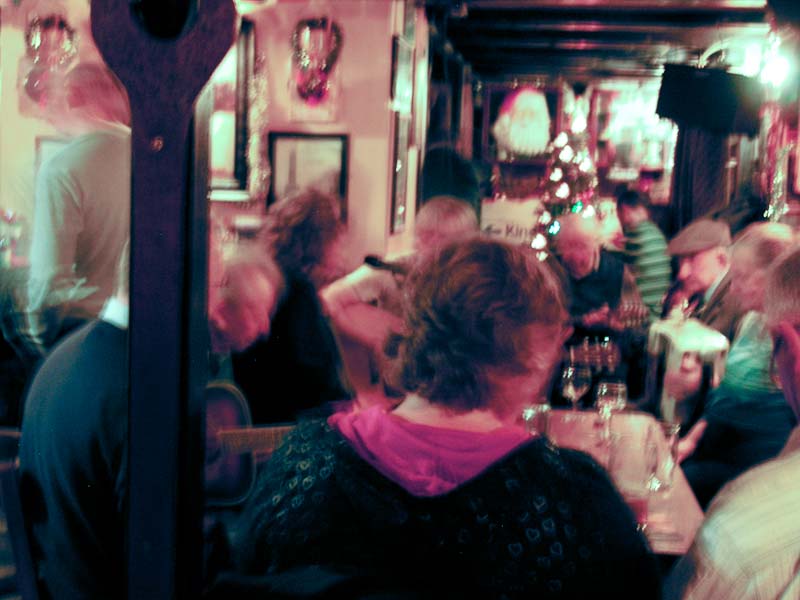
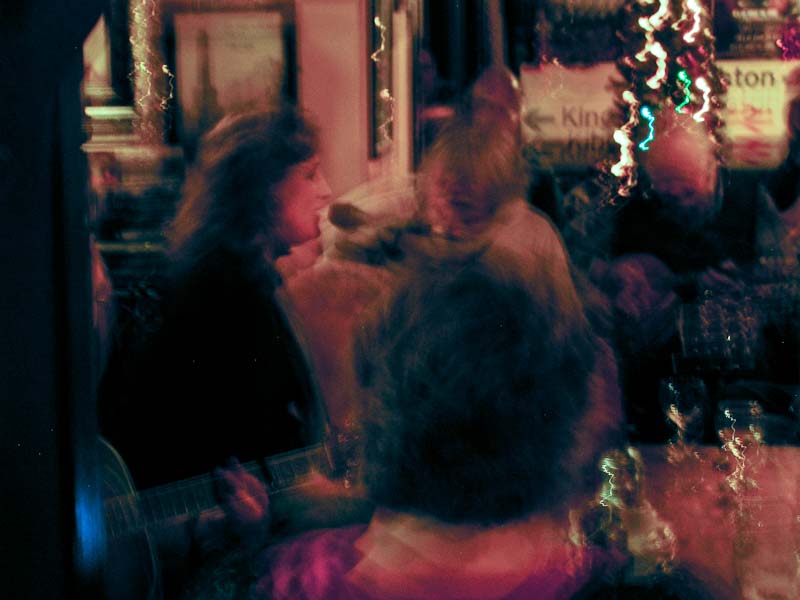
Things were already well underway and the crowd was shoulder to shoulder.
We managed to find a seat and ordered a pint or two. We were joined later
by a couple from Clare on vacation and had a good chat between sessions. Later
we surrendered our seats and joined the standing crowd closer to the music.
Karen eventually joined in for a song or two. The pictures didn't turn out
well as the light was poor and I didn't want to use a flash. In addition it
was all I could to to stand upright with the crowd and jostling. I didn't
even think about raising the ISO setting. I had an interesting discussion
about wine, women and song with a very inebriated local who mistook me for
his best friend. Either that, or I was just the friend 0' the moment. He had
an opinion about everything, but was incapable of expressing it clearly. It
didn't stop him from trying. Eventually things slowed down and cleared out.
Not as early as you'd think on a Sunday night though. Somewhere along in the
evening I realized I was coming down with a sore throat but didn't let that
stop anything. We headed out into the cold night air and back to our B&B.
|
TOP
| BACK
|
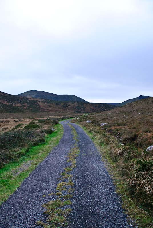
Camp, Co. Kerry to Kilfenora, Co. Clare
|
|
Monday 12/31
We'd arranged to be up at a fairly early hour with John
as we'd still a good drive ahead of us to Kilfenora in County Clare. He had
a full Irish laid out and we tucked into one of the best breakfasts of the
trip. After we chatted some more and settled up before repacking and loading
the
car. We said our goodbyes and promised to return for a visit in the future.
We highly recommend the Camp Junction
House B&B! This would be an excellent location for exploring this part
of the peninsula and would keep you out of the tourist traffic. The beaches
in the area are wonderful and obviously the music and pub activity are lively.
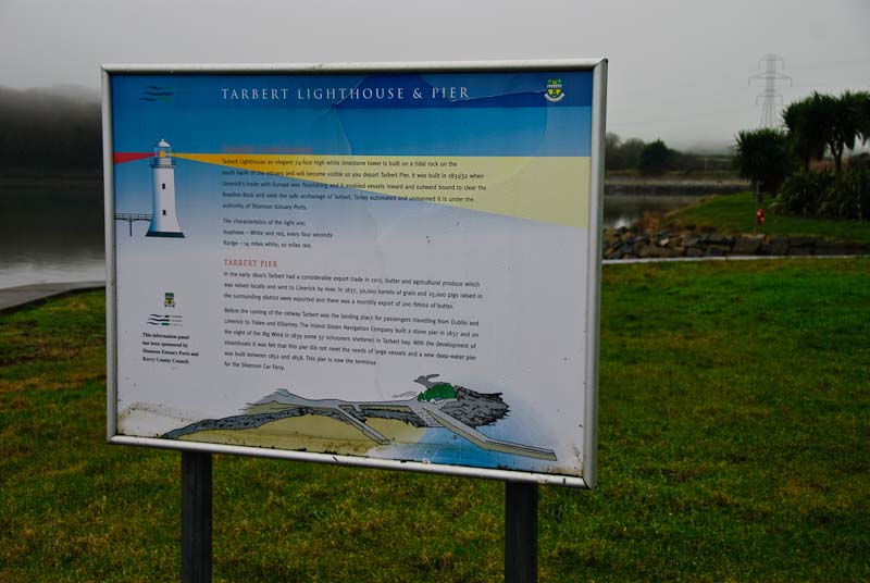
We were off, our route went through Tralee and to the
Tarbert ferry where we'd cross from Kerry to Clare. We'd gone this route in
the past and it bypassed the congestion around Limerick and saved time and
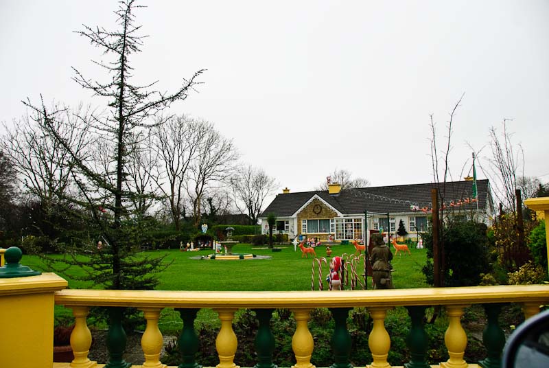
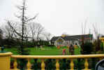
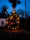
distance. We encountered a house with many residual Christmas decorations
and had to stop for a picture. It looked like the North Pole had exploded
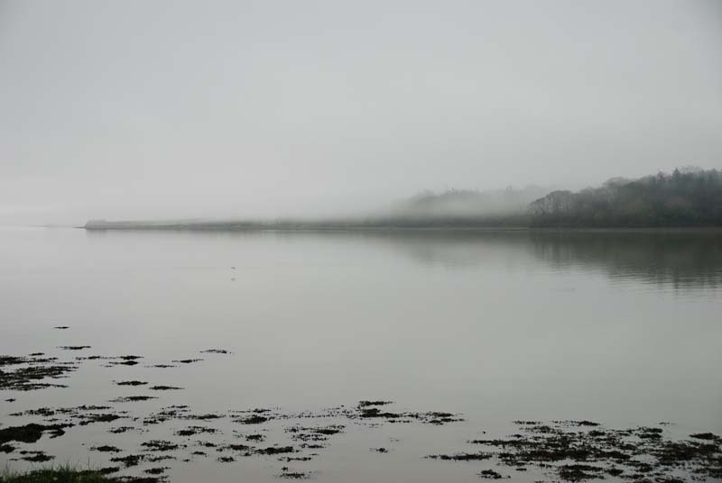
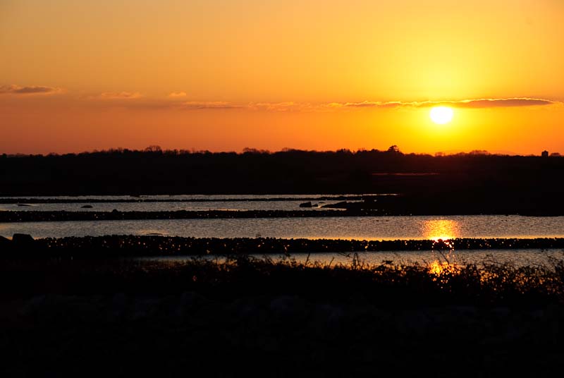
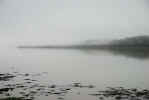
on their lawn. As we neared the ferry, the weather continued to get greyer
and the clouds and mist were hanging very low. We stopped for a few pictures
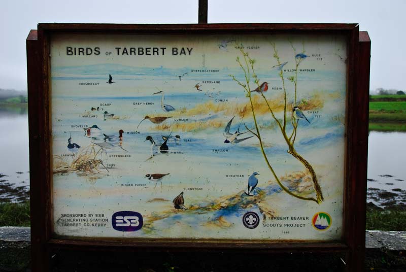
on the way. There is a wildlife/bird refuge along the road, but we didn't
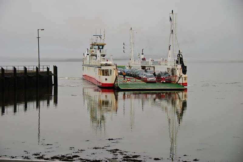
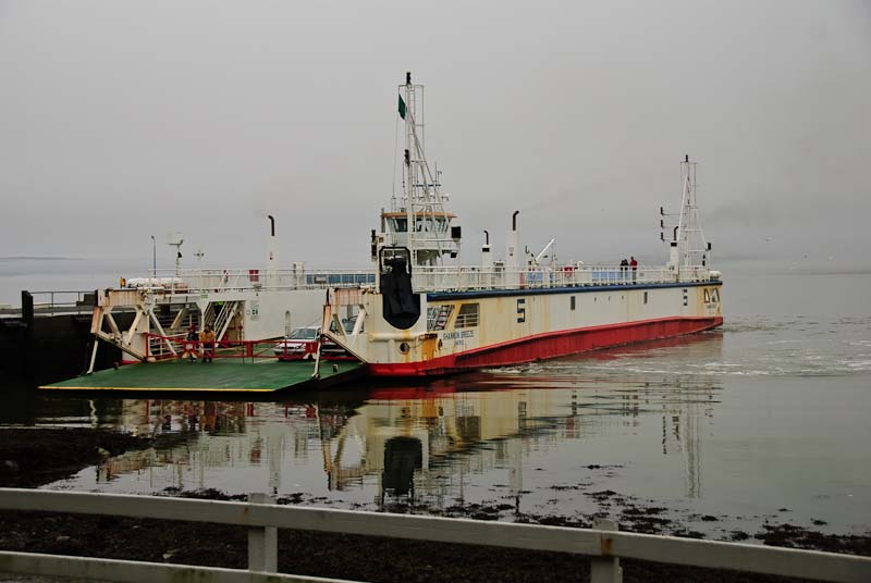
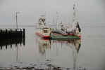
see much of either. Eventually we came around the corner to the ferry. We
had arrived just as the ferry was leaving and had about a half an hour wait
until the next one. We parked in line and I got out to explore the pier and
surrounding area.

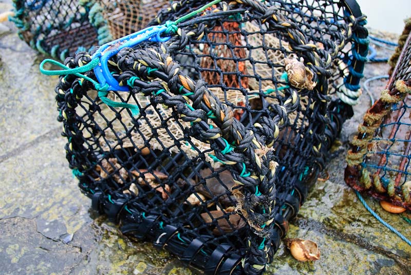
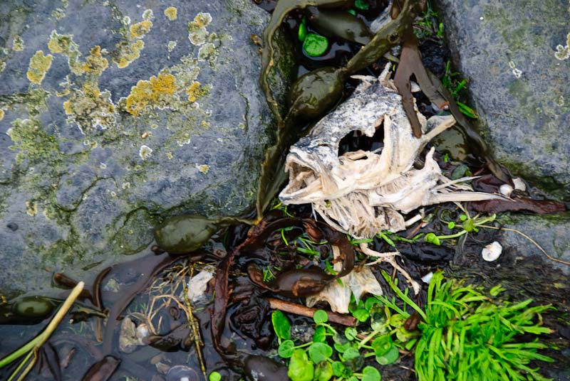
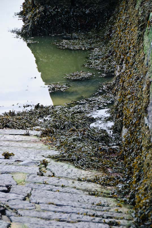
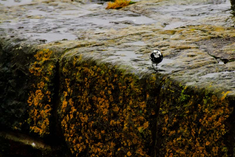
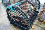
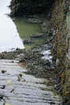
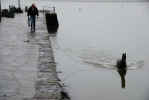
On the pier were a number of traps and one the pier was the refuse
of countless fishing trips. Most of the boats were out and so was the tide.
The pier was very slippery from the rain and the stone surface was almost
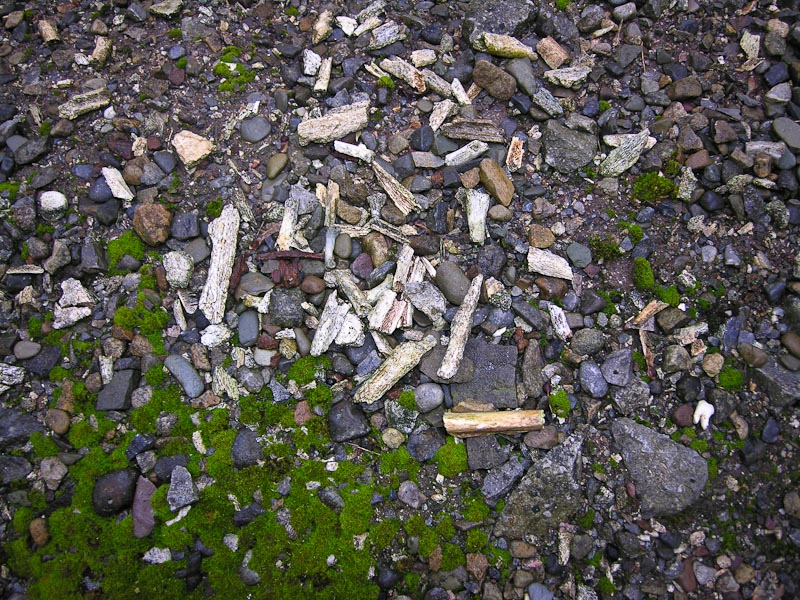
polished from use. Skeletal fish heads, shells and other related debris added
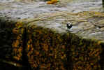
to the unstable footing. A number of small birds were foraging for fishy snacks.
I walked, actually more slid down a ramp and managed to avoid a fall. There
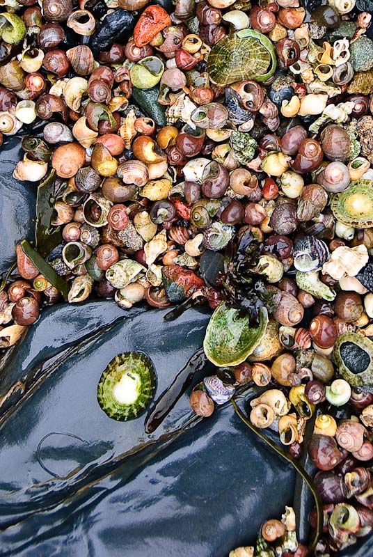
was no way I was getting back up that way. I walked out onto the rocks below
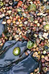
the stone wall and found piles of small fine shells that had been washed up
by years of tide activity. I rummaged through my camera bag and found a large
zip lock bag. I always keep several as they make good emergency camera covers
in the rain and you can put interesting items in them. The shells qualified
and I filled the bag with several handfuls. The fish heads stayed put.
The shells ranged in size of a quarter down to a pin head. There was a variety
of sizes and colors. They traveled safely home and we put them in a Guinness
pint glass on our dining room buffet. Our granddaughter like to look at them
and when she's older we'll pour them out on some paper to examine more closely.

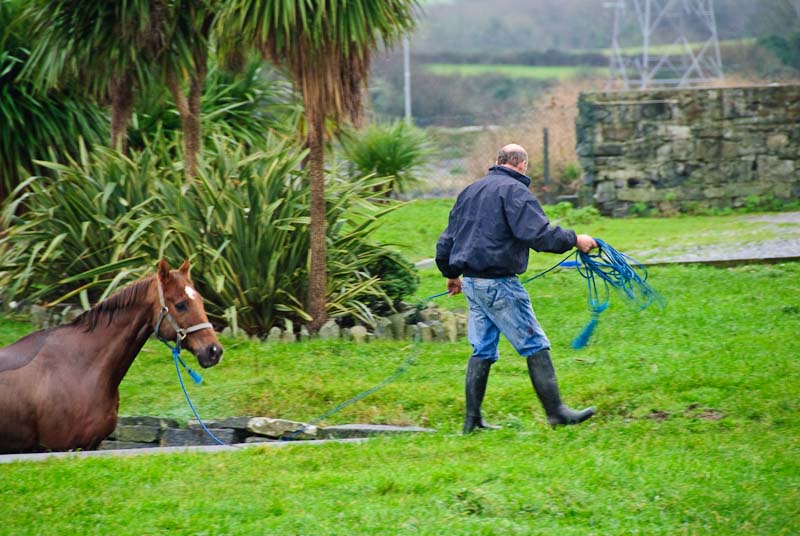
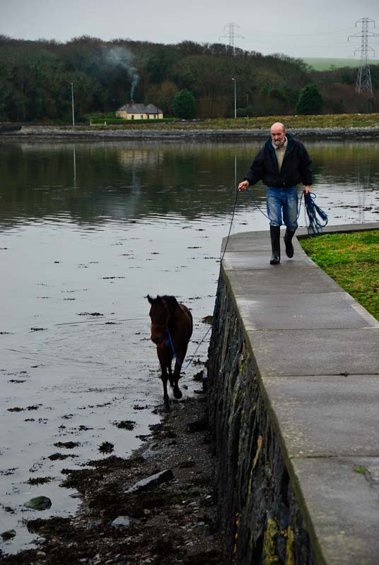
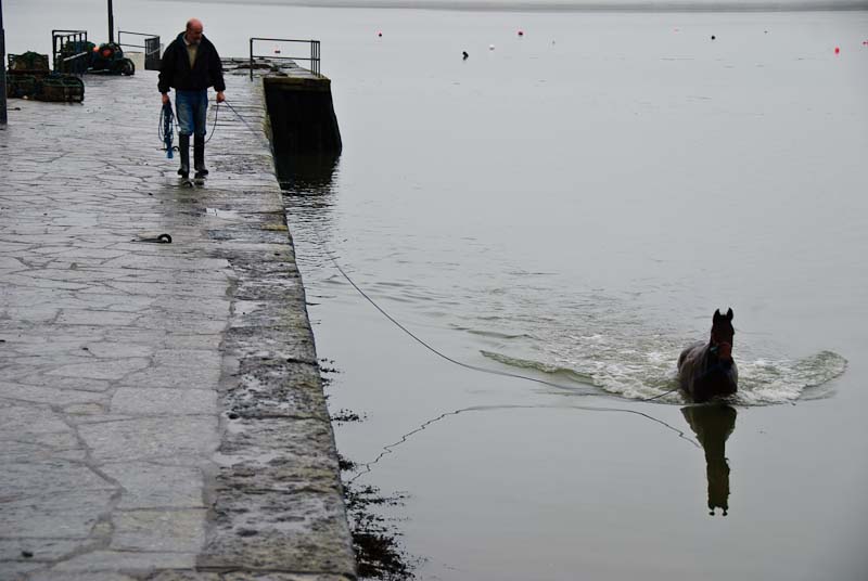
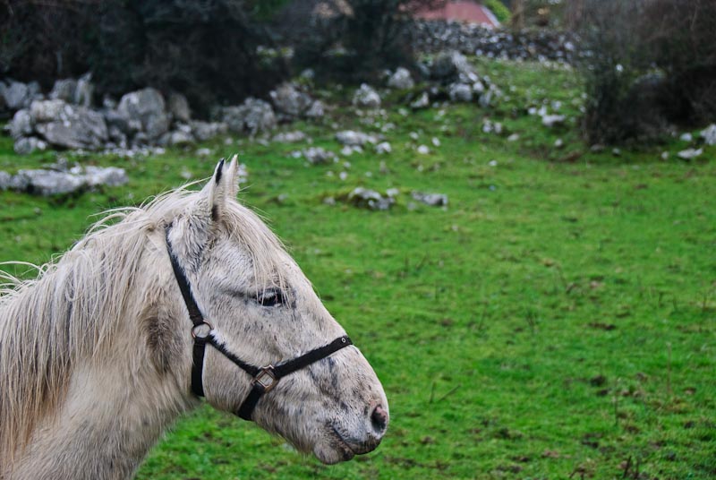
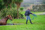
On the other side of the pier a truck and trailer pulled up an unloaded
two horses. They were taking them for a swim along the pier and we watched
as they walked along the pier while the horses swam alongside. We were told
it was good exercise. The horses looked very well kept and seemed to enjoy
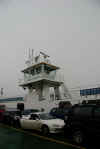
the swim, but also seemed to be glad to be out of the cold water. Shortly
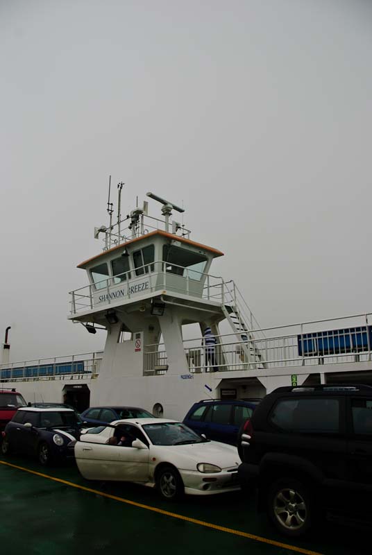
after the ferry arrived and we got back in the
car and drove aboard for the
ride across to Co. Clare.


 The drive to Kilfenora was uneventful. The weather continued to spit rain
and be dark and cold. We traveled up towards
Ennistymon where we needed to find
a cash machine to pay for the cottage. This proved difficult, but eventually
we found one after several failed attempts. They were either not working or
closed. Out of Ennistymon we took the road to Kilfenora. We passed through
a number of small towns and arrived in Kilfenora without incident. We resisted
the urge to stop at Linnane's Pub for a pint, and took the side road down
to Brook Cottage.
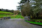
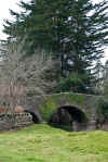
The drive was fairly easy to find and proved to be a sharp left off
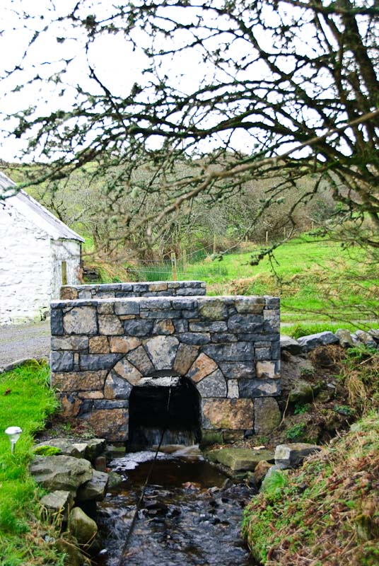
a rising hill on a corner. The lane plunged down the hill to a small bridge
over a small brook that circled around and behind the cottage. Very nice and
scenic. There was a
car parked in front and we pulled alongside. We knocked
on the door and were welcomed in to the main room by our host and hostess
and son. They had a peat fire going in the hearth and showed us around and
got us situated.
The drive to Kilfenora was uneventful. The weather continued to spit rain
and be dark and cold. We traveled up towards
Ennistymon where we needed to find
a cash machine to pay for the cottage. This proved difficult, but eventually
we found one after several failed attempts. They were either not working or
closed. Out of Ennistymon we took the road to Kilfenora. We passed through
a number of small towns and arrived in Kilfenora without incident. We resisted
the urge to stop at Linnane's Pub for a pint, and took the side road down
to Brook Cottage.
The drive was fairly easy to find and proved to be a sharp left off
a rising hill on a corner. The lane plunged down the hill to a small bridge
over a small brook that circled around and behind the cottage. Very nice and
scenic. There was a
car parked in front and we pulled alongside. We knocked
on the door and were welcomed in to the main room by our host and hostess
and son. They had a peat fire going in the hearth and showed us around and
got us situated.
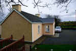
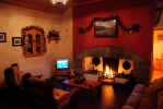
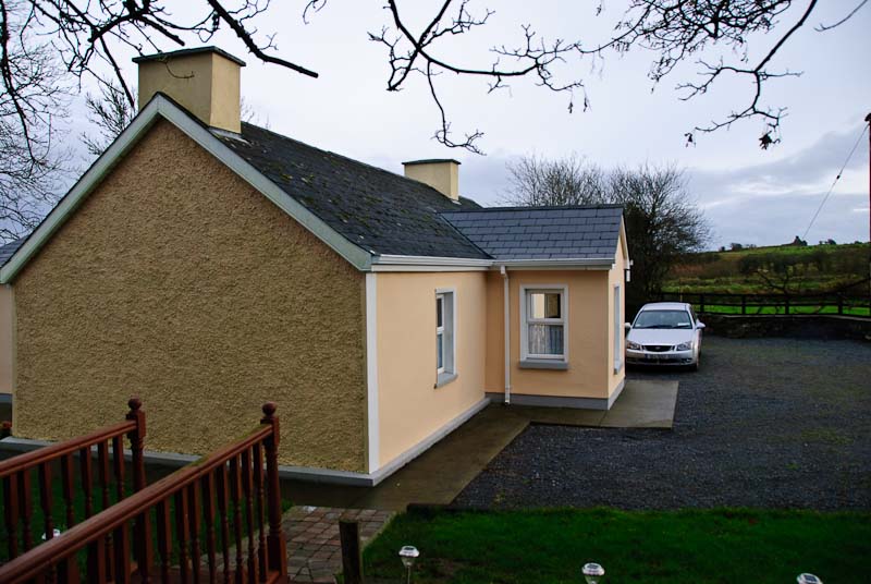
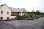
Brook
Cottage is fully modernized with a full kitchen, two bathrooms and
two bedrooms. The living room area has a large fireplace and comfortable chairs
and couch. The whole cottage is well appointed with antiques and Irish decorative
touches. The rooms and beds are comfortable and have extra quilts and blankets.
The cottage was so nice we arranged to extend our stay for an additional week
and forego going in search of other accommodations further North. There is
plenty to do and see in the area, especially if you like historical sites,
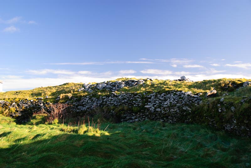
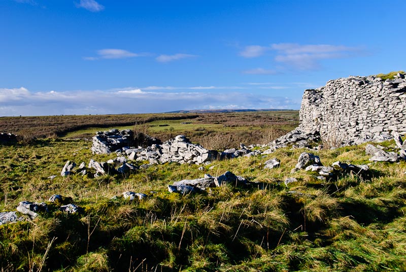
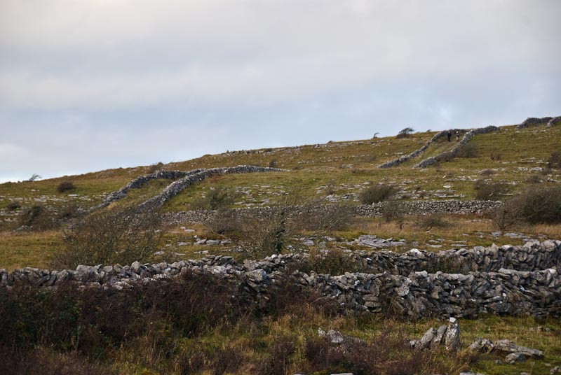
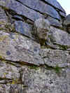
ancient forts, stone walls, ring forts and dolmans.
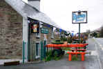
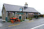
Linnane's pub in Kilfenora is our favorite hangout for food, drinks and
activities although we had some good meals at
Vaughan's. We recommend the Bacon and Cabbage at either pub. Note: Bacon
isn't the crispy stuff that's called streaky bacon, think ham, only better.
We elected to stay in for the evening as I wasn't feeling
good, still had the sore throat. We fixed dinner and watched a little bizarre
British TV and then headed for bed. The bed was very comfortable and well
stocked with blankets and quilts which we appreciated. The brook may have
been picturesque, but at this time of year it made the little hollow the cottage
is in cold and damp. The stone floors and walls may have something to do with
it as well. Any other time of year, this shouldn't be an issue.
Book interlude
Here are some books we read, reread or discovered
on our trip. We think you'll enjoy them too. They are all related to
traveling, living and surviving in Ireland. They are best to read after
you've been once. So much will make more sense.
|
TOP
| BACK
|
Kilfenora, Co. Clare
|
|
Tuesday 1/1
 Our
first morning in Clare and a new year! We slept well and got up leisurely
and fixed breakfast and sat looking out the sliding glass door towards the
brook while we ate. A little cleanup and then headed off for some driving
around the area. We headed toward Ennis with the intent of visiting Quin Friary.
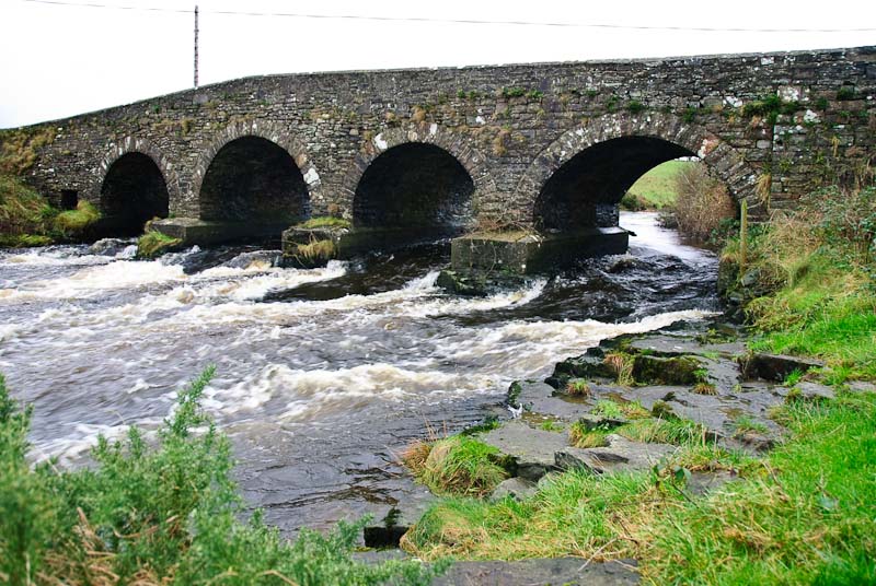
Whatever else we found on the way was a bonus. We passed through
Ennistymon, hit the cash machine and then headed out of town. A short
distance later we saw a stone bridge and took a side road to check it out.
It really wasn't that exciting. The water was moving fast and had a yellowish
cast. The surrounding area was a bit bare and even from a ways down stream
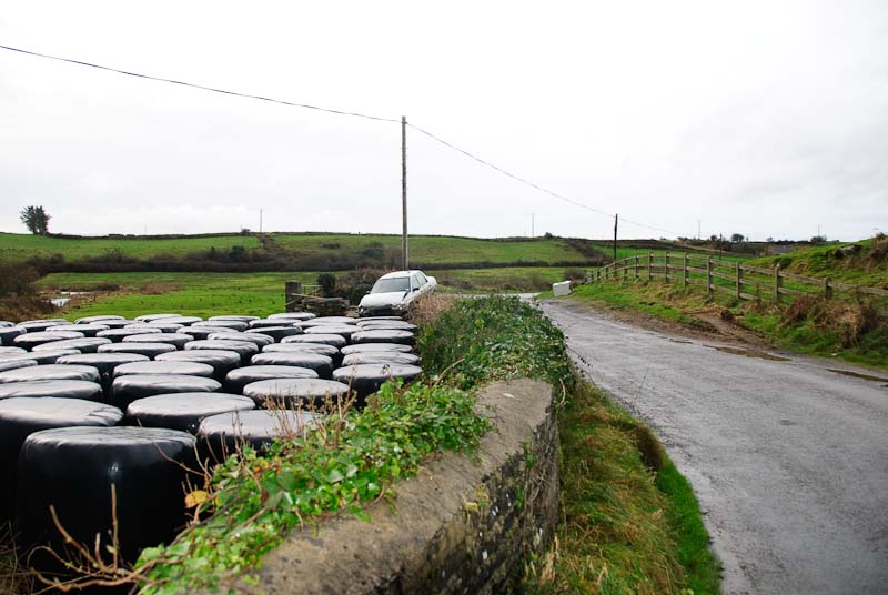
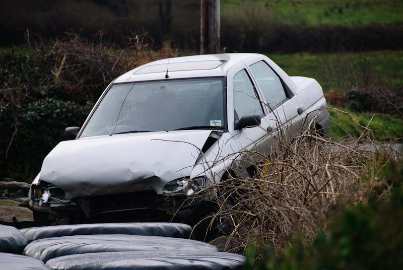
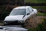
it wasn't great. We did notice a
car nearby perched on a a stone wall. Evidently
a casualty of the night before. There was a very sharp corner that the driver
failed to negotiate. The windshield was intact, but the rest of the
car was
doing poorly. We saw the
car a day or so later on a flat bed truck. Our
first morning in Clare and a new year! We slept well and got up leisurely
and fixed breakfast and sat looking out the sliding glass door towards the
brook while we ate. A little cleanup and then headed off for some driving
around the area. We headed toward Ennis with the intent of visiting Quin Friary.
Whatever else we found on the way was a bonus. We passed through
Ennistymon, hit the cash machine and then headed out of town. A short
distance later we saw a stone bridge and took a side road to check it out.
It really wasn't that exciting. The water was moving fast and had a yellowish
cast. The surrounding area was a bit bare and even from a ways down stream
it wasn't great. We did notice a
car nearby perched on a a stone wall. Evidently
a casualty of the night before. There was a very sharp corner that the driver
failed to negotiate. The windshield was intact, but the rest of the
car was
doing poorly. We saw the
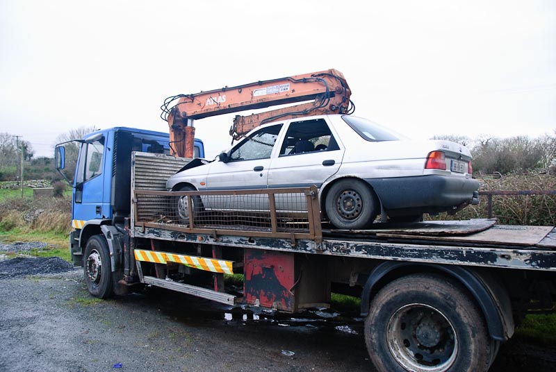
car a day or so later on a flat bed truck.
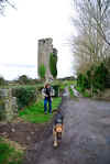
We made rapid progress down to
Quin, winding through some scenic country and some small towns and other
less scenic and not so small towns. We passed through Quinn and drove a short
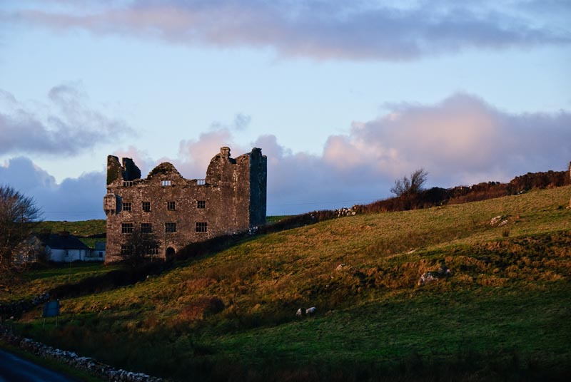
way further to see if we could spot anything interesting. We did! We found
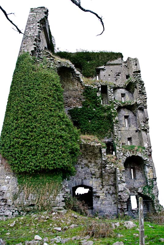
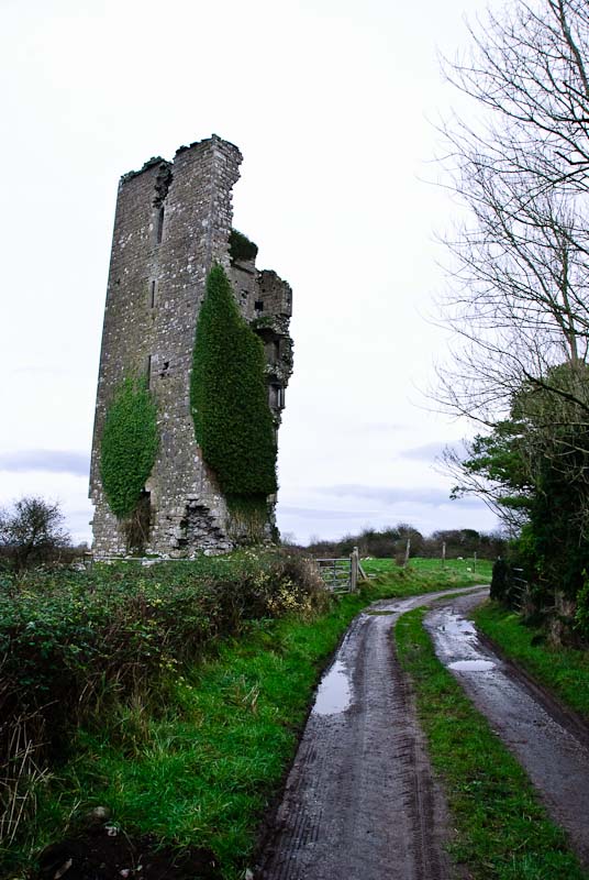
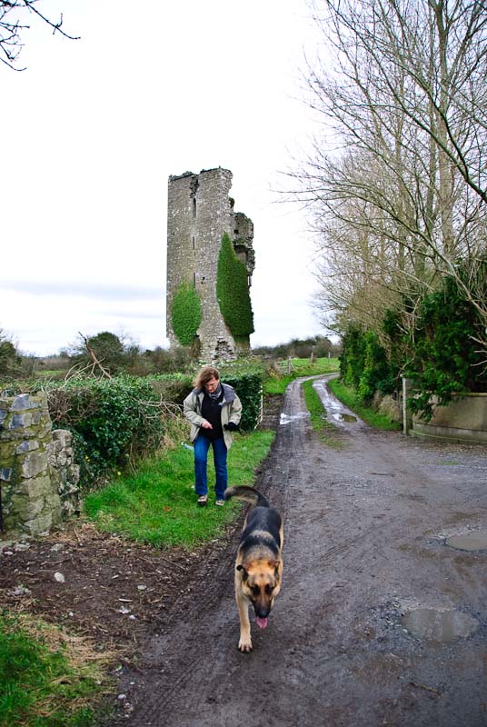
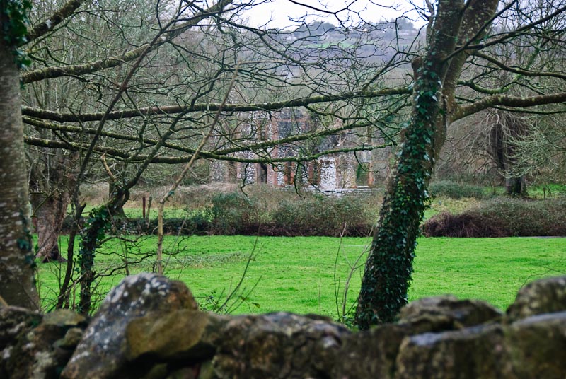
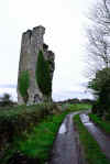
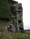
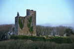
Ballymarkahan Castle. It was visible from the road and through some trees.
We drove down a lane until we reached a driveway to a house. We parked along
the road and talked along the lane to the castle. We hopped over the fence
and approached it through the field. We were trying to stay off the farm property,
but found that there was easy access up the driveway. We took this route back.
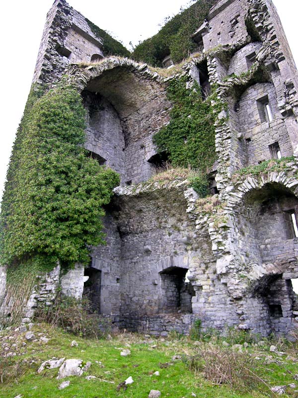
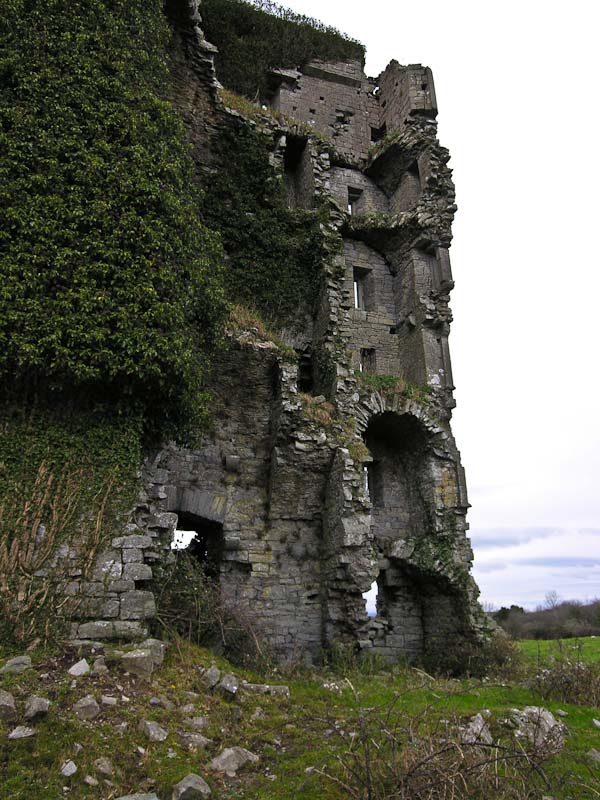
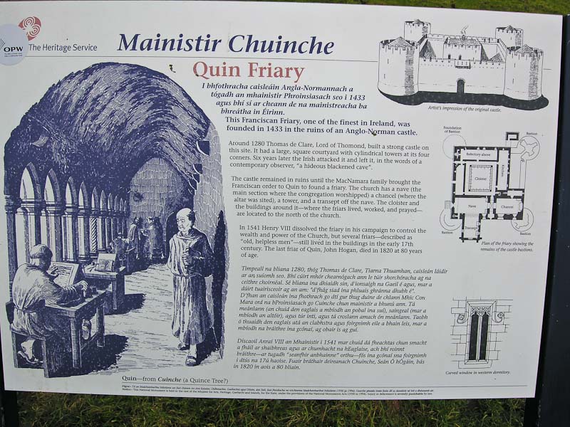
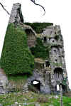
Ballymarkahan Castle has an interesting history that you can read
here. The castle itself is in bad shape and looks like more parts could
fall off at any time. Just the way we like them. As one wall and most of another
was missing, you could see the inside and the remains of the floors. We didn't
get to close and it held together while we walked around it. As we crossed
the fence and onto the driveway, the farm dogs discovered us and ran to get
acquainted. We had an escort back to the
car and they were very disappointed
to see us go.

Back in
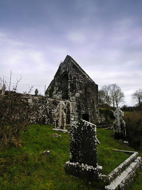
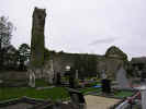
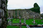
Quin we found parking along the road and walked out to the large ruins
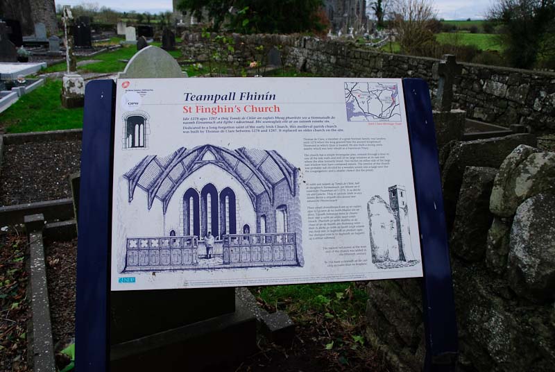
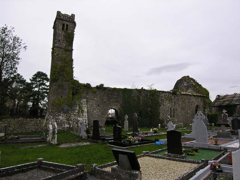
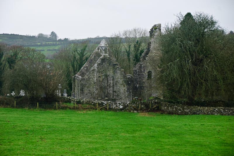
of the abbey. As we got closer we realized there were two sets of ruins. The
closest was St. Finghan's Church and the one futher on,
Quin Friary. St. Finghans
was built between 1278 and 1285. According to tradition, the church was dedicated
to St. Finghin, but by 1839, John O'Donovan was unable to discover which St.
Finghin it commemorated or even which holy day had been kept in his honour.
No part of the church appeared older than the fifteenth century to him. We
wandered around St. Finghan's and couldn't find out either. There is a fairly
substantial graveyard around the church. We took a few pictures and then walked
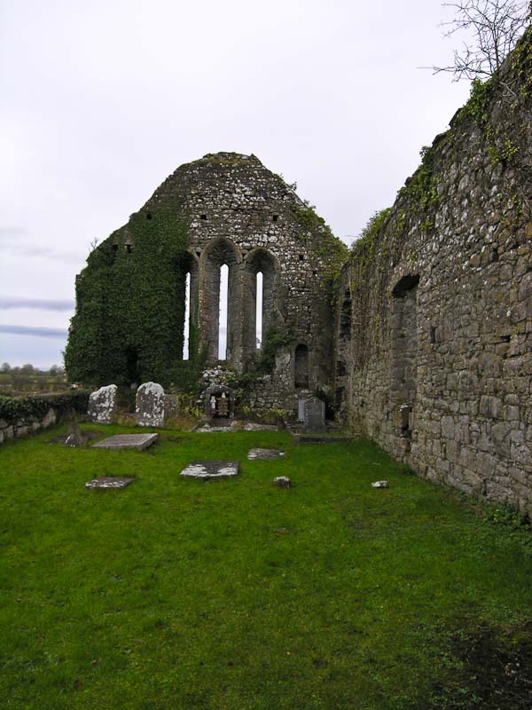
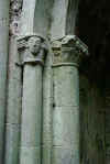
down the path towards Quin Friary.
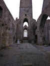

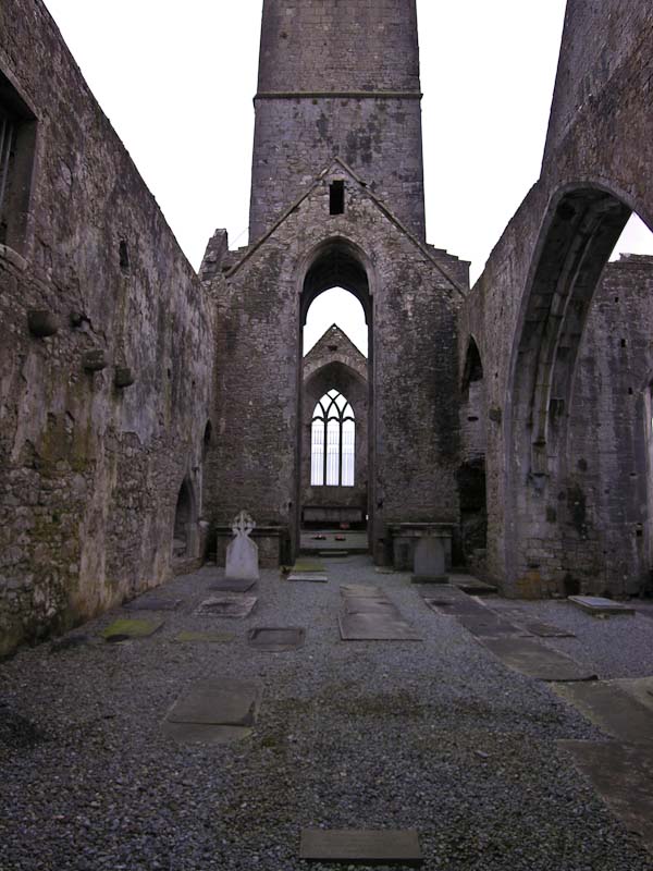
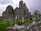
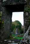
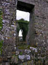
Quinn
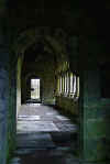
Friary was founded by the McNamaras in the 14th century. The cloisters
were built in 1402 and remain one of the prominent features of the site. Unfortunately
the place was locked tight and we could only peer through windows. The ruins
are quite large and took some time to walk around. We were able to see bits
and pieces of the cloisters, but not well. Evidently you can go up in the
tower as well and there is a good view from there. Perhaps another time.
 Walking
back, we took a different route and passed a nice stone bridge over a river.
The town was pretty quiet and we elected to leave it that way and headed back
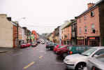
towards Kilfenora. We stopped in Ennis to find some place for lunch. The town
was crowded and we skirted around the edge. We found a small takeaway called
Yvonne's and got some hamburgers. We parked in a
car park and found that Irish
takeaway isn't any better than ours. We set off again with heartburn and indigestion.
We picked up a bag of turf in Corofin
at the same place we'd shopped in 2005. The price was about the same as well.
We headed back to the cottage, freshened up a bit and went off to
Linnane's for a pint and dinner. Walking
back, we took a different route and passed a nice stone bridge over a river.
The town was pretty quiet and we elected to leave it that way and headed back
towards Kilfenora. We stopped in Ennis to find some place for lunch. The town
was crowded and we skirted around the edge. We found a small takeaway called
Yvonne's and got some hamburgers. We parked in a
car park and found that Irish
takeaway isn't any better than ours. We set off again with heartburn and indigestion.
We picked up a bag of turf in Corofin
at the same place we'd shopped in 2005. The price was about the same as well.
We headed back to the cottage, freshened up a bit and went off to
Linnane's for a pint and dinner.
|
TOP
| BACK
|
Kilfenora, Co. Clare
|
|
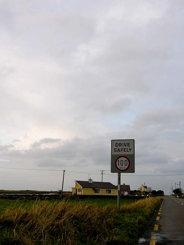
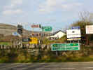
Wednesday 1/2
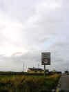
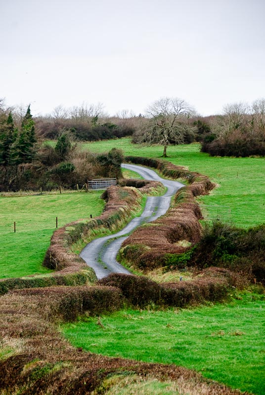
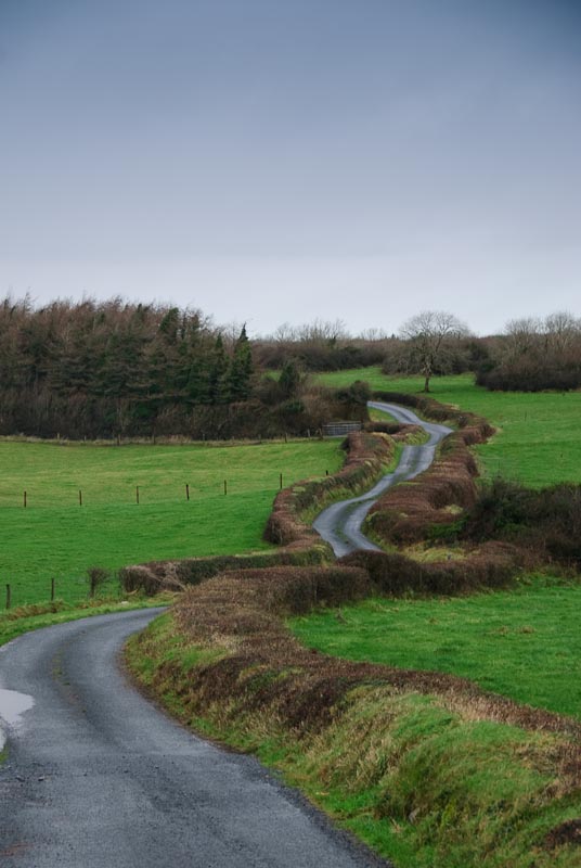
 Today's
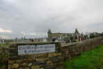
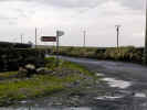
starting topic is crazy Irish roads and driving. I think the sign to the left
pretty much says it all. A narrow, barely two lane road with no lighting and
occasional road stripes. The sign reads Drive Safely 100 km/h. We had to turn
around and go back to take a picture of this sign. Locals do travel at these
speeds. I tried it once and quickly slowed to a much more reasonable speed
as 100 felt like I was on the edge of control. Not to speak of what might
happen when you come around a corner and find a tractor taking up both lanes.
We managed to keep out of the way of those traveling at 100 km/h most of the
time, and didn't wish to join their ranks. Speaking of joining their ranks,
as we drove along we saw an interesting looking graveyard down a lane off
the main road. We turned off and followed the road out to Clohanes Graveyard.
Parts of it were interesting and parts were odd. Some of the crypts had been
vandalized and headstone propped up to block the holes. One of the crypts
was painted bright yellow. Maybe there was a paint sale? We wandered around
a bit and then headed back to the
car when it started to rain. Just outside
of Doonbeg we stopped in a small store for snacks. The woman behind the counter
told us to visit the Bridges of Ross if weather permitted. We had a nice chat
and then we were off again with Club soda and biscuits. Today's
starting topic is crazy Irish roads and driving. I think the sign to the left
pretty much says it all. A narrow, barely two lane road with no lighting and
occasional road stripes. The sign reads Drive Safely 100 km/h. We had to turn
around and go back to take a picture of this sign. Locals do travel at these
speeds. I tried it once and quickly slowed to a much more reasonable speed
as 100 felt like I was on the edge of control. Not to speak of what might
happen when you come around a corner and find a tractor taking up both lanes.
We managed to keep out of the way of those traveling at 100 km/h most of the
time, and didn't wish to join their ranks. Speaking of joining their ranks,
as we drove along we saw an interesting looking graveyard down a lane off
the main road. We turned off and followed the road out to Clohanes Graveyard.
Parts of it were interesting and parts were odd. Some of the crypts had been
vandalized and headstone propped up to block the holes. One of the crypts
was painted bright yellow. Maybe there was a paint sale? We wandered around
a bit and then headed back to the
car when it started to rain. Just outside
of Doonbeg we stopped in a small store for snacks. The woman behind the counter
told us to visit the Bridges of Ross if weather permitted. We had a nice chat
and then we were off again with Club soda and biscuits.
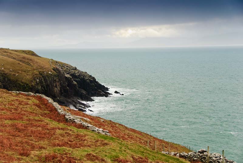
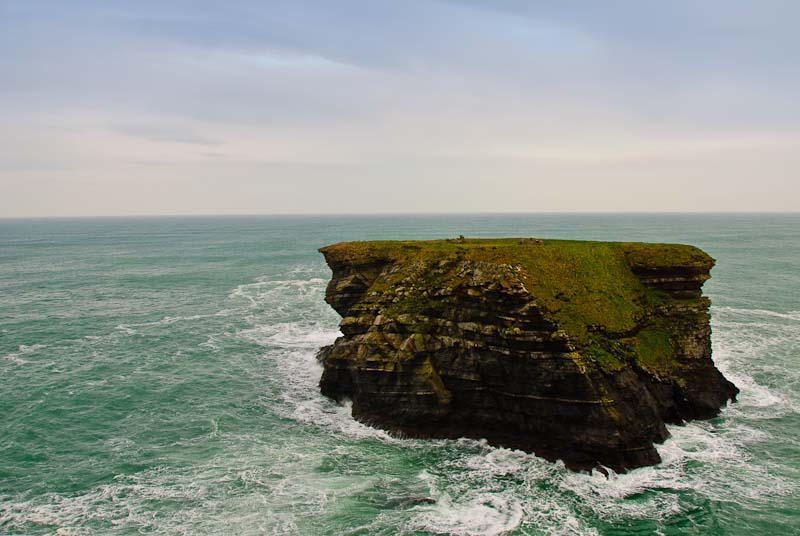
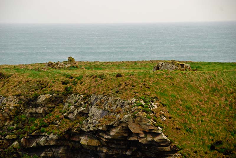
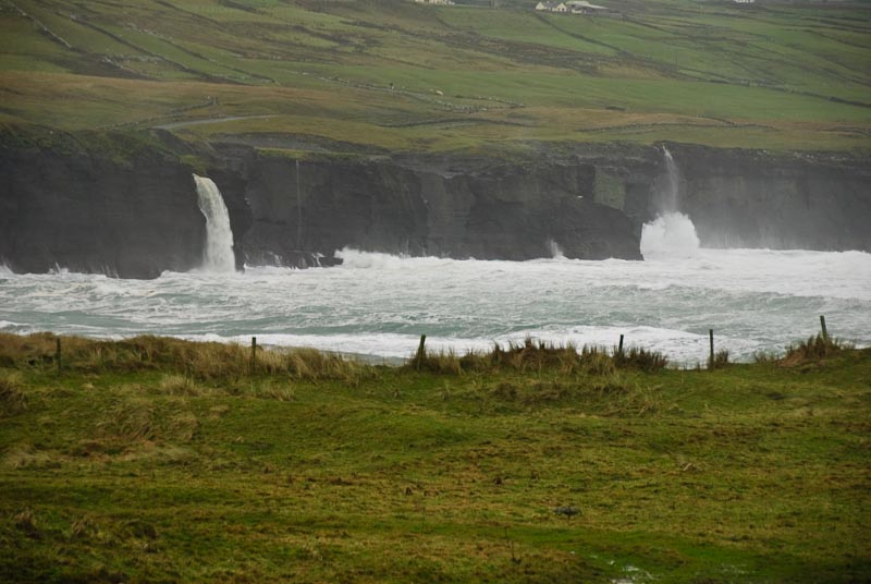
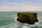
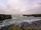
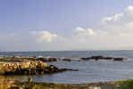
We followed the coast road. There were a number of interesting
spots that we stopped and took pictures and then hopped back in the
car quickly
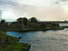
to avoid the rain. A Fooagh Point there was a large island, block of stone
or what ever it was perched in the surf (actually I think it is called a sea-stack).
On top you could make out the remains of buildings. At one point this must
have been connected to the mainland and that connection or bridge was worn
away. The sides of the rock were to steep to make any transit off the island
less than feasible.

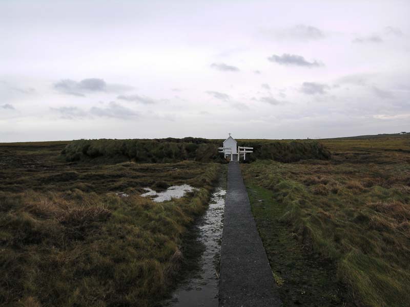
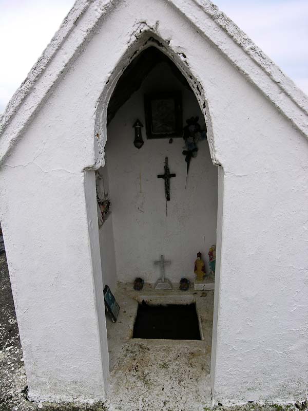
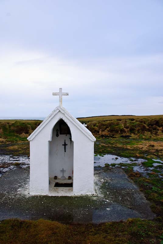
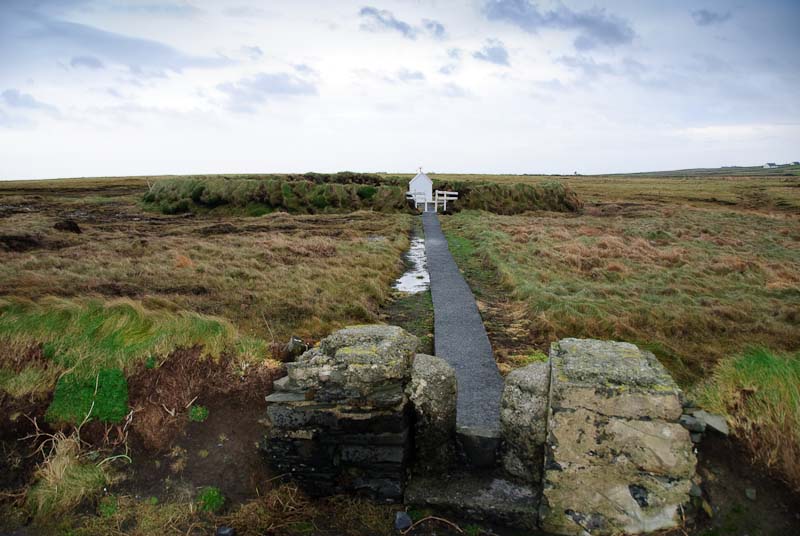
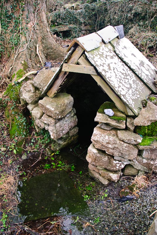
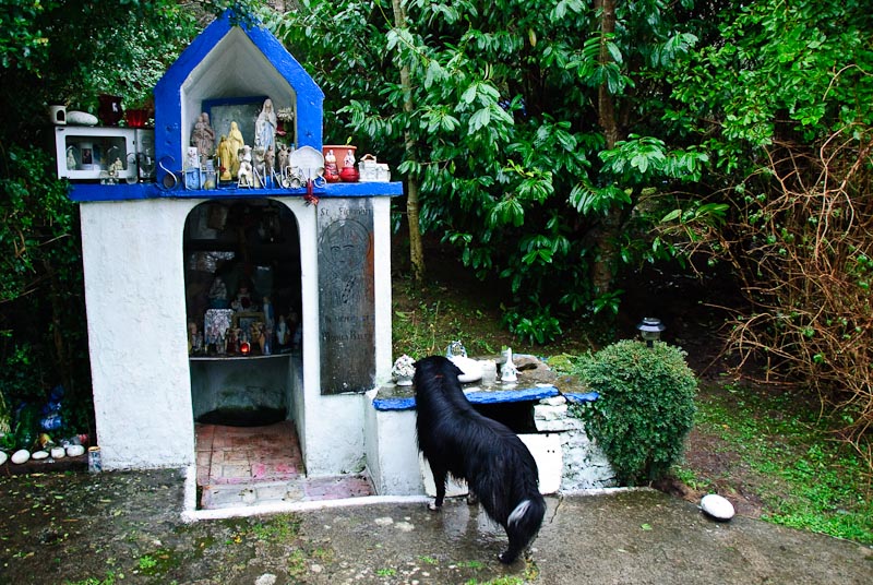
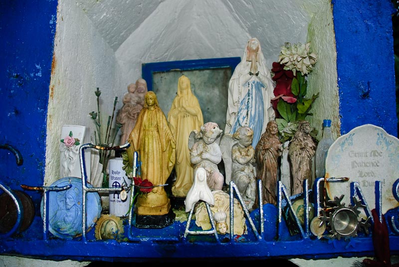
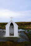
Just a bit further down the road we saw a small white structure surrounded
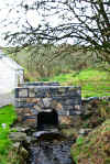
by a wall. Looked like a shrine or holy well, so off we went to see. Sure
enough it was an unmarked holy well. Very desolate countryside, but it was
well tended. We found out in a recent edition of Ireland of the Welcomes that
it is Fooaugh Holy Well. We have not been able to find out much more about
it.

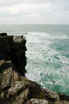
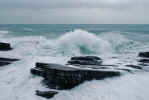
 Shortly after we came to a
car park and view point. We bundled up and walked
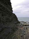
out in the wind, light rain and ocean spray to have a look around. There were
some incredible rock formations and steep cliffs falling off down to jagged
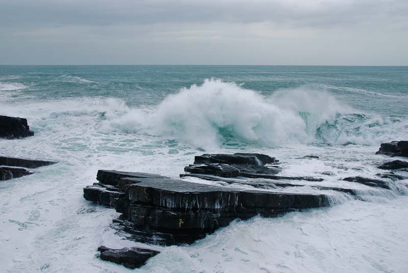
rocks and the surf below. We spent about an hour wandering around looking
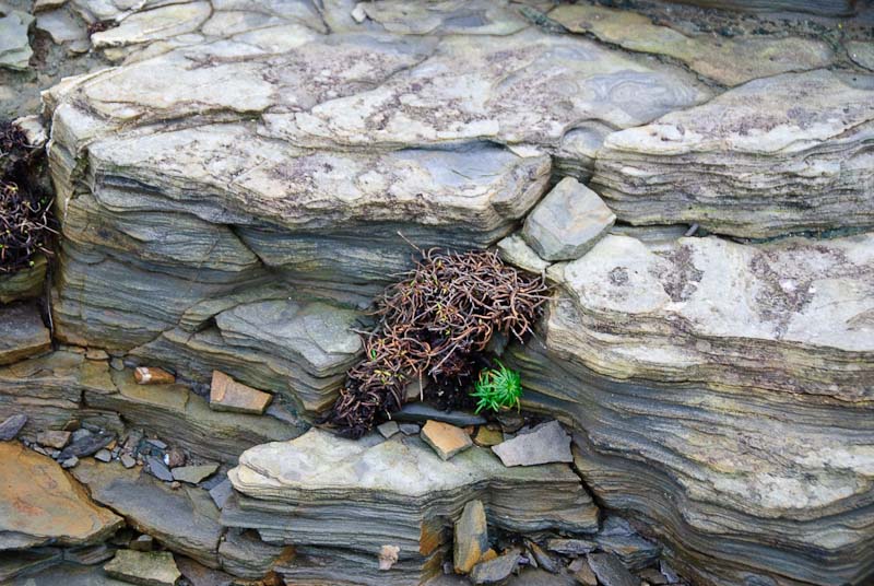
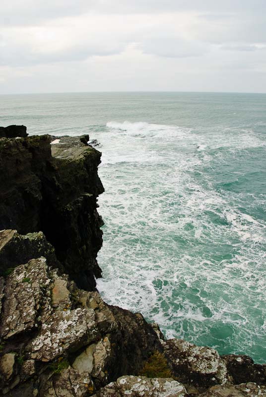
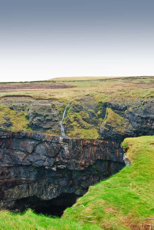
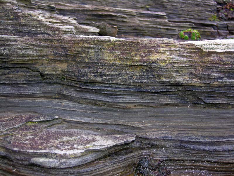
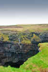
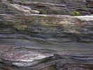
at the layered rock and strange landscape. Waterfalls ran off of sheer cliffs
to the sea below, and the layered rocks were twisted and warped.
Shortly after we came to a
car park and view point. We bundled up and walked
out in the wind, light rain and ocean spray to have a look around. There were
some incredible rock formations and steep cliffs falling off down to jagged
rocks and the surf below. We spent about an hour wandering around looking
at the layered rock and strange landscape. Waterfalls ran off of sheer cliffs
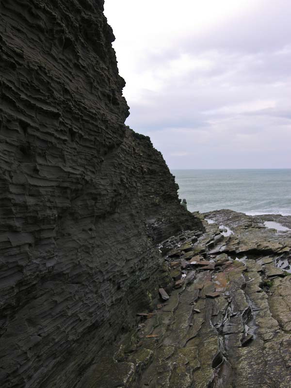
to the sea below, and the layered rocks were twisted and warped.
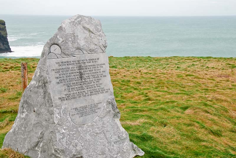
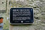
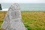 Nearby was the Ocean Rowers
Memorial at Dunlicka Castle, Kilkee unveiled on March 22, 2003. It commemorates
several teams of ocean rowers lost at sea. The memorial reads:
Nearby was the Ocean Rowers
Memorial at Dunlicka Castle, Kilkee unveiled on March 22, 2003. It commemorates
several teams of ocean rowers lost at sea. The memorial reads:
Memorial erected by Kilkee Civic Trust in honour of Ocean Rowers who were
lost at sea.
David Johnstone and John Hoare rowing together West to East from Virginia
Beach (USA) in 1966.
Kenneth Kerr rowing solo West to East from St. John's, Newfoundland (Canada)
in 1980.
Andrew Wilson rowing solo West to East from St. John's, Newfoundland (Canada)
in 1980.
Eugene Smurgis rowing East to West from London (England) in 1993.
Peter Bird rowing solo West to East from Nakhodka (Russia) in 1996.
Nenad Belic rowing West to East from Cape Cod (USA) in 2001 and whose boat
"LUN" was recovered off this headland in November 2001.
"Pity the drowned in time of storm
for the sun comes
when the rain is gone."
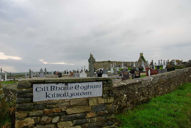
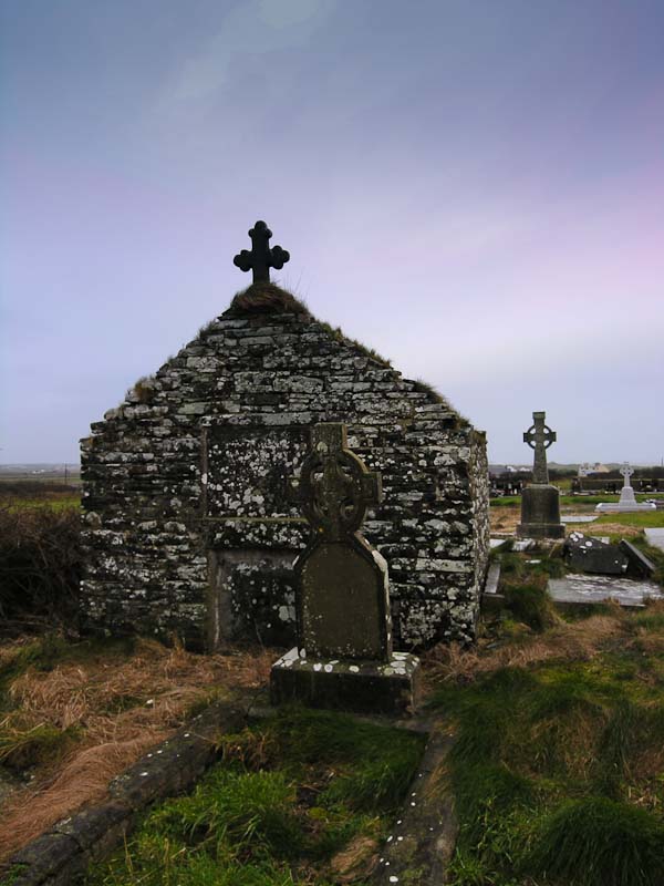
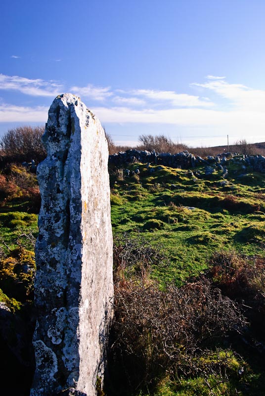
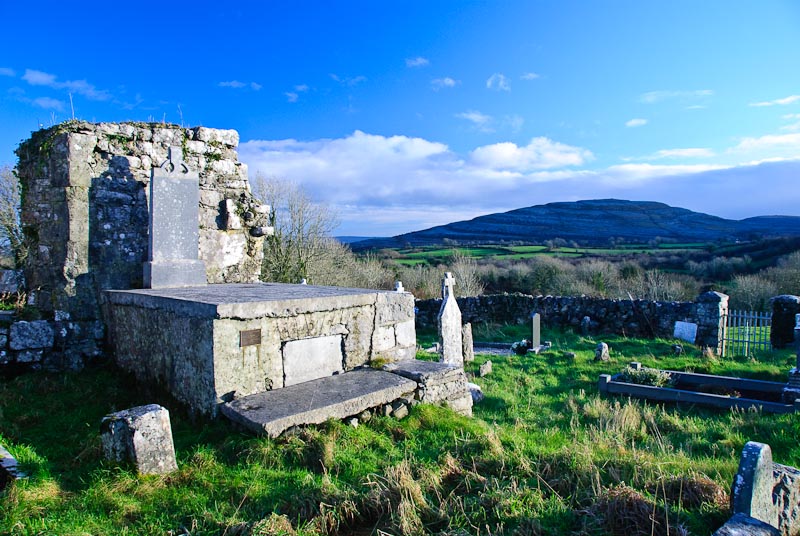
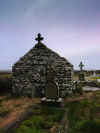
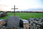
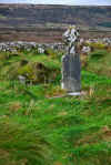
Kilballyowen Graveyard is alongside the road right before you enter
Kilballyowen. It has a number of interesting headstones and a ruined church.
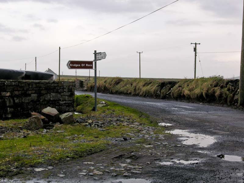
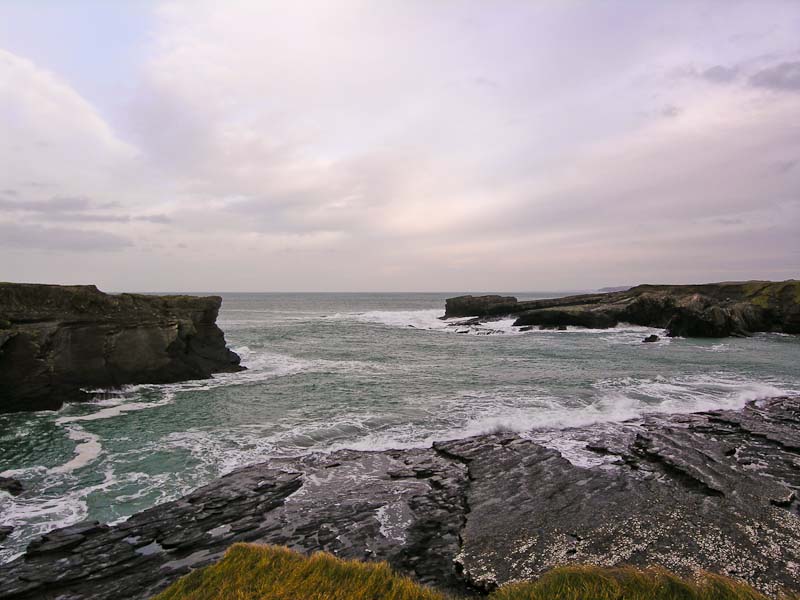
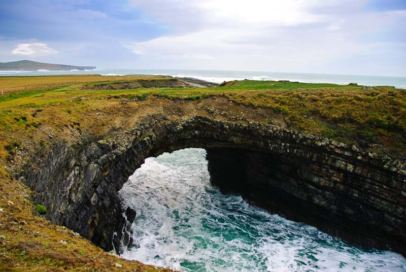
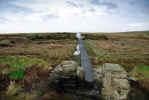
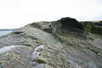
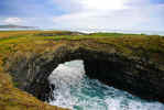
We were in search of the Bridges of Ross. We didn't know what we
were looking for specifically, but were told by a shopkeeper to go see them.
We knew roughly where they were and sure enough we ran across a sign. There
was a small
car park, but no bridges. Actually there were three at one time,
but two have collapsed and it is a good walk to the third. We didn't know
what to look for, but just kept walking along the coastline and looking at
the rocks and surf. This is a great location for just poking around if you
like the ocean and sea watching. Eventually we ran across the bridge. I risked
its collapse and went across to the other side. It seemed stable, I imagine
it has a few good years left in it. All around there were smaller cutouts
in the rock that the surf rushed through.
Some geological info. Evidently this is a good area for
bird watching at certain times of the year. A
fanciful engraving of the site showing other bridges that existed at one
time.

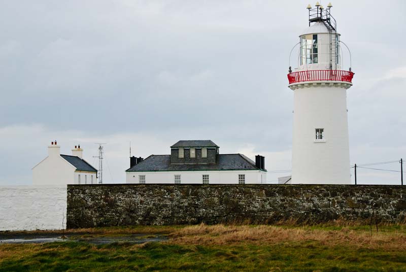
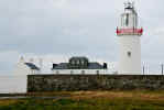
We completed the drive out to the Loop Head Lighthouse. It is walled
off and the gate was closed. It isn't particularly picturesque, but there
it is. It was a pretty short stop since we couldn't walk around or climb anything.
 We wandered around the lower part of Loop Head. There are a number of small
towns and roads leading off that were probably interesting. We saw a heron
and some other interesting birds. At this point we were a little tired from
the earlier activity and the weather had turned colder and wetter so our enthusiasm
was not high. To truly explore this area it would be a good idea to stay a
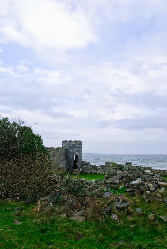
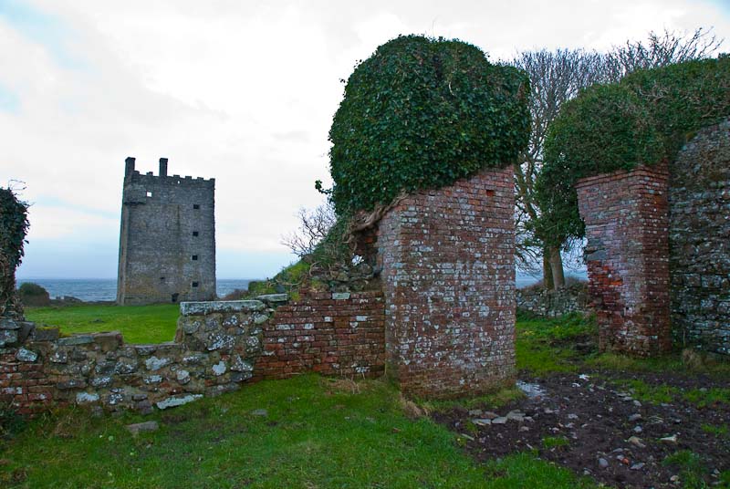
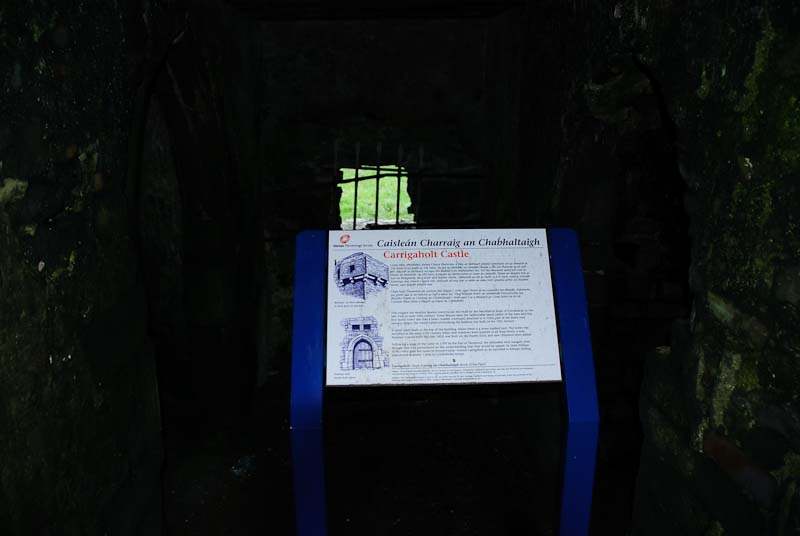
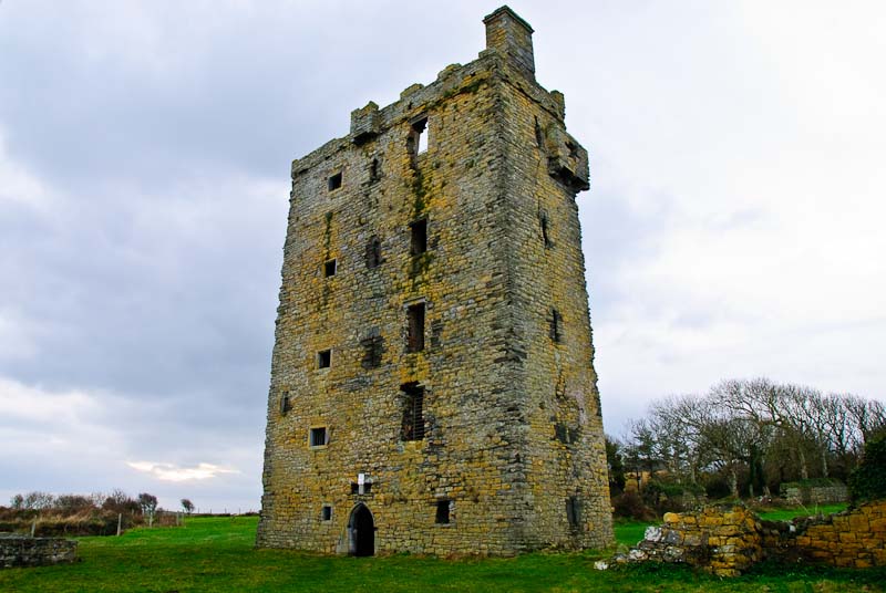
few days. We saw signs to Carrigaholt and
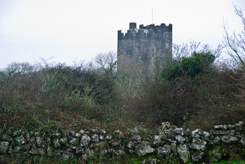
Carrigaholt Castle and followed the road out to the castle. Take the R487
out to the coast and turn right and then left on the road out to the pier.
There isn't a lot of parking room as the road is part of a industrial area
and working pier. There is a good deal of fishing activity both commercial
and sport. There is a large gateway in front of a field. The field was pretty
messy, skirting the edge is the least muddy option. It is probably better
in the summer depending on how long ago it last rained. The castle looks like
it may be open for viewing inside, but was locked up when we visited. There
are fairly large grounds with a tower in one corner of the wall that provides
a good view if you climb up inside.
We wandered around the lower part of Loop Head. There are a number of small
towns and roads leading off that were probably interesting. We saw a heron
and some other interesting birds. At this point we were a little tired from
the earlier activity and the weather had turned colder and wetter so our enthusiasm
was not high. To truly explore this area it would be a good idea to stay a
few days. We saw signs to Carrigaholt and
Carrigaholt Castle and followed the road out to the castle. Take the R487
out to the coast and turn right and then left on the road out to the pier.
There isn't a lot of parking room as the road is part of a industrial area
and working pier. There is a good deal of fishing activity both commercial
and sport. There is a large gateway in front of a field. The field was pretty
messy, skirting the edge is the least muddy option. It is probably better
in the summer depending on how long ago it last rained. The castle looks like
it may be open for viewing inside, but was locked up when we visited. There
are fairly large grounds with a tower in one corner of the wall that provides
a good view if you climb up inside.


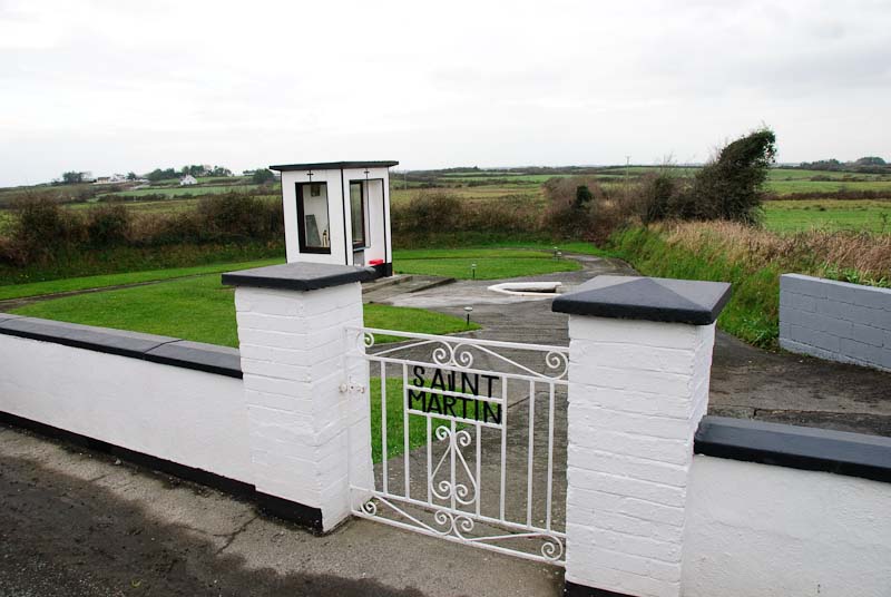
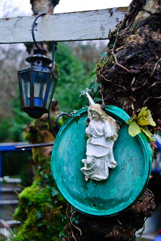
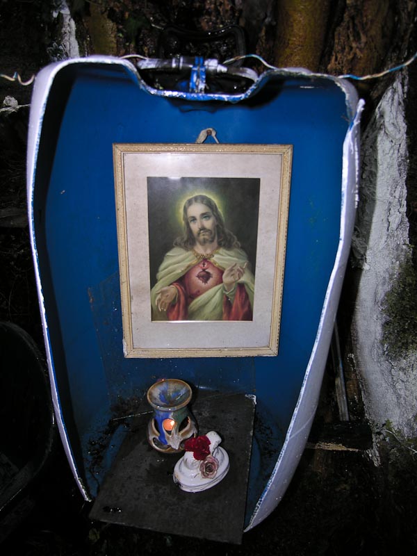
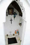
 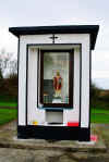 I'm not really sure how we got to
St. Martin's Holy Well, although I think we found it on the map later.
We were following some sign for a wildlife bird refuge near the Poulnasherry
Bay estuary which we never really found, or if we did we were unimpressed.
The weather was so bad that we probably couldn't do it justice anyway. Anyway,
along the road we spotted the gate and pulled off the road to take a look.
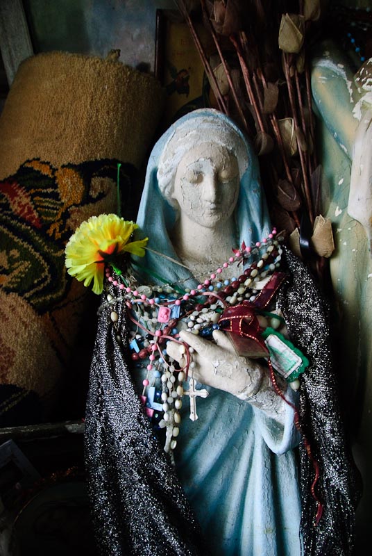
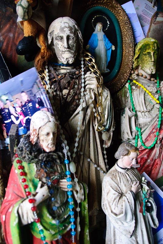
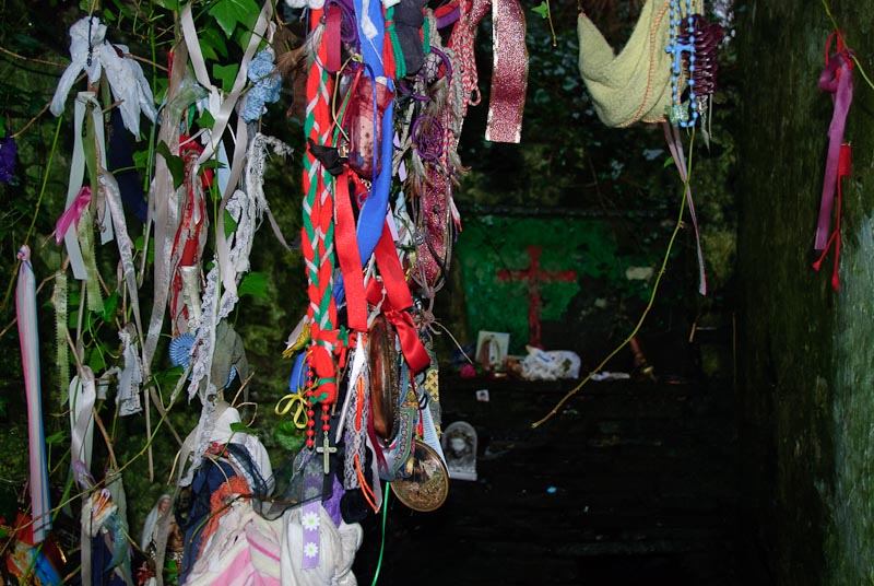
I'm not sure who St. Martin was, but we could only assume that he was the
patron Saint of mugs or hot beverage drinking devices in general. There were
a good collection of them adorning the front of the shrine. We particularly
liked the one that said Hot Daddy. We'd pretty much exhausted our sense of
adventure at this point and we headed back in the most direct route we could
find to Kilfenora. It was a long drive in the rain and not much more eventful
happened. We stopped in at Vaughan's in Kilfenora for some soup and a pint
and called it a night early as I still had the sore throat and general achiness.
I'm not really sure how we got to
St. Martin's Holy Well, although I think we found it on the map later.
We were following some sign for a wildlife bird refuge near the Poulnasherry
Bay estuary which we never really found, or if we did we were unimpressed.
The weather was so bad that we probably couldn't do it justice anyway. Anyway,
along the road we spotted the gate and pulled off the road to take a look.
I'm not sure who St. Martin was, but we could only assume that he was the
patron Saint of mugs or hot beverage drinking devices in general. There were
a good collection of them adorning the front of the shrine. We particularly
liked the one that said Hot Daddy. We'd pretty much exhausted our sense of
adventure at this point and we headed back in the most direct route we could
find to Kilfenora. It was a long drive in the rain and not much more eventful
happened. We stopped in at Vaughan's in Kilfenora for some soup and a pint
and called it a night early as I still had the sore throat and general achiness.
|
TOP
| BACK
|
Kilfenora, Co. Clare
|
|
Thursday 1/3
Today we wanted to hang out a little closer to home
while taking advantage of the good weather. An expedition
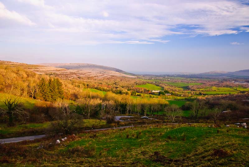
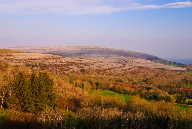
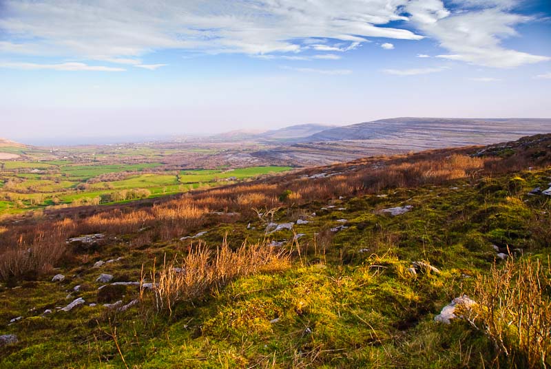
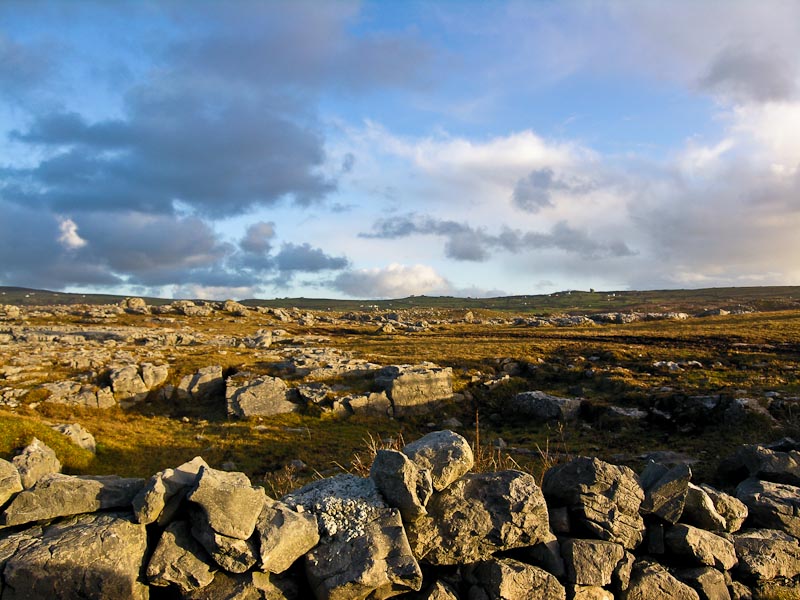
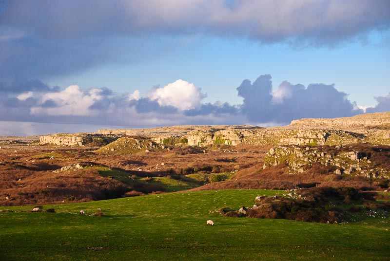
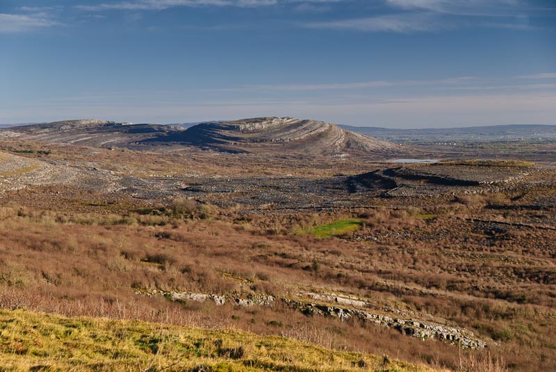
into the heart of the Burren was in order. We took off after breakfast towards
Ballyvaughan. After
Lisdoonvarna there
is a high point and then a drop down through winding curves known as Corkscrew
Hill. There are nice viewpoints at the top in several spots. We parked alongside
the road and walked out along the road to get some new perspectives. The road
down can be a bit narrow and harrowing depending on who is coming up. No tour
buses this time of year! We made it down safely and through the winding road
through the trees. Eventually you hit a split in the road, going off in many
directions. We took the road to the immediate left and headed back up hill
as it said there was a woodworker's shop. We never found it. What we did find
according to Tim Robinson's
The Burren: A Two Inch Map of the Uplands of North-west Clare, were
interesting historic sites.
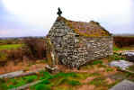
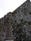
 Rathborney Church is just off a small gravel road on your right. There
are actually two sites on the road prior to this site, but are more difficult
to get to and recommended only if you like mud and cow muck (if you can tell
the difference). The drive into this site was in good condition, well graveled
and there is a small
car
park alongside. The church is from approximately
A.D. 1500 with parts being conceivably older. The church appears to be sitting
atop a rath or earthen ring fort. Thus the name "the rath of the burren".
This isn't uncommon as one group of people would pick the best site in a area
for a home and then another would come along and logically pick the same spot
and build atop the remains of their predecessors. The window on the East side
of the church is nicely carved as are some other elements of doors and windows.
The grounds are quite large and fairly well kept with a number of graves with
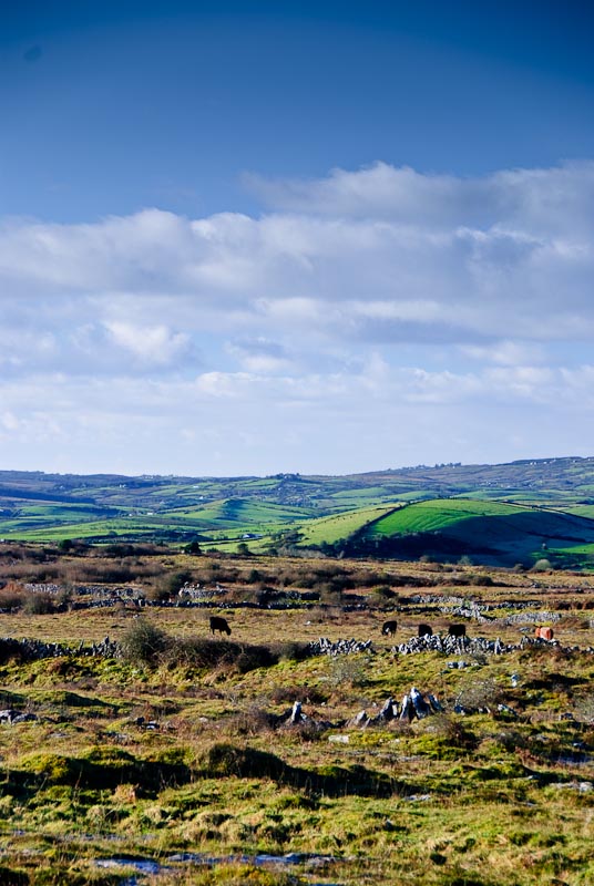
nice crosses. There is a wonderful view of the Burren in all directions.
Rathborney Church is just off a small gravel road on your right. There
are actually two sites on the road prior to this site, but are more difficult
to get to and recommended only if you like mud and cow muck (if you can tell
the difference). The drive into this site was in good condition, well graveled
and there is a small
car
park alongside. The church is from approximately
A.D. 1500 with parts being conceivably older. The church appears to be sitting
atop a rath or earthen ring fort. Thus the name "the rath of the burren".
This isn't uncommon as one group of people would pick the best site in a area
for a home and then another would come along and logically pick the same spot
and build atop the remains of their predecessors. The window on the East side
of the church is nicely carved as are some other elements of doors and windows.
The grounds are quite large and fairly well kept with a number of graves with
nice crosses. There is a wonderful view of the Burren in all directions.
Driving back down the road and on towards Ballyvaughan you see Newtown
Castle off the road to the left. The castle was restored and now is the home
of the exhibit center for the nearby
Burren College of Art. There is
also a confusing intersection that can take several minutes to decipher. Just
keep going straight to get to
Ballyvaughan.
We had no particular need to stop in Ballyvaughan. It is a nice small
town, and we made a quick stop at a gift shop, but didn't find anything interesting.
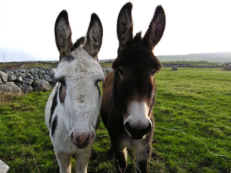
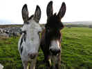
We retraced our steps through Ballyvaughan, around Black Head and down towards
Doolin. Along the way we ran into some friendly donkeys and the ruins of
Balinalackin Castle. The
castle is sitting next to a hotel called Ballinalacken House. The castle was
the home of the local O'Briens, and build around 1840. It looks good from
a distance. Up close there are more modern additions that aren't so scenic.
We continued on into Ennistymon to get some cash from an ATM and
to fuel up. We couldn't find an Internet cafe in Ennistymon and continued
on into Ennis. We finally found a Internet cafe at the top end of town. It
was a bit of a hike and as we didn't know where to go, we did some wandering.
It gave us a good feel for the layout of the central part of Ennis. We did
some money transferring, paid some bills, and read our email. This is a pretty
good way to go as you don't have to tote a laptop around and look for wireless.
Cost is usually about €1 an hour. By this time we were hungry and walked back
down to Cruises Bar. We'd had a nice pint here in the past and thought we'd
give them a go for lunch. We had soup and bread, creamy veg for Karen and
seafood chowder for me. We decided to get some coffee to keep us going and
found a small cafe down a side street that made a good cup. Back to the
car
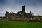
and then off for one of our favorite spots, Kilmacduagh.
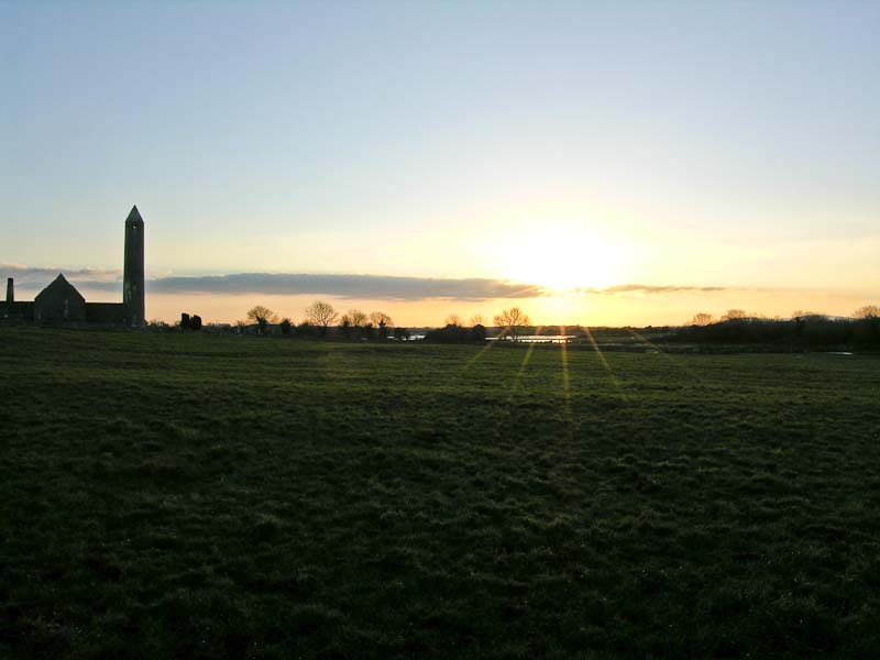
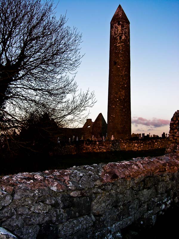
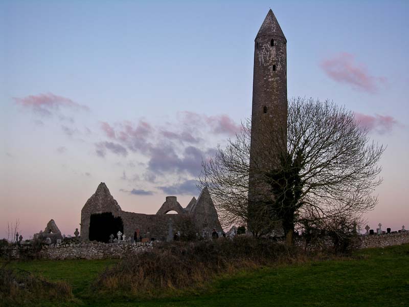
 We
drove up through Gort in Co. Galway on the main road and then back down to
the Kilmacduagh Monastic site on a back road. It is said that in the Diocese
of Kilmacduagh, no man will ever die from a lightning strike. One unlucky
man was struck, but the strength of it made him fly into Co. Clare, where
he then died. The sky was pretty clear and Co. Clare was a reasonable distance
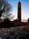
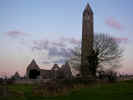
away, so we took our chances even though the tower is clearly the tallest
thing around. We again acquired a temporary pet as a local Golden Retriever
befriended us and guided us around the
car park, but didn't accompany us into
the site. The site is broken into three sections, down the road from the
car
park is one set of ruins, immediately next to the
car park is another with
the main area with the leaning round tower is across the field. We set out
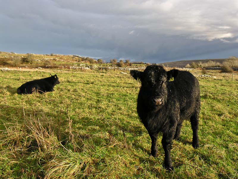
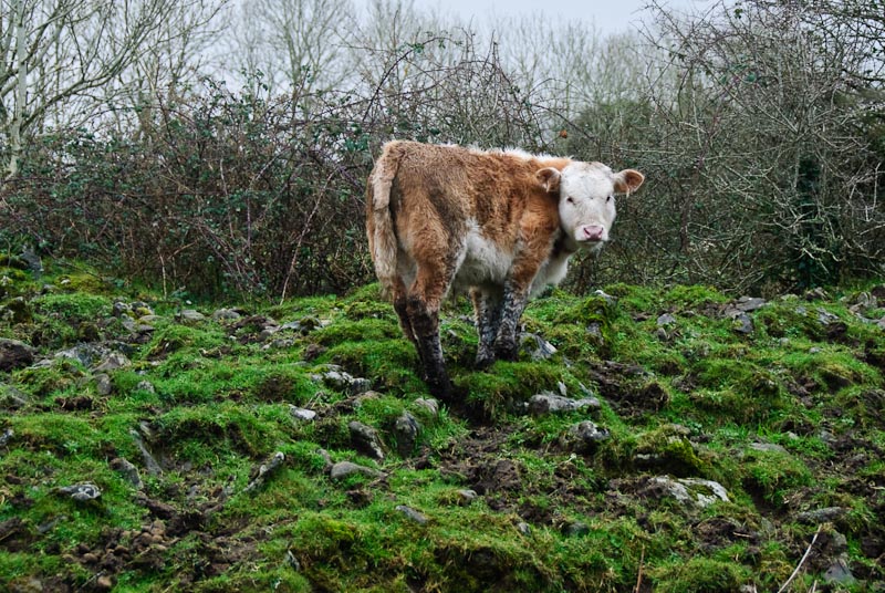
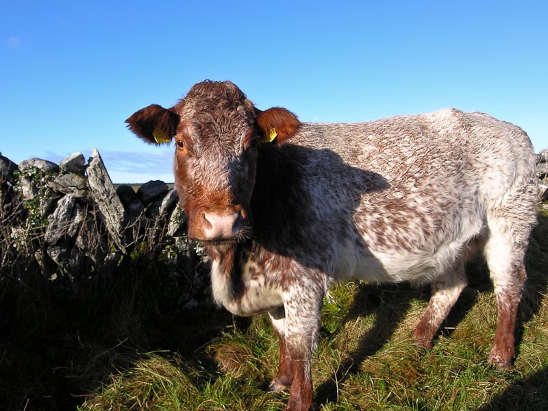
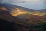
for the lower part and met a herd of muddy cows who were happy to munch proffered
grass from our side of the fence. The sun was sinking fairly low and we didn't
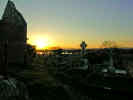
linger long down below as we wanted the good light in the graveyard. Back
up at the
car park we crossed the field and began to take a number of pictures
with the Burren in the background and the sun silhouetting the ruins of the
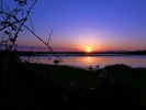
monastery and round tower. Past the main complex the ground dropped off and
a lake or just a lot of standing water from the rain created a nice reflection
of the setting sun. We stayed and took pictures until it was to dark to keep
shooting without a tripod (and our fingers were numb). It was clear but very
cold. We made our way back (carefully) across the graveyard and out onto the
road and back to the
car park. We
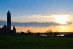
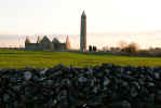
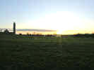
drove up through Gort in Co. Galway on the main road and then back down to
the Kilmacduagh Monastic site on a back road. It is said that in the Diocese
of Kilmacduagh, no man will ever die from a lightning strike. One unlucky
man was struck, but the strength of it made him fly into Co. Clare, where
he then died. The sky was pretty clear and Co. Clare was a reasonable distance
away, so we took our chances even though the tower is clearly the tallest
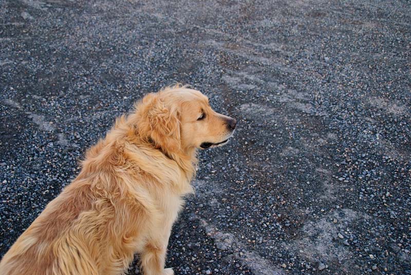
thing around. We again acquired a temporary pet as a local Golden Retriever
befriended us and guided us around the
car park, but didn't accompany us into
the site. The site is broken into three sections, down the road from the
car
park is one set of ruins, immediately next to the
car park is another with
the main area with the leaning round tower is across the field. We set out
for the lower part and met a herd of muddy cows who were happy to munch proffered
grass from our side of the fence. The sun was sinking fairly low and we didn't
linger long down below as we wanted the good light in the graveyard. Back
up at the
car park we crossed the field and began to take a number of pictures
with the Burren in the background and the sun silhouetting the ruins of the
monastery and round tower. Past the main complex the ground dropped off and
a lake or just a lot of standing water from the rain created a nice reflection
of the setting sun. We stayed and took pictures until it was to dark to keep
shooting without a tripod (and our fingers were numb). It was clear but very
cold. We made our way back (carefully) across the graveyard and out onto the
road and back to the
car park.


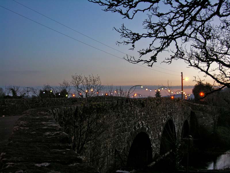
 We drove along the back roads t0wards Corofin.
The Christmas lights were up along the bridge and in town. We stopped for
a few pictures and then headed on to
Kilfenora.
Back in Kilfenora we tried
Linnanes Pub, but it was closed (no one ever tells us anything). We saw
a light in Nagles Pub across the street and thought we'd give it a try. Things
were pretty quiet, one other fellow was drinking with purpose at the bar.
We pulled up a stool and ordered a couple of pints. We chatted with the bartender
but he seemed mostly interesting in asking us computer questions when he heard
I had an IT background. He also was trying to figure out how to get the music
off a CCR DVD onto a CD. We didn't find it as pleasant as
Linnanes Pub, but maybe it was an off night. Back at home we had a homemade
potato and chicken casserole and put our feet up in front of a peat fire for
the evening.
We drove along the back roads t0wards Corofin.
The Christmas lights were up along the bridge and in town. We stopped for
a few pictures and then headed on to
Kilfenora.
Back in Kilfenora we tried
Linnanes Pub, but it was closed (no one ever tells us anything). We saw
a light in Nagles Pub across the street and thought we'd give it a try. Things
were pretty quiet, one other fellow was drinking with purpose at the bar.
We pulled up a stool and ordered a couple of pints. We chatted with the bartender
but he seemed mostly interesting in asking us computer questions when he heard
I had an IT background. He also was trying to figure out how to get the music
off a CCR DVD onto a CD. We didn't find it as pleasant as
Linnanes Pub, but maybe it was an off night. Back at home we had a homemade
potato and chicken casserole and put our feet up in front of a peat fire for
the evening.
|
TOP
| BACK
|
Kilfenora, Co. Clare
|
|
Friday 1/4
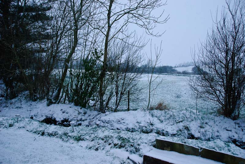
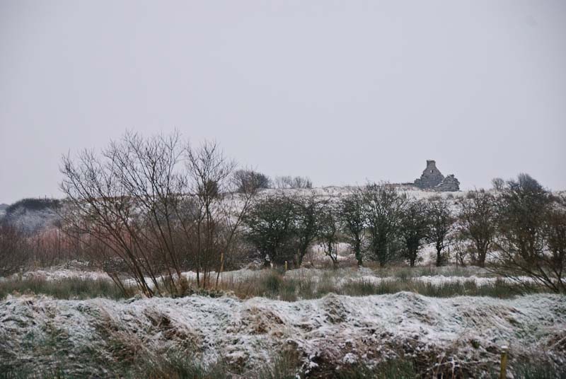
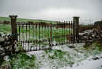
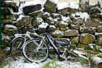
We woke up to snow, both on the ground and falling. We'd risen fairly
early as it was still dark. While we were getting breakfast ready I peaked
out the curtain in front of the sliding glass door and was surprised to see
the white ground. Karen didn't believe me until I drew the curtain and revealed
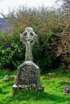
the falling flakes on a good two to three inches of snow. It was pretty much
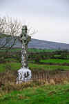
gone by noon, but we got out and took some pictures and slogged into Kilfenora
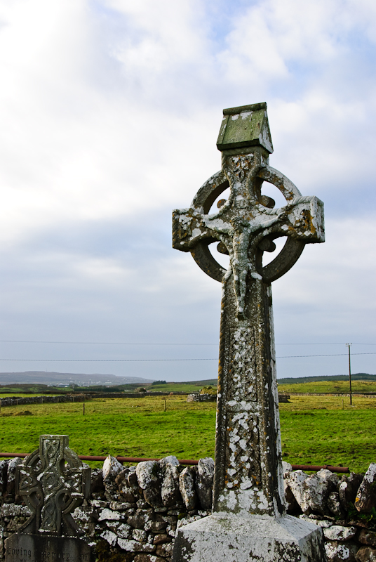
for some grocery items. We tried to see the cathedral in the snow, but it
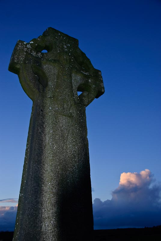
was locked up. We walked across the field to the high cross and took some
pictures. We picked up some water and other small items and headed back to
the cottage. It began to rain and hail with stiff winds on the way back. Probably
not the best idea, but one can't always be sensible.
 We decided to make a run into Corofin for more groceries and some turf as
the roads were clear. We got out of the wet clothes, into dry ones and off
we went again. We returned home and dropped off the groceries and headed out
for some site seeing as the weather was now sunny. Typical Irish weather!
Back on the road again and back towards Corofin. Our first stop was Coad Church
just up the road from Kilnaboy Church. Just take the road near Kilnaboy and
keep driving until you see Coad on the left. It is a small site with some
nice views of the countryside, sheep and lots of gravestones. Allegedly
Maura Rua of Lemaneagh
Castle was buried in the
Coad
graveyard.
We decided to make a run into Corofin for more groceries and some turf as
the roads were clear. We got out of the wet clothes, into dry ones and off
we went again. We returned home and dropped off the groceries and headed out
for some site seeing as the weather was now sunny. Typical Irish weather!
Back on the road again and back towards Corofin. Our first stop was Coad Church
just up the road from Kilnaboy Church. Just take the road near Kilnaboy and
keep driving until you see Coad on the left. It is a small site with some
nice views of the countryside, sheep and lots of gravestones. Allegedly
Maura Rua of Lemaneagh
Castle was buried in the
Coad
graveyard.


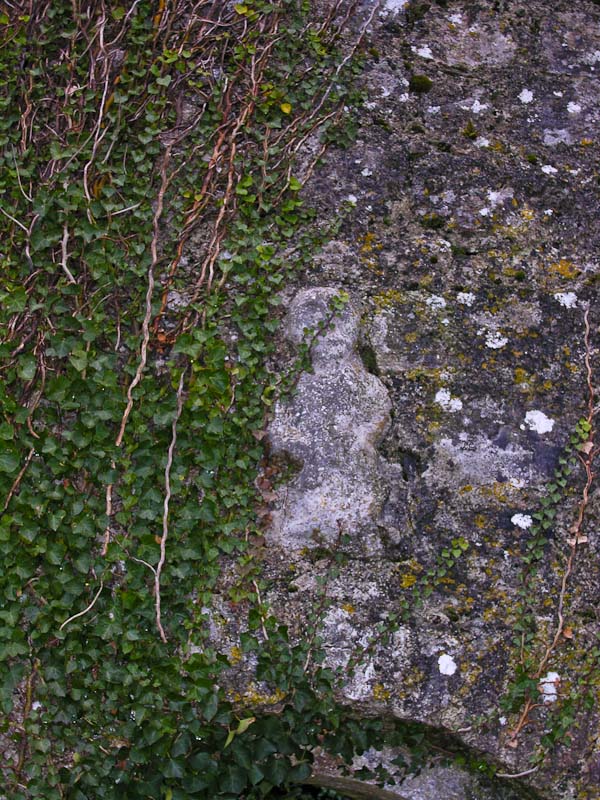
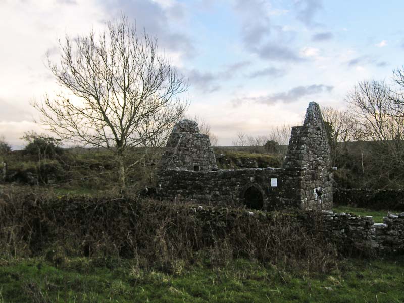
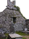
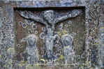
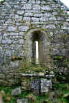
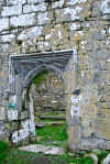
 Kilnaboy Church or Kill Inghinêbaoith is one of our favorites. I think because
we originally happened on it unexpectedly. It is perched on a hill overlooking
the road between Kilfenora and Corofin and Lake Inchiquin quite close to Corofin.
We've visited every trip to the best of my knowledge. There really isn't a
lot to see. The grounds are small and the graveyard is still in use. There
is the sheila na gig
over the door, always an object of interest. The stump of a round tower remains
not far from the church and ivy covers just about everything. The round tower
is said to have succumbed to an Cromwellian cannon assault. The rusted iron
gate still screeches a protest as you enter. The church dates to about the
16th century with some repairs made around 1715. A good description made of
the site in about 1910 by
Thomas Johnson
Westropp is
here.
Kilnaboy Church or Kill Inghinêbaoith is one of our favorites. I think because
we originally happened on it unexpectedly. It is perched on a hill overlooking
the road between Kilfenora and Corofin and Lake Inchiquin quite close to Corofin.
We've visited every trip to the best of my knowledge. There really isn't a
lot to see. The grounds are small and the graveyard is still in use. There
is the sheila na gig
over the door, always an object of interest. The stump of a round tower remains
not far from the church and ivy covers just about everything. The round tower
is said to have succumbed to an Cromwellian cannon assault. The rusted iron
gate still screeches a protest as you enter. The church dates to about the
16th century with some repairs made around 1715. A good description made of
the site in about 1910 by
Thomas Johnson
Westropp is
here.
 Following our map (Tim Robinson's
The Burren: A Two Inch Map of the Uplands of North-west Clare
Following our map (Tim Robinson's
The Burren: A Two Inch Map of the Uplands of North-west Clare )
and booklet we drove to Lemanagh Castle and then out onto the Burren in search
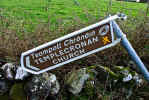
of Templecronan Church.
This was supposed to have some interesting carvings. We didn't really have
the specifics, but there are not many roads in this area and we bravely sallied
forth. We ended up at the end of a lane dead ending in a driveway of a house
under construction. This obviously wasn't it. We made a u-turn and spotted
a sign we'd missed before. Because the sign was lying on the ground, we had
to guess at the actual direction is had been pointing in. We parked nearby
and proceeded over a stone wall and across a field. There was a path that
we followed until we came to another gate. The path appeared to go left instead
of through the gate. Through the gate were a number of cows and not much else.
We followed the path for about 10 minutes through some pretty rough ground
and found nothing except more rocks. We retracted our steps and this time
went through the gate. The cows looked at us curiously but made no moves to
either run or attack. We passed within a few feet and found another faint
path. We followed it out to a stone wall and in the distance we could see
the remains of a church. This must be it! As we got closer we could see the
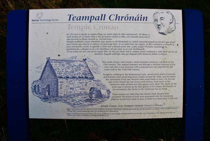
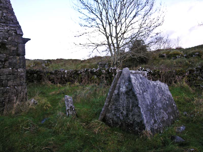
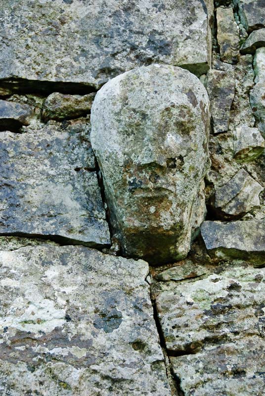
blue and white signage that indicate a heritage site. Sure enough it was Templecronan
Church. The grounds are surrounded by a low stone wall and the church is quite
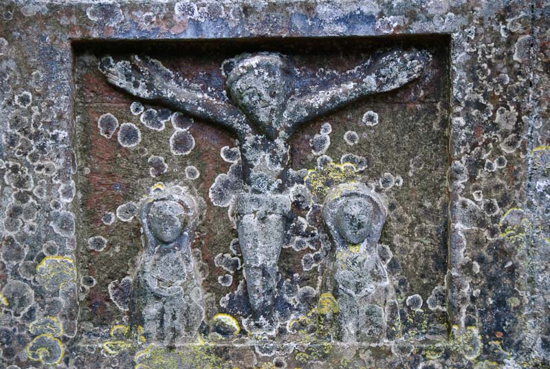
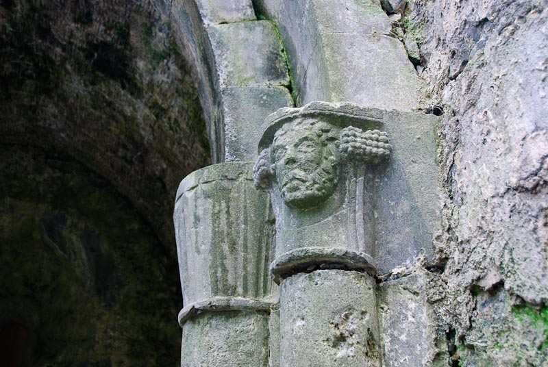
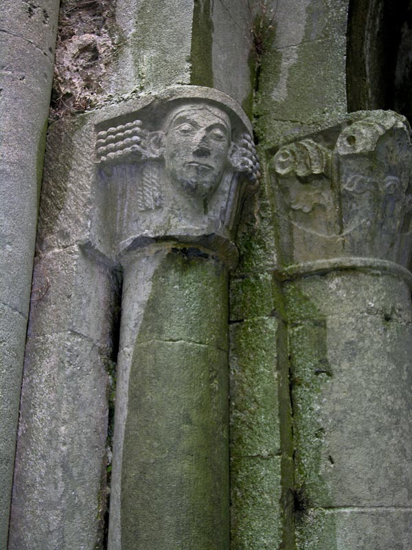
small. It is thought to be an early monastic site, probably pre 12th century.
There are pre Romanesque carvings of heads projecting from the walls. Nearby
are two tombs made of stone slabs propped against each other. We were struck
by how quiet it was. )
and booklet we drove to Lemanagh Castle and then out onto the Burren in search
of Templecronan Church.
This was supposed to have some interesting carvings. We didn't really have
the specifics, but there are not many roads in this area and we bravely sallied
forth. We ended up at the end of a lane dead ending in a driveway of a house
under construction. This obviously wasn't it. We made a u-turn and spotted
a sign we'd missed before. Because the sign was lying on the ground, we had
to guess at the actual direction is had been pointing in. We parked nearby
and proceeded over a stone wall and across a field. There was a path that
we followed until we came to another gate. The path appeared to go left instead
of through the gate. Through the gate were a number of cows and not much else.
We followed the path for about 10 minutes through some pretty rough ground
and found nothing except more rocks. We retracted our steps and this time
went through the gate. The cows looked at us curiously but made no moves to
either run or attack. We passed within a few feet and found another faint
path. We followed it out to a stone wall and in the distance we could see
the remains of a church. This must be it! As we got closer we could see the
blue and white signage that indicate a heritage site. Sure enough it was Templecronan
Church. The grounds are surrounded by a low stone wall and the church is quite
small. It is thought to be an early monastic site, probably pre 12th century.
There are pre Romanesque carvings of heads projecting from the walls. Nearby
are two tombs made of stone slabs propped against each other. We were struck
by how quiet it was.

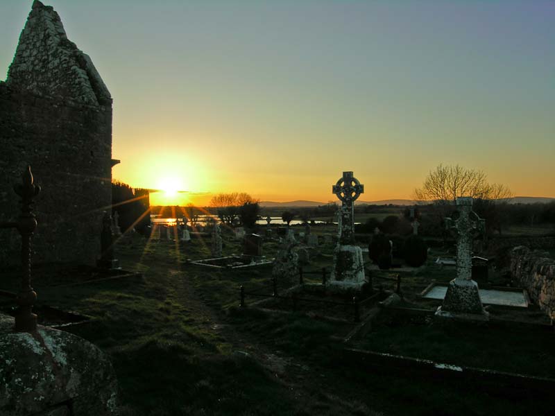
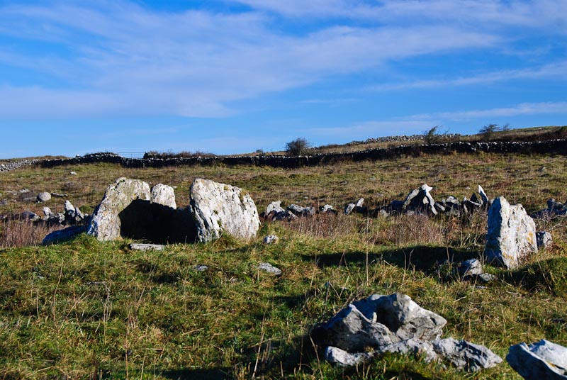
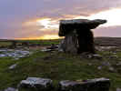
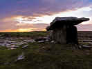
Since we were in the area we thought we'd pay a visit to the Poulnabroune
Dolman. Last time we were in 2004 here the crowds were intense and rude. People
were walking under the dolman in spite of it being roped off. With the cold
and time of year, we were hoping for very little activity. The grounds had
changed and there was a new
car park instead of having to park along the road.
There were also about 6 to 8 signs with historic information. There was only
one other
car in the park and we could see them heading back towards us. We
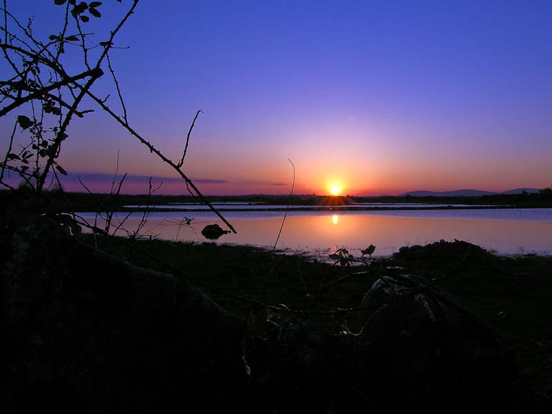
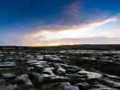
took a quick look at the signage and headed out to the dolman. The sky was
beginning to turn orange and purple as the sun was close to setting. We found
some good angles that hid the rope barrier and the nearby buildings. The sun
bounced off the limestone making it look wet. We took a lot of pictures as
the light changed. Late afternoon is a good time to visit although the ground
is a bit rough for navigation after dark. Don't stay out to long. We headed
back when the visiblity began to get bad and got back to the
car in one piece.
We decided to call it a day and headed for Kilfenora and a dinner at the cottage.
|
TOP
| BACK
|
Kilfenora, Co. Clare
|
|
Saturday 1/5
 A relatively unexciting trip to Galway to do some shopping. This still isn't
our favorite town. We keep trying, but it just hasn't worked for us. It was
crowded, but it was Saturday. We visited a lot of the small shops, but didn't
find a lot interesting and the prices were high. We had lunch in an interesting
restaurant that was mostly working people on lunch break. The menu was heavily
oriented to chips and other fried food. It was hearty fare and kept us going
the rest of the day once we'd requested some clean, not food encrusted silverware
and water glasses without lipstick.
A relatively unexciting trip to Galway to do some shopping. This still isn't
our favorite town. We keep trying, but it just hasn't worked for us. It was
crowded, but it was Saturday. We visited a lot of the small shops, but didn't
find a lot interesting and the prices were high. We had lunch in an interesting
restaurant that was mostly working people on lunch break. The menu was heavily
oriented to chips and other fried food. It was hearty fare and kept us going
the rest of the day once we'd requested some clean, not food encrusted silverware
and water glasses without lipstick.
We made a trip out to Spiddal because we do like this town. We tooks some
pictures in the graveyard but gave Hughes Bar a miss this time out.
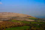
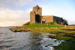
On the way back we stopped near Kinvara to take some pictures of Dunguaire
Castle, but the weather was getting colder and we had intermittent rain so
we didn't linger long. Back in Kilfenora we had a relaxing night in with dinner
and some odd British telly.
|
TOP
| BACK
|
Kilfenora, Co. Clare
|
|
Sunday 1/6
Karen had now acquired the sore throat and didn't feel
up to anything except keeping warm and drinking hot tea and watching Irish
TV. I took off for some more obscure sites that I'd found on Tim Robinson's
The Burren: A Two Inch Map of the Uplands of North-west Clare.
Below are some links for purchasing this map. It ranges from €8-€15 and is
worth every penny. You can also purchase it in the Burren area of Clare at
many stores, but it helps to study it before going and chart out some routes.
Here is a
great site for viewing
the Burren Map and photos of major sites from the map. The perfect pair for
the Burren map is Carleton Jones' excellent book, "The
Burren And The Aran Islands: Exploring The Archaeology "
"
 The
first intended stop was
Kilmoon church located just out of Lisdoonvarna. It is signed from the
main road, but is hard to see. The church is just a short distance down the
side road. There is little parking, just a wide spot in the road. The grounds
were very overgrown and walking was a bit treacherous with the tall grass
obscuring the rough ground. There is a wide range of new and old stones and
the church is small and in bad shape. There are nice views in all directions
and the site stands on a small hill. There is a nice cross and a holy well
across the field. The
first intended stop was
Kilmoon church located just out of Lisdoonvarna. It is signed from the
main road, but is hard to see. The church is just a short distance down the
side road. There is little parking, just a wide spot in the road. The grounds
were very overgrown and walking was a bit treacherous with the tall grass
obscuring the rough ground. There is a wide range of new and old stones and
the church is small and in bad shape. There are nice views in all directions
and the site stands on a small hill. There is a nice cross and a holy well
across the field.

 The
next stop
Killeany Church, is a bit harder to find and requires some walking. There
could be an easier way, but according to the map you need to take a turn off
the main road, go down a short distance, park along the road and walk through
several fields along a path to the church. There are several gates along the
way and you can either climb over or open the gate (be sure to close it securely
behind you) and go through. There is a reason for the gates, they are to keep
the cows and occasional bull contained. It is better to be on the other side
of the fence of a territorial bull. The cows aren't small either. I believe
there are three gates to navigate and then a path that turns abruptly to the
right and across a small stream to the church. The ground gets progressively
rougher, but isn't to bad to walk over. It is a good distance to walk. There
is an iron gate to the entrance of the church grounds. The gate is a bit rusty
and stiff, but this is the best way in. The rock wall is a bit rough to climb
over. The
next stop
Killeany Church, is a bit harder to find and requires some walking. There
could be an easier way, but according to the map you need to take a turn off
the main road, go down a short distance, park along the road and walk through
several fields along a path to the church. There are several gates along the
way and you can either climb over or open the gate (be sure to close it securely
behind you) and go through. There is a reason for the gates, they are to keep
the cows and occasional bull contained. It is better to be on the other side
of the fence of a territorial bull. The cows aren't small either. I believe
there are three gates to navigate and then a path that turns abruptly to the
right and across a small stream to the church. The ground gets progressively
rougher, but isn't to bad to walk over. It is a good distance to walk. There
is an iron gate to the entrance of the church grounds. The gate is a bit rusty
and stiff, but this is the best way in. The rock wall is a bit rough to climb
over.
Inside the wall, things were a bit overgrown, so watch your step.
The church is much larger than
Kilmoon church, but in pretty bad shape as well. There are good views
in all directions with a clear view of the Burren. This is well worth the
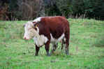
walk and the cow dodging. One the way back, a calf was watching me skeptically,
but didn't seem overly concerned. As I rounded the corner after crossing the
creek, a largish bull had wandered over and was standing just about where
I intended to go. His back was to me so I circled wide and came around slowly
so he could see me. I had some room to move in all directions in case he decided
to get feisty. He just watched me curiously as I moved around him. I took
a couple of pictures and he continued to watch me without concern. He seemed
to be a young bull as the horns were short. He had the obligatory ring in
his nose and all in all, seemed to be a nice fellow. I didn't push my luck,
and headed over to the gate and slipped through. I've heard horror stories
of people being chased across the field, but never had any problem. Most Irish
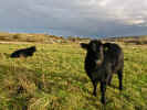
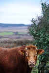
bovines seem to be more scared of me than I am of them.
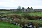

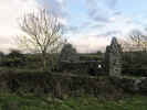
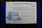
 My next stop was
Cahermacun Church and stone fort. It was a little distance away. Continuing
on the main road towards Ballyvaughan, down Corkscrew Hill and then to a four
way split in the road. Right before the split, there was a cow standing on
the stone wall watching traffic go by. Turn left at the split and head back
up the hill. There are several churches and other sites up this road including
Glenaraha, Rathnaboy and then Cahermacun. We'd visited
Rathborney Church earlier, but hadn't explored Cahermacun. There
was a gate in front of the road so I parked outside and went through. The
ground was very torn up by cows and tractors and I soon had mud up to mid
calf. Good thing I had my trusty
Columbia Sportswear
My next stop was
Cahermacun Church and stone fort. It was a little distance away. Continuing
on the main road towards Ballyvaughan, down Corkscrew Hill and then to a four
way split in the road. Right before the split, there was a cow standing on
the stone wall watching traffic go by. Turn left at the split and head back
up the hill. There are several churches and other sites up this road including
Glenaraha, Rathnaboy and then Cahermacun. We'd visited
Rathborney Church earlier, but hadn't explored Cahermacun. There
was a gate in front of the road so I parked outside and went through. The
ground was very torn up by cows and tractors and I soon had mud up to mid
calf. Good thing I had my trusty
Columbia Sportswear waterproof boots. They are comfortable and good in all sorts of terrain from
the Burren rock to ankle deep mud (I think it was mud, with all the cows around
you never know). This is a site for the very dedicated tourist. There was
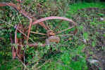
some old farm equipment rusting off to the side among the grass and weeds.
The church was very overgrown and between the weeds and muck, I had a hard
time getting over to the door. The cows had been hanging out inside as the
ground was covered in hoof prints. No one was home and I slogged around. The
inside is covered in ivy and while you can see the layout pretty well, there
isn't a lot to see. There are separate rooms, possibly the living areas were
part of the church or had been added or adapted over time. There appeared
to be fireplaces with chimneys in some of the smaller rooms. I escaped without
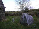
losing a boot and walked behind the church to firmer ground. There was a large
circular raised area full of trees and bushes. It was the remains of a stone
fort, maybe earthen walls, but maybe just a lot of dirt covered the remains
of the rock. Caher means stone fort, where rath is usually an earthen fort.
Rathbourney is built on a ring fort. I ducked through the trees and looked
around, but apart from some large burrows into the bank, there was nothing
to see. I slogged back to the
car, trying to stay along the fence line where
the cows hadn't torn up the ground.
waterproof boots. They are comfortable and good in all sorts of terrain from
the Burren rock to ankle deep mud (I think it was mud, with all the cows around
you never know). This is a site for the very dedicated tourist. There was
some old farm equipment rusting off to the side among the grass and weeds.
The church was very overgrown and between the weeds and muck, I had a hard
time getting over to the door. The cows had been hanging out inside as the
ground was covered in hoof prints. No one was home and I slogged around. The
inside is covered in ivy and while you can see the layout pretty well, there
isn't a lot to see. There are separate rooms, possibly the living areas were
part of the church or had been added or adapted over time. There appeared
to be fireplaces with chimneys in some of the smaller rooms. I escaped without
losing a boot and walked behind the church to firmer ground. There was a large
circular raised area full of trees and bushes. It was the remains of a stone
fort, maybe earthen walls, but maybe just a lot of dirt covered the remains
of the rock. Caher means stone fort, where rath is usually an earthen fort.
Rathbourney is built on a ring fort. I ducked through the trees and looked
around, but apart from some large burrows into the bank, there was nothing
to see. I slogged back to the
car, trying to stay along the fence line where
the cows hadn't torn up the ground.


The next stop was Corcomroe Abbey. I had to go through Ballyvaughan
and then along the coastline up to Bell Harbor. Along the way I saw
Bishopsquarter. Actually I'd noticed it as we'd gone by here on our way
to Galway. It was a small graveyard sitting up on a hill alongside the road.
There was a church and a larger crypt. I parked nearby and climbed the hill.
There was a wonderful view along the coast and behind across the valley with
the Burren in the distance. There were a number of interesting headstone with
some crosses, nothing very old. The church had a nice doorway, but nothing
exceptional inside. There is a nice beach across the road. The sky had started
to darken as I walked up to the church and now the rain was starting to fall.
I pulled up the hood on my (you guessed it) Columbia Sportswear waterproof
jacket and headed back to the
car.
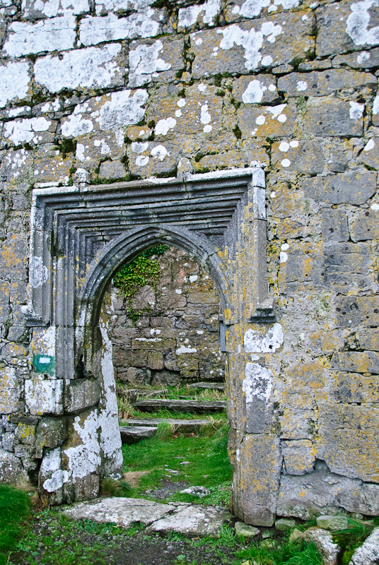
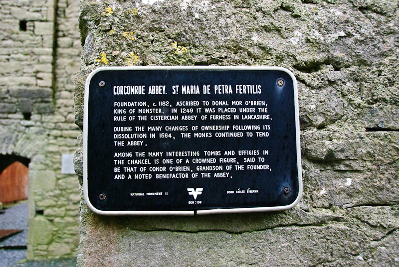
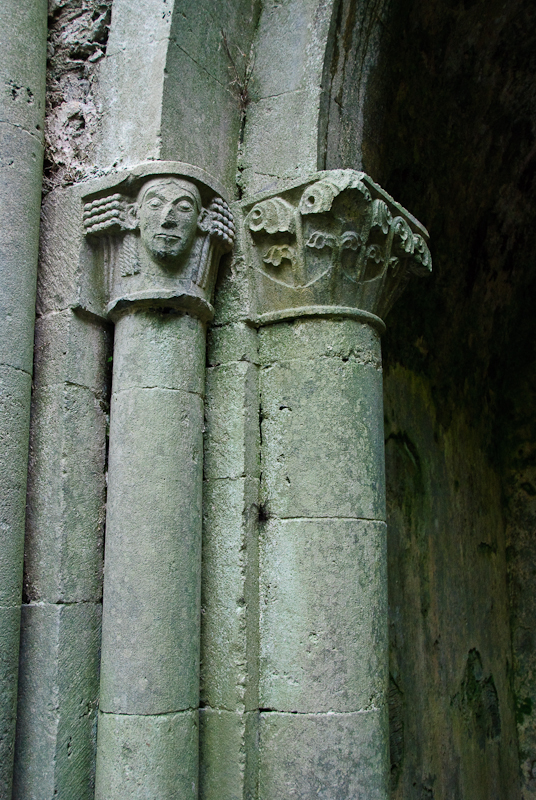
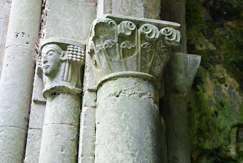
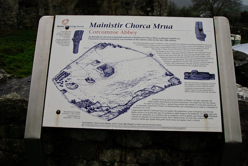
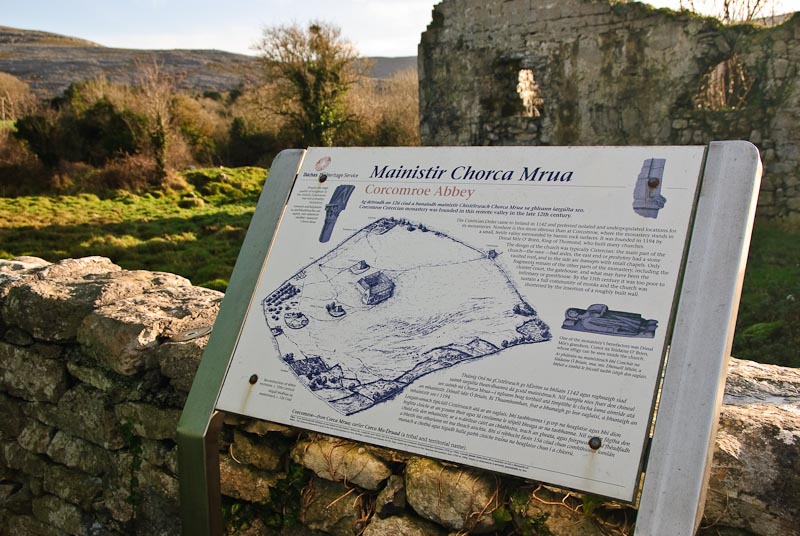
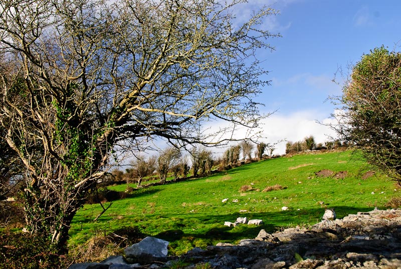
Corcomroe Abbey was the next stop. Just up the road a little further
to Bell Harbor and turn right. Pretty much the next left was marked to Corcomroe
Abbey. In tourist season I imagine you could follow the tour buses as this
is a major site. No buses today and the rain continued to come down with increasing
force. I drove to Corcomroe and waiting in the
car park until the rain slowed
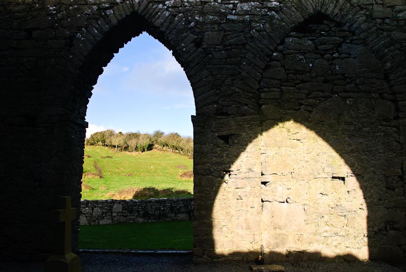
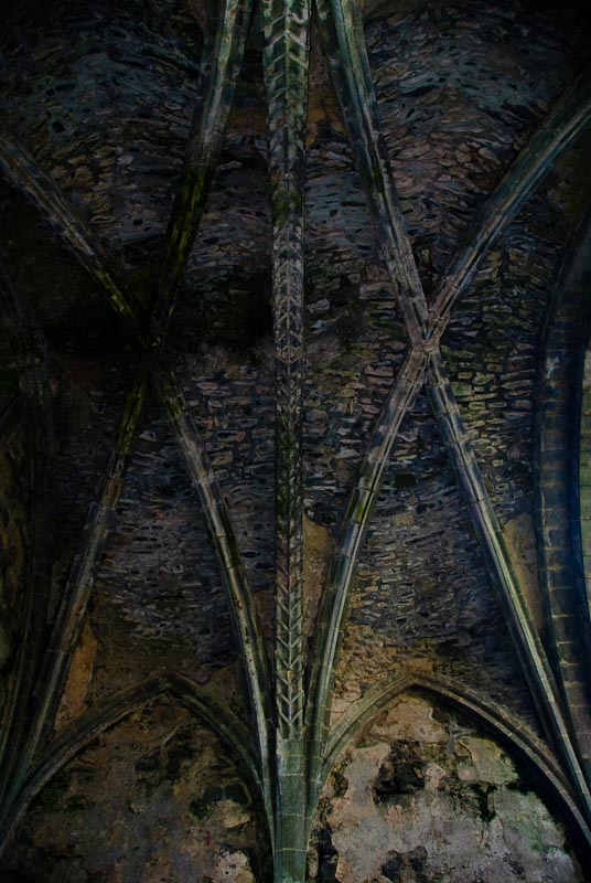
enough to take a look around. Everything was dripping from the downpour. Inside
things were a bit more sheltered, but the light was poor. I did a quick look
around for future reference and got back to the
car before the next deluge.
It rained pretty much all the way back to the cottage.

Back at the cottage Karen was still feeling sick, but a little better.
We had soup and leftover chicken (see you can have leftovers even when traveling!).
We showered and intended to go out to
Linnanes Pub for an evening of music. There were to be three women fiddlers
including
Siobhan Peoples, who was Linnane's niece. Karen ran out of gas before
we got out the door. We discussed my going alone and I decided to stay in
and stay warm and dry. This would have been fun, but a lot less fun while
sick and I still wasn't 100%. I built a fire and immediately the power went
out. We pulled up the chairs close and toasted our toes by candle light. Shortly
after the power came back on and we read and lounged until bedtime.
|
TOP
| BACK
|
Kilfenora, Co. Clare
|
|
Monday 1/7
  We decided today would be a shopping day. We'd pick up some groceries and
try to finish up any gift shopping we had planned. The morning drive to Ennis
was nice, but the weather changed to rain as we arrived.
Ennis is the nearest large
city to Kilfenora. Ennis
has a number of interesting sites that we didn't visit this trip, but have
in the past. The Ennis Friary is a very nice site located right in town at
the end of Abbey Street, the main street close to the main
car park. We found
parking easily, (affordable at €3) and headed over to the bottom of Abbey
Street near the Ennis Friary. There are a number of shops all along the street,
some touristy and some local. The weather was cold with intermittent rain
so we didn't spend much time on the street. We popped in and out of the shops,
partially browsing and also looking for some specific items. We wanted some
Irish language children's books for the forthcoming granddaughter, and found
a good bookstore with quite a nice selection. It was warm and dry and we killed
a good amount of time and a few Euros there. We picked up some scones at a
bakery, and some coffee in another shop and had a snack while we walked. Throat
lozenges proved a necessity as we were both still fighting sore throats and
the wet weather wasn't helping.
We decided today would be a shopping day. We'd pick up some groceries and
try to finish up any gift shopping we had planned. The morning drive to Ennis
was nice, but the weather changed to rain as we arrived.
Ennis is the nearest large
city to Kilfenora. Ennis
has a number of interesting sites that we didn't visit this trip, but have
in the past. The Ennis Friary is a very nice site located right in town at
the end of Abbey Street, the main street close to the main
car park. We found
parking easily, (affordable at €3) and headed over to the bottom of Abbey
Street near the Ennis Friary. There are a number of shops all along the street,
some touristy and some local. The weather was cold with intermittent rain
so we didn't spend much time on the street. We popped in and out of the shops,
partially browsing and also looking for some specific items. We wanted some
Irish language children's books for the forthcoming granddaughter, and found
a good bookstore with quite a nice selection. It was warm and dry and we killed
a good amount of time and a few Euros there. We picked up some scones at a
bakery, and some coffee in another shop and had a snack while we walked. Throat
lozenges proved a necessity as we were both still fighting sore throats and
the wet weather wasn't helping.

Irish bank money transfers are a bigger production than at home.
There were guards with automatic weapons. Maybe it was because it was Ulster
Bank, but I don't think so as we've seen it elsewhere. I would imagine the
guards in camo with automatic weapons are a good deterrent to anyone with
nefarious thoughts. We found a small cafe for lunch and got a corner seat
and had soup and sandwiches. The cafe was small and very warm with a lot of
bodies crammed in along with the steam from the food. We visited the local
Dunnes store and picked up a carrying bag that was quite sturdy and much cheaper
than at home. It also has additional significance as we like
The Dunnes Stores Girl song by John Spillane. Visit him on
MySpace and hear some music
clips or buy his album
Hey Dreamer
song by John Spillane. Visit him on
MySpace and hear some music
clips or buy his album
Hey Dreamer on Amazon.
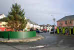
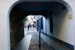
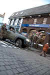
We drove back to Kilfenora through Corofin. The weather had improved
again and the light was good on the fields and stone walls. Back in Kilfenora
we stopped in a Vaughan's for dinner as Linnane's was closed, probably from
the lively night before. Karen had salmon and I had bacon and cabbage. Both
were very nice and a seat by the coal stove and a pint rounded out the meal
nicely.
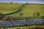
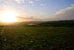
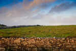
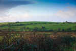
|
TOP
| BACK
|
Kilfenora, Co. Clare
|
|
Tuesday 1/8
 Another morning dawned with some promise. The skies were blue and the trees
around Brook
Cottage were full of birds. Quite a racket they made altogether. By the
time we'd got in the
car to head towards
Doolin, the clouds were rolling
in and the sky was turning gray. By the time we reached Doolin, we were into
full rain. We drove through Doolin and then out to the pier where we'd caught
the ferry to
Inis Oirr in 2005. The sea looked very choppy, restless and angry. Not
a good day to be out on the ocean. We snapped a few pictures and then headed
back towards Doolin. Along the road you could see water running off the cliffs
while the waves pounded below. I used the zoom as I didn't want to tromp all
the way across the field in the rain. I know this breaks my rule of the best
zoom being your two feet.
Another morning dawned with some promise. The skies were blue and the trees
around Brook
Cottage were full of birds. Quite a racket they made altogether. By the
time we'd got in the
car to head towards
Doolin, the clouds were rolling
in and the sky was turning gray. By the time we reached Doolin, we were into
full rain. We drove through Doolin and then out to the pier where we'd caught
the ferry to
Inis Oirr in 2005. The sea looked very choppy, restless and angry. Not
a good day to be out on the ocean. We snapped a few pictures and then headed
back towards Doolin. Along the road you could see water running off the cliffs
while the waves pounded below. I used the zoom as I didn't want to tromp all
the way across the field in the rain. I know this breaks my rule of the best
zoom being your two feet.
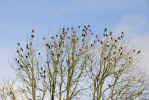
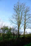
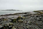
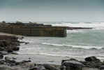
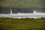
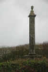
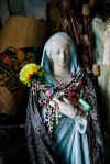 We
drove down the coast, past the Cliffs of Moher. We figured we could give it
a miss this time around as the weather wasn't pleasant and the parking had
increased. We had plenty of pictures from prior years. Further down the road,
we waved as we went by
Moher Lodge B&B, one of
our favorite places to stay. Just down away and around the corner was
St. Brigid's Well.
The tall monument just across the way is your landmark to turn and park. The
monument is to
Cornelius O'Brien who developed the area and the Cliffs in particular.
He developed pathways, stables and other amenities including a piper to roam
around and play. Unfortunately the piper got drunk and went over the edge.
St. Brigid's Well
is another site we visit every time we come. It changes as new items are left
and old ones taken away. It had been cleaned up pretty well and you could
see the water better this trip. No fish or eels visible though. If you see
one, your prayers are sure to be granted. Many of the statues were unchanged,
but with additional accessories. This is an excellent site for photos as long
as there are not any other visitors. The graveyard above the well also has
some nice stones and is worth a visit. We
drove down the coast, past the Cliffs of Moher. We figured we could give it
a miss this time around as the weather wasn't pleasant and the parking had
increased. We had plenty of pictures from prior years. Further down the road,
we waved as we went by
Moher Lodge B&B, one of
our favorite places to stay. Just down away and around the corner was
St. Brigid's Well.
The tall monument just across the way is your landmark to turn and park. The
monument is to
Cornelius O'Brien who developed the area and the Cliffs in particular.
He developed pathways, stables and other amenities including a piper to roam
around and play. Unfortunately the piper got drunk and went over the edge.
St. Brigid's Well
is another site we visit every time we come. It changes as new items are left
and old ones taken away. It had been cleaned up pretty well and you could
see the water better this trip. No fish or eels visible though. If you see
one, your prayers are sure to be granted. Many of the statues were unchanged,
but with additional accessories. This is an excellent site for photos as long
as there are not any other visitors. The graveyard above the well also has
some nice stones and is worth a visit.
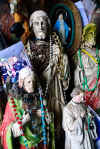
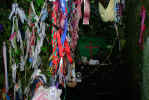
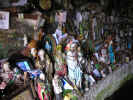
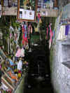

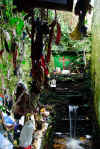
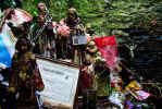
The next stop was
Lahinch to see if any shops were open. Along the way we spotted the
Liscannor Stone & Rock Shop. We'd
never visited although we passed it many times. It looked warm and dry and
was open, all good things. Inside it was larger than it appeared. There were
one or two other people wandering around through the huge selection of rock
related objects from all over the world. We found some magazines and books
from the area and ended up purchasing Carleton Jones' excellent book, "The
Burren And The Aran Islands: Exploring The Archaeology
". This is the perfect book to accompany your wanderings in Clare as it explains
why things are there as well as guiding you to new places. Read it before
you visit Clare!
Lahinch is full of shops
mostly related to surfing and gold, but most were not open this time of year.
The ones that were had some good sales. We parked near the seawall and watched
the waves crashing in. The sign warning not to swim seemed a bit ridiculous
this time of year. You'd be turned into fish food in nothing flat out there.
The rain started up again and we drove to the main street to explore the stores.
We found some good deals on sweaters and books. I picked up an Irish wool
hat in another for a good price (it has since gone missing). We fancied a
bit of lunch about this time and found an open restaurant, The Cornerstone.
Prices are a bit high for lunch, even this time of year, but the food was
good. I recommend the fish and chips. When we got back into the
car it was
hard to hold on to the
car door because of the wind. We stopped at the corner
store on the way out of town for Sudafed.
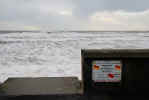
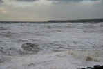
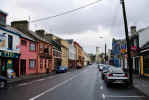
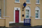
We had picked up a nice booklet in the Kilfenora store that we frequented
that had pictures and descriptions of many of the churches in the area. We
wanted to visit Kilshanny church as the photos and description looked interesting
Kilshanny
is a small town just out of Ennistymon that is right off the main road to
Kilfenora. The town has a single pub and not much else. We found Kilshanny
church down a side road near a farm (what isn't near a farm in Ireland?).
The church is recognizable from the bush growing near the top of the front
wall. The weather was still quite windy, but the rain had died down and we
parked and went over the wall. There are some interesting carvings on the
walls of Kilshanny and I think we found most of them. There were not that
many walls. We decided to leave when our fingers started getting numb. St.Augustine's
Holy Well is somewhere nearby, but we gave that a miss this time in favor
of staying warm and dry.
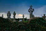
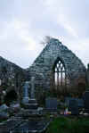
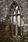
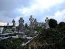
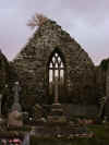
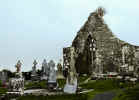
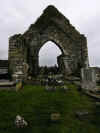 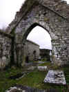
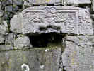

|
TOP
| BACK
|
Kilfenora, Co. Clare
|
|
Wednesday 1/9
 We
started by heading into Corofin for a stop at the chemists for still ailing
bodies. Along the way, just before Corofin, we spotted something nailed to
a tree and below what appeared to be a Holy Well. It was. Just off the road
is a low stone wall with an entrance. The ground is a bit messy with some
miscellaneous pieces of plastic and other bits that may have blown in. I took
a few pictures and didn't find any sign saying who's well it was. Later we
found that is is St. Fleming's Holy Well and is good for eyes. Good to know
but at the moment we were more interesting in the well for colds and internal
ailments.
Here is a 360 view of the Holly Well. Near the well was a field with a
mix of horses and donkeys. There was a cute baby donkey that seemed inclined
to come visit, but the others didn't think it was a good idea. In another
field was a lot of dirty cows that were curious about our antics as we slogged
through some thick mud and grass to get to the wall separating them. A short
distance down the road we spotted a
car on a truck. It looked familiar. On
closer examination it proved to be the
car we'd seen wrecked near a stone
bridge in Ennistymon on New Years day. We
started by heading into Corofin for a stop at the chemists for still ailing
bodies. Along the way, just before Corofin, we spotted something nailed to
a tree and below what appeared to be a Holy Well. It was. Just off the road
is a low stone wall with an entrance. The ground is a bit messy with some
miscellaneous pieces of plastic and other bits that may have blown in. I took
a few pictures and didn't find any sign saying who's well it was. Later we
found that is is St. Fleming's Holy Well and is good for eyes. Good to know
but at the moment we were more interesting in the well for colds and internal
ailments.
Here is a 360 view of the Holly Well. Near the well was a field with a
mix of horses and donkeys. There was a cute baby donkey that seemed inclined
to come visit, but the others didn't think it was a good idea. In another
field was a lot of dirty cows that were curious about our antics as we slogged
through some thick mud and grass to get to the wall separating them. A short
distance down the road we spotted a
car on a truck. It looked familiar. On
closer examination it proved to be the
car we'd seen wrecked near a stone
bridge in Ennistymon on New Years day.
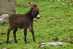
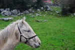

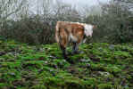
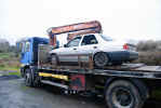
In Corofin we located the chemist and got a few things to soothe
aches, pains, sore throats and other maladies. Across the street on the front
of the Angler's Rest as a great Guinness sign that demanded a picture. We
got back in the
car and headed out in search of Rath Church.

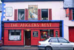
 Here is a good site for historic sites in Clare. It is the
Clare Archeological Trail.
There is a map
(shown at left) that is pretty accurate and helps you get around. We were
unknowingly following this trail. If we'd had the map, we could have seen
a few more sites along the way.
Rath church was another entry in our booklet that we wanted to see. It
was fairly easy to find from the good directions in the book and our
Burren Map. The church has a small
car park with a sign marking the church.
There is a stone wall surrounding the grounds. There church has a number of
interesting stones in the cemetery and an interesting carving of a sheela-na-gig
surrounded by biting animals. Down the hill in the distance is
Rath Castle, not much more than a ivy covered wall or two in front of
the loch.
Here is a good site for historic sites in Clare. It is the
Clare Archeological Trail.
There is a map
(shown at left) that is pretty accurate and helps you get around. We were
unknowingly following this trail. If we'd had the map, we could have seen
a few more sites along the way.
Rath church was another entry in our booklet that we wanted to see. It
was fairly easy to find from the good directions in the book and our
Burren Map. The church has a small
car park with a sign marking the church.
There is a stone wall surrounding the grounds. There church has a number of
interesting stones in the cemetery and an interesting carving of a sheela-na-gig
surrounded by biting animals. Down the hill in the distance is
Rath Castle, not much more than a ivy covered wall or two in front of
the loch.

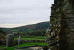

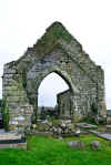
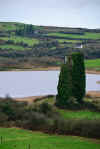
Leaving the Rath church site, there is a good view of
Dysert Castle in the distance to
the South and back the way we came, the road snaked off in the distance. Just
find a wide spot in the road and pull over.

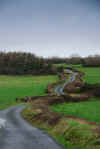
Our next planned stop was
Dysert O'Dea, but as we came around a bend in the road we saw a flash
of red in the trees and pulled over to investigate. What we'd found, even
though we didn't know it at the time was Synge Lodge. It is the remains of
a 19th century brick house. Over a couple of the exterior doors are family
crests. From the site you can see Dysert
Castle and a bit of
Dysert O'Dea through the trees. There isn't a lot more than crumbling
walls and roof tiles. Getting to it requires slogging across a field which
was quite muddy, but bull free.
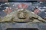

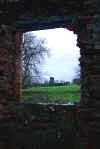
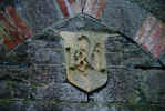
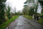
 Dysert
O'Dea is probably best known for the arched doorway, but has other interesting
headstones and crosses nearby. The rain was still holding off, so we found
parking along the road and walked through the gate and up the gravel path
to the site. The arched doorway catches your eye almost immediately. The finely
carved heads, each different takes some time to examine. Inside the church
is the usual stones along with bones of some kind littering the ground. We
didn't see any signs of excavation, so maybe they were dropped by a bird.
There were quite a few. There is a round tower or what's left of it on the
back side of the church and you can see Synge Lodge through the trees. Across
the field is the 12th century high cross. You can either hop the wall and
walk out to it, or drive around by the
Dysert Castle and see it there.
Along the fence line there were a number of small birds in the trees. Maybe
they thought we were bringing lunch. We disappointed them. Dysert
O'Dea is probably best known for the arched doorway, but has other interesting
headstones and crosses nearby. The rain was still holding off, so we found
parking along the road and walked through the gate and up the gravel path
to the site. The arched doorway catches your eye almost immediately. The finely
carved heads, each different takes some time to examine. Inside the church
is the usual stones along with bones of some kind littering the ground. We
didn't see any signs of excavation, so maybe they were dropped by a bird.
There were quite a few. There is a round tower or what's left of it on the
back side of the church and you can see Synge Lodge through the trees. Across
the field is the 12th century high cross. You can either hop the wall and
walk out to it, or drive around by the
Dysert Castle and see it there.
Along the fence line there were a number of small birds in the trees. Maybe
they thought we were bringing lunch. We disappointed them.
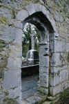
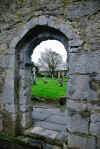
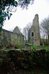
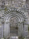

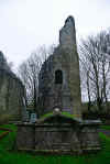
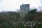
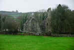
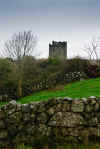
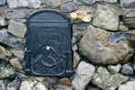
 Leaving Dysert O'Dea, we wandered over to the castle, but it was closed. Just
like last time. We spent some time wandering on back roads just to see what
would turn up. We found an interesting mailbox set in a stone wall. Further
along we came to a dead end and as we were turning around, heard barking.
All we could see was a black and white dog head appearing at intervals above
the stone wall. We were invading his territory and he was making his feelings
known. He seemed to be somewhat apologetic about the barking, as if to say
"sorry folks, just doing my job, I'd really like you to come over and visit".
Leaving Dysert O'Dea, we wandered over to the castle, but it was closed. Just
like last time. We spent some time wandering on back roads just to see what
would turn up. We found an interesting mailbox set in a stone wall. Further
along we came to a dead end and as we were turning around, heard barking.
All we could see was a black and white dog head appearing at intervals above
the stone wall. We were invading his territory and he was making his feelings
known. He seemed to be somewhat apologetic about the barking, as if to say
"sorry folks, just doing my job, I'd really like you to come over and visit".
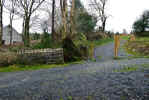
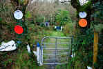 As
we wandered we realized we were in the vicinity of St. Flannan's Holy Well.
We'd visited this last time around and had to get directions. After some driving,
we realized we'd need directions again. We flagged a passing
car and we told
which road to take. Sure enough, there is was, sporting a new sign and a nicely
graveled drive. Last time around we'd taken a muddy path through weeds and
mud to get to the well. This time there was a new gravel path with wood posts
guiding you to the site. We picked up a couple of doggy friends once again.
They seem to know dog people. One was the grown puppy from last time, no lest
flea ridden and a new friend who herded us up the path. We came to a new gate
and let ourselves through and came to the familiar battered second gate, painted
in blue. Pretty much everything is blue, either the plastic bottles or recycled
appliances are either blue or white. There were more decorations and as you
walked around the large looped path, there was even more icons and decorations
than before. The grounds were nicely kept. This is a must see if you're interested
in holy wells. As
we wandered we realized we were in the vicinity of St. Flannan's Holy Well.
We'd visited this last time around and had to get directions. After some driving,
we realized we'd need directions again. We flagged a passing
car and we told
which road to take. Sure enough, there is was, sporting a new sign and a nicely
graveled drive. Last time around we'd taken a muddy path through weeds and
mud to get to the well. This time there was a new gravel path with wood posts
guiding you to the site. We picked up a couple of doggy friends once again.
They seem to know dog people. One was the grown puppy from last time, no lest
flea ridden and a new friend who herded us up the path. We came to a new gate
and let ourselves through and came to the familiar battered second gate, painted
in blue. Pretty much everything is blue, either the plastic bottles or recycled
appliances are either blue or white. There were more decorations and as you
walked around the large looped path, there was even more icons and decorations
than before. The grounds were nicely kept. This is a must see if you're interested
in holy wells.
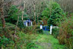
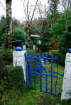
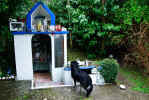
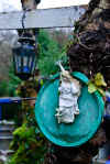
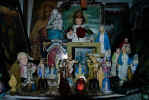
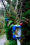

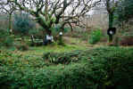
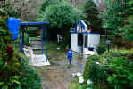

After all this slogging around in cold, rainy weather, we needed
some hot food. Biddy Early's
was just down the road (click the link to learn more about Biddy Early). We'd
visited here before. As far as I know it is Ireland's only microbrew, certainly
the only one close to St. Flannan's Holy Well.
Biddy Early Brewery and Pub is located in
Inagh about 10 miles from Ennis as you head for Lahinch or the Cliffs of Moher
and well worth a stop. We'd sampled their food and beer in 2005. Unfortunately
this trip we caught them between batches, so it was Guinness and hot tea.
Karen had a bowl of veg soup and brown bread while I went for the Shepherd's
pie with enough veg on the side to keep a horse alive for a week. A big plate
of Shepherd's pie, same size of potatoes and another of carrots. We got warmed
up while we had a good chat with the bartender.
Outside the rain had picked up and as it was late in the afternoon we headed
back to Kilfenora. In town we picked up another bag of peat and some fire
starters. Peat burns well, but fire starters get it going quickly and create
less mess than wadded up newspaper. As we usually had a good draft coming
down the chimney because of wind, ashes tended to fly about if they built
up. We also had quite a few stray hailstones bouncing across the floor at
different times. Not a big deal since the floor was stone, but it surprised
us the first time it happened. We stayed in for the night to keep warm, and
skipped dinner as the big lunch was still with us.
|
TOP
| BACK
|
Kilfenora, Co. Clare
|
|
Thursday 1/10
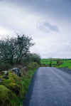
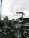 We got up a little earlier and had some breakfast and then took off for
Noughaval. The sun was just coming up and the high clouds were breaking
up and letting the morning sun dry some of the rain from the night before.
We stopped at several points along the road to take pictures of the rolling
hills crossed by stone walls. Noughaval is a market town and was once a much
large town with a thriving community. The name means new acquisition, although
nothing around looked new. The church is located centrally in the town. There
is a market stone near the entrance, or more probably the remains of a market
stone. The church is in pretty decent shape with a number of interesting stone
constructions. There is the usual mix of old and new headstones. The countryside
surrounding the church is worth attention as well as the church. There are
many photo opportunities along the rock wall surrounding the grounds.
Here is a 360 view near the church.
We got up a little earlier and had some breakfast and then took off for
Noughaval. The sun was just coming up and the high clouds were breaking
up and letting the morning sun dry some of the rain from the night before.
We stopped at several points along the road to take pictures of the rolling
hills crossed by stone walls. Noughaval is a market town and was once a much
large town with a thriving community. The name means new acquisition, although
nothing around looked new. The church is located centrally in the town. There
is a market stone near the entrance, or more probably the remains of a market
stone. The church is in pretty decent shape with a number of interesting stone
constructions. There is the usual mix of old and new headstones. The countryside
surrounding the church is worth attention as well as the church. There are
many photo opportunities along the rock wall surrounding the grounds.
Here is a 360 view near the church.
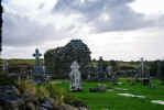
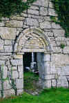
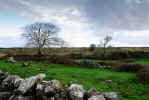

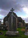
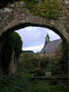
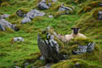
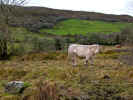 We continued along the road looking for Kilcorney Church. Along the way numerous
sheep posed on the hillsides and cows eyed us over stone walls. We stopped
several times for pictures. This roads requires slow driving as it is narrow
and winding, but the views make it worthwhile. Kilcorney Church is on the
right side of the road and comes up suddenly. It is a small 10-11th century
parish church with some interesting features on the grounds. Inside the church
is a small stone font. On the ground outside the church is piece of a carved
stone window arch. In the hills behind the grounds are the Wild Horse Caves.
This cave has several potholes and floods periodically spilling water into
the valley below. This cave was famous in the eighteenth century for throwing
out floods of water full of fish, and this is remembered traditionally, although
the floods have been rare and insignificant since 1833.Wild horses are said
to come out of the cave and their descendents live in the valley below.
We continued along the road looking for Kilcorney Church. Along the way numerous
sheep posed on the hillsides and cows eyed us over stone walls. We stopped
several times for pictures. This roads requires slow driving as it is narrow
and winding, but the views make it worthwhile. Kilcorney Church is on the
right side of the road and comes up suddenly. It is a small 10-11th century
parish church with some interesting features on the grounds. Inside the church
is a small stone font. On the ground outside the church is piece of a carved
stone window arch. In the hills behind the grounds are the Wild Horse Caves.
This cave has several potholes and floods periodically spilling water into
the valley below. This cave was famous in the eighteenth century for throwing
out floods of water full of fish, and this is remembered traditionally, although
the floods have been rare and insignificant since 1833.Wild horses are said
to come out of the cave and their descendents live in the valley below.
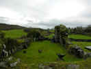

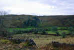
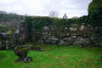
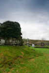
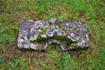
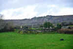
We drove further across the Burren heading for Ballyvaughan. We
made several stops for photos as the mood and scenery struck us. We passed
through Ballyvaughan and along the coast road towards Kinvara.
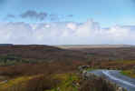
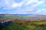
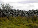
Further along we saw the short lane out to Fanore Beach and since
the weather was nice, took off towards the water. The sand was a gold color
and the tide was out, revealing many interesting seaweed covered rocks. We
acquired another short term dog that insisted on accompanying us around. He/she
would retrieve anything thrown from a stick to a rock. There was some interesting
art at the
car park. It looked like all the flotsam and jetsam that had washed
ashore affixed to a piece of plywood. It was interesting in a trashy sort
of way. There have been sightings of a
Fungi
knockoff in the bay.
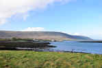
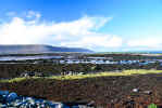
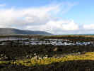
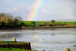
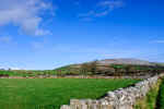 At Bells Harbor Quay a rainbow caught our attention and we pulled into the
car park to take more pictures. We took the road to the right towards Corcomroe
Abbey and followed the signs. The day was significantly better than when I'd
made a visit a few days before. The sun was shining and we made several stops
along the stone wall lined road to take pictures of the walls and Burren in
the distance. The road dead ended into the
carcar park of Corcomroe Abbey. The
usual blue and white sign told us about the site. The sun perfectly illuminated
the interior carvings and arched doorways and windows. There was some restoration
going on at the back of the abbey, but we avoided that area and focused on
the interior and the landscape around the site. Karen had a good time photographing
the faces and figures on the columns and graves along the walls.
At Bells Harbor Quay a rainbow caught our attention and we pulled into the
car park to take more pictures. We took the road to the right towards Corcomroe
Abbey and followed the signs. The day was significantly better than when I'd
made a visit a few days before. The sun was shining and we made several stops
along the stone wall lined road to take pictures of the walls and Burren in
the distance. The road dead ended into the
carcar park of Corcomroe Abbey. The
usual blue and white sign told us about the site. The sun perfectly illuminated
the interior carvings and arched doorways and windows. There was some restoration
going on at the back of the abbey, but we avoided that area and focused on
the interior and the landscape around the site. Karen had a good time photographing
the faces and figures on the columns and graves along the walls.


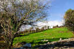
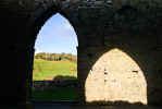
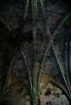
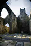
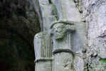
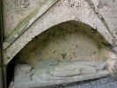
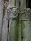
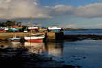
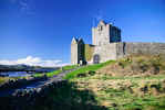 We backtracked to Bells Harbor and then up the road to Kinvara. We were hoping
for a good lunch spot and better weather to see the castle and town. Lunch
was our first focus. We stopped in a likely looking restaurant which was deserted,
once we saw the prices we deserted too. Down along the quay we found a small
cafe and Internet access. Karen did some bank work while I wandered along
the quayside and took pictures of the boats and castle in the distance. Once
Karen was done we had a nice lunch of sandwiches in the cafe and then went
to take pictures of Dunguaire Castle.
We backtracked to Bells Harbor and then up the road to Kinvara. We were hoping
for a good lunch spot and better weather to see the castle and town. Lunch
was our first focus. We stopped in a likely looking restaurant which was deserted,
once we saw the prices we deserted too. Down along the quay we found a small
cafe and Internet access. Karen did some bank work while I wandered along
the quayside and took pictures of the boats and castle in the distance. Once
Karen was done we had a nice lunch of sandwiches in the cafe and then went
to take pictures of Dunguaire Castle.
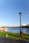


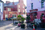
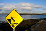
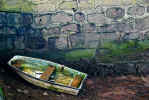
We took the return drive back through Ballyvaughan and then around
Black Head and down the coast towards Doolin. Along the way the sun lit up
the rock and turned the brown grass golden against a blue sky full of puffy
white clouds. We stopped several times along the way when rock formations
or the scattered erratics made a unusually striking composition.
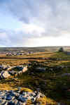
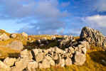
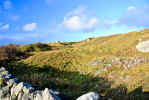
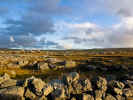
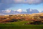
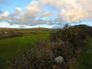 Further down the road heads inland and along the right side there is a beautiful
view of green fields with the Burren in the background. The landscape was
dotted with sheep sharply contrasting the deep green of the field. We pulled
over at a convenient wide spot in the road and shot a series of panoramas
as well as individual photos of the landscape. The setting sun was tinting
the clouds with purple and the Burren was glowing a golden red. Further down
the road was Ballynalacken Castle and Hotel. This looks a lot better from
a distance than up close, but good photo locations are difficult on the winding
road.
Further down the road heads inland and along the right side there is a beautiful
view of green fields with the Burren in the background. The landscape was
dotted with sheep sharply contrasting the deep green of the field. We pulled
over at a convenient wide spot in the road and shot a series of panoramas
as well as individual photos of the landscape. The setting sun was tinting
the clouds with purple and the Burren was glowing a golden red. Further down
the road was Ballynalacken Castle and Hotel. This looks a lot better from
a distance than up close, but good photo locations are difficult on the winding
road.
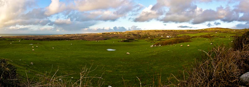
Back in Kilfenora we walked out to the West high cross in the field
and took more pictures of it against the setting sun and deep blue purple
sky. Then we called it a day and headed back to the cottage for dinner and
a rest.

|
TOP
| BACK
|
Kilfenora, Co. Clare
|
|
Friday 1/11
Off to a day of adventure, but first a stop in
Ennistymon for cashing in all the
spare change. We'd accumulated a lot and it filled up a good size zip lock
bag. (These are handy to have as you'll find in our
travel tips) Once cashed in and several pounds
lighter, we went in search of the waterfalls that we'd heard about. It was
still fairly early and the sun was hiding behind high clouds. The river Inagh
runs through town and there is a Falls Hotel which leads one to believe there
must be some falls. Sure enough, down a road off the main street we found
some parking (probably illegally, but hard to tell). There were the falls
complete with a trail alongside with viewing points. There was a lot
of spray coming off the water and the sun still hadn't risen high enough to
shed much light on the area. I walked out quite a way down the trail with
had a wooden viewing platform and then went down towards the water. On a sunny
day (like this day a few hours later) it would make for some great pictures.
We took what we could and then back to the
car to go exploring. We were feeling
a bit better from the colds and wanted to stretch our legs while we could.
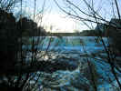
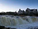
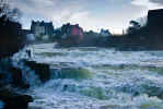
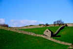 On the way out of town, heading back toward Corofin we saw a little house/stable
along a stone wall in a field that we'd seen on our first trip through the
area. This time of year the grass was much greener and I hopped out of the
car for a lot of pictures. It was a bit risky as there wasn't a parking place
so we just pulled off and turned on the flashers. I was standing in the road
most of the time and watching/listening for oncoming cars while trying to
get good angles. I survived, but had to make a run for it as a large truck
was coming towards us and the only safe place was in the
car. Back on the
road we went through Corofin, our home
base in 2005 and then toward Kilnaboy on R476. Just after Kilnaboy at Leana
should be the next right) is a road that heads up
Roughan Hill.
Roughan Hill is probably one of the first settled Neolithic sites in the area.
It is littered with dolmans, wedge tombs and other remains of Neolithic settlements.
In many areas you can see low grass covered ridges snaking across fields.
These are the remains of Neolithic stone walls that have collapsed or been
covered up by years of growth. Some of the sites are marked, some you can
see from the road and some you have to find using a map like Tim Robinson's
The Burren: A Two Inch Map of the Uplands of North-west Clare.
Actually this is probably the only map unless you use Carleton Jones' excellent
book, "The
Burren And The Aran Islands: Exploring The Archaeology
" and follow the coordinates given there on a topographic map. The sun had
come out in force and the interior of the
car was deceptively warm. Outside
it was still pretty brisk with a cold breeze playing over the hillside.
On the way out of town, heading back toward Corofin we saw a little house/stable
along a stone wall in a field that we'd seen on our first trip through the
area. This time of year the grass was much greener and I hopped out of the
car for a lot of pictures. It was a bit risky as there wasn't a parking place
so we just pulled off and turned on the flashers. I was standing in the road
most of the time and watching/listening for oncoming cars while trying to
get good angles. I survived, but had to make a run for it as a large truck
was coming towards us and the only safe place was in the
car. Back on the
road we went through Corofin, our home
base in 2005 and then toward Kilnaboy on R476. Just after Kilnaboy at Leana
should be the next right) is a road that heads up
Roughan Hill.
Roughan Hill is probably one of the first settled Neolithic sites in the area.
It is littered with dolmans, wedge tombs and other remains of Neolithic settlements.
In many areas you can see low grass covered ridges snaking across fields.
These are the remains of Neolithic stone walls that have collapsed or been
covered up by years of growth. Some of the sites are marked, some you can
see from the road and some you have to find using a map like Tim Robinson's
The Burren: A Two Inch Map of the Uplands of North-west Clare.
Actually this is probably the only map unless you use Carleton Jones' excellent
book, "The
Burren And The Aran Islands: Exploring The Archaeology
" and follow the coordinates given there on a topographic map. The sun had
come out in force and the interior of the
car was deceptively warm. Outside
it was still pretty brisk with a cold breeze playing over the hillside.
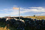
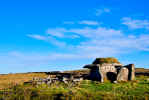 Our
first stop was the Parnabinnia Wedge Tomb. It was easier to spot as there
was a sign and it was visible from the road. There is a wide spot in the road
near the sign and we pulled into it. We grabbed the camera gear and zipped
up our jackets and went over to the rock wall. There isn't easy access over
a lot of the walls so you need to climb over carefully without damaging any
sensitive bits, or figure a way around. In some cases we found it easier to
disassemble part of the wall. Walk through and then reassemble it on the return
trip. The stones are pretty rough and precariously balanced so climbing on
them can be dangerous. Once over the wall, you are faced by a field of grass
and stone with many dips and holes. It is pretty rough walking and we were
glad for our boots. The stone of the Burren can be slippery when wet and is
often balanced on other rocks. All this to say that solid footing is difficult
and it is slow going in spots. The wedge tomb is fairly large and certainly
more than one person could put together. These were probably both boundary
markers for a tribe as well as a burial site. If you sufficient brains and
brawn to assemble a wedge tomb, you were probably a tribe to be reckoned with.
We noticed a large boulder nearby and had seen some others along the way.
These are
erratics,
often rounded boulders dropped by glaciers and are strewn around the landscape
like a giant child's dropped marbles. We walked out to the one across the
road from the wedge tomb and were rewarded with a sweeping view across the
Burren not visible from the road. We shared the view with a few cows and many
cow pies.
Here is a 360 view near the tomb. Our
first stop was the Parnabinnia Wedge Tomb. It was easier to spot as there
was a sign and it was visible from the road. There is a wide spot in the road
near the sign and we pulled into it. We grabbed the camera gear and zipped
up our jackets and went over to the rock wall. There isn't easy access over
a lot of the walls so you need to climb over carefully without damaging any
sensitive bits, or figure a way around. In some cases we found it easier to
disassemble part of the wall. Walk through and then reassemble it on the return
trip. The stones are pretty rough and precariously balanced so climbing on
them can be dangerous. Once over the wall, you are faced by a field of grass
and stone with many dips and holes. It is pretty rough walking and we were
glad for our boots. The stone of the Burren can be slippery when wet and is
often balanced on other rocks. All this to say that solid footing is difficult
and it is slow going in spots. The wedge tomb is fairly large and certainly
more than one person could put together. These were probably both boundary
markers for a tribe as well as a burial site. If you sufficient brains and
brawn to assemble a wedge tomb, you were probably a tribe to be reckoned with.
We noticed a large boulder nearby and had seen some others along the way.
These are
erratics,
often rounded boulders dropped by glaciers and are strewn around the landscape
like a giant child's dropped marbles. We walked out to the one across the
road from the wedge tomb and were rewarded with a sweeping view across the
Burren not visible from the road. We shared the view with a few cows and many
cow pies.
Here is a 360 view near the tomb.
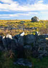
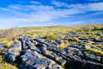
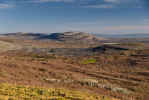
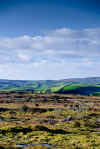
 The next stop was another sign reading Leaba Wedge Tomb. This one is a longer
walk across a field, through a ring of stone, perhaps the remains of a settlement
to the wedge tomb further on. Again this is rough walking and a sprained ankle
would be an easy thing to acquire. We also spotted some standing stones nearby
or perhaps parts of another tomb. Again the scenery around is both bleak and
beautiful. Much of the top soil has worn away after years of farming, wind
and rain, but this was a very fertile area at one time and seems to be good
grazing still. We had some fun when we found a large rock slab that tilted
as you stood on it and had an impromptu teeter totter moment.
The next stop was another sign reading Leaba Wedge Tomb. This one is a longer
walk across a field, through a ring of stone, perhaps the remains of a settlement
to the wedge tomb further on. Again this is rough walking and a sprained ankle
would be an easy thing to acquire. We also spotted some standing stones nearby
or perhaps parts of another tomb. Again the scenery around is both bleak and
beautiful. Much of the top soil has worn away after years of farming, wind
and rain, but this was a very fertile area at one time and seems to be good
grazing still. We had some fun when we found a large rock slab that tilted
as you stood on it and had an impromptu teeter totter moment.
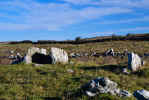
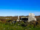
 Further down the road we ran into a string of cows walking along the road
towards us. We stopped and took some pictures, moved forward and took the
next ones picture and so on. They stopped and looked at us. Each one was a
different color and they seemed to be mildly amazed to see people out on the
road at this time of year and hour. We were probably a bit wind blown and
odd looking as well. As we drove along there was the occasional farm, but
they were few and far between. We saw a few other things that could have been
tombs or Neolithic stuff, but nothing sufficient to make us leave the
car.
Some of the sites are either a hole in the ground or a small pile of stones.
Interesting enough to an archaeologist, but not enough to make us brave the
cold.
Further down the road we ran into a string of cows walking along the road
towards us. We stopped and took some pictures, moved forward and took the
next ones picture and so on. They stopped and looked at us. Each one was a
different color and they seemed to be mildly amazed to see people out on the
road at this time of year and hour. We were probably a bit wind blown and
odd looking as well. As we drove along there was the occasional farm, but
they were few and far between. We saw a few other things that could have been
tombs or Neolithic stuff, but nothing sufficient to make us leave the
car.
Some of the sites are either a hole in the ground or a small pile of stones.
Interesting enough to an archaeologist, but not enough to make us brave the
cold.
 We
were now looking for a sign to
Cahercommaun, a large
triple walled ring fort perched on the edge of a cliff. According to the map
it was just ahead and a short walk off the road. We found a sign directing
us towards a trail and we parked nearby. There is a house right at the sign
and a large monument sign with some information about the site. According
to the sign the site was around a mile or less down the trail. We threw some
water in the pack, locked up, zipped up and off we went. The trail winds along
a field and then down through some scrubby trees and brush. Eventually the
trail winds out into the base of a hill and stairs take you up to the top.
The trail is a nice graveled surface and well maintained, but at this point
we felt that it exceeded the estimated distance. Often in Ireland the distance
are underestimated so as to seemingly not discourage the intrepid traveler.
It is a nice walk particularly if you visualize Neolithic folks walking the
same route to the imposing fort at the top. Yet the fort isn't at the top,
at least not yet. When you get to the top there is a large field. If you walk
to the left, you can go to the edge of the hill and look out across the Burren
and see the paved road in the distance. We
were now looking for a sign to
Cahercommaun, a large
triple walled ring fort perched on the edge of a cliff. According to the map
it was just ahead and a short walk off the road. We found a sign directing
us towards a trail and we parked nearby. There is a house right at the sign
and a large monument sign with some information about the site. According
to the sign the site was around a mile or less down the trail. We threw some
water in the pack, locked up, zipped up and off we went. The trail winds along
a field and then down through some scrubby trees and brush. Eventually the
trail winds out into the base of a hill and stairs take you up to the top.
The trail is a nice graveled surface and well maintained, but at this point
we felt that it exceeded the estimated distance. Often in Ireland the distance
are underestimated so as to seemingly not discourage the intrepid traveler.
It is a nice walk particularly if you visualize Neolithic folks walking the
same route to the imposing fort at the top. Yet the fort isn't at the top,
at least not yet. When you get to the top there is a large field. If you walk
to the left, you can go to the edge of the hill and look out across the Burren
and see the paved road in the distance.
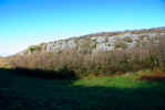
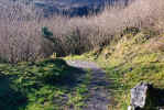

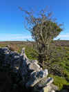
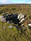
Where you actually need to be is to the right, over a stone wall
and across another field. The surface is the same rock strewn, slippery, hole
ridden surface that we'd encountered before. There is a trail but it vanishes
at point and then reappears like Brigadoon, only in shorter intervals. There
are some interesting bits along the way that look like ruined small buildings,
fire pits and other holes with stones. In the distance you can see the stone
walls of the ring fort. Keep going in that direction and watch your step,
it gets better and worse. As you arrive at the ring fort, there is a walkway
built around the outer wall. This is a fairly recent addition and certainly
not original to the site as it deters from the point of a fort if you provide
a comfortable raised walkway along the perimeter. We took advantage of the
walkway, which was a bit slick from the condensation and chilly air. Still
it was much better than
 slogging
through grass and finding unexpected holes. The remains of the walls are enveloped
in long grass, perhaps at other times of the year this is trimmed back, but
it made the site look old and abandoned. We walked around the boardwalk to
the entrance on the far side. There is a platform overlooking the inner rinds.
This also was very slippery. We decided to get off the beaten path and over
the walls and go into the inner ring. This area is even more overgrown, but
you can see where there were small huts and openings in the wall. During excavations
in the past, some nice artifacts have been unearthed. We didn't see any gold
or jewelry laying out, so we clambered out of the center and Karen went back
to the boardwalk and I climbed up on the wall to look down the cliff wall.
There is a pretty significant drop. No one would be sneaking up that side
to attack the fort. I walked around the perimeter of the inner wall and then
hopped down to examine the middle area. There wasn't a lot to see, but this
is a pretty good size enclosure and took someone a lot of time to pile up
the stones. Not that there are a lack of them in the area still. I believe
some Irishman way back stacked the first stone on another, it became a national
compulsion and they've been doing it ever since. slogging
through grass and finding unexpected holes. The remains of the walls are enveloped
in long grass, perhaps at other times of the year this is trimmed back, but
it made the site look old and abandoned. We walked around the boardwalk to
the entrance on the far side. There is a platform overlooking the inner rinds.
This also was very slippery. We decided to get off the beaten path and over
the walls and go into the inner ring. This area is even more overgrown, but
you can see where there were small huts and openings in the wall. During excavations
in the past, some nice artifacts have been unearthed. We didn't see any gold
or jewelry laying out, so we clambered out of the center and Karen went back
to the boardwalk and I climbed up on the wall to look down the cliff wall.
There is a pretty significant drop. No one would be sneaking up that side
to attack the fort. I walked around the perimeter of the inner wall and then
hopped down to examine the middle area. There wasn't a lot to see, but this
is a pretty good size enclosure and took someone a lot of time to pile up
the stones. Not that there are a lack of them in the area still. I believe
some Irishman way back stacked the first stone on another, it became a national
compulsion and they've been doing it ever since.
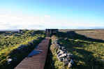
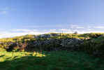
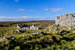
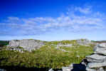
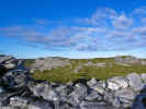
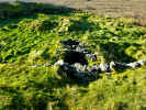
|
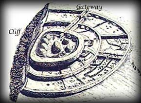
|
|
|
Arial sketch of Cahercommaun
|
Arial photo of Cahercommaun
|
We headed back toward the trail or what we hoped was the trail. We'd
been up here for over two hours, but had not seen another person. At one time
this was a thriving community, perhaps the center of life in the area, but
now it was just ruins with nothing but the sound of the wind. Kind of sobering
when you think of all the "stuff" we've built and how it will be in a few
hundred or so years. We were a bit foot sore and wind blown by now and still
had a long walk back. We'd also worked up a bit of an appetite and we
interested in looking for food as nothing remained from Neolithic times in
the way of a cafe or pub.
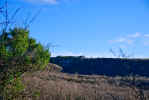
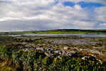
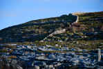
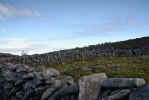
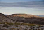
Back at the
car we consulted the map and decided to continue North
along the road through the Burren. Just a short distance down the road there
was a nice view of Cahercommaun perched on the cliff edge. All along the way
were stone wall snaking along a landscape dominated with slabs of limestone.
We eventually landed in Castletown and charted our next course for new and
unexplored areas of the Burren by taking a right towards Fahee and Glencolumbkille
South.
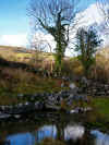
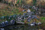 Our next destination was Tobar Columchille or Columchille's Holy Well and
Stone Cross. We had pretty good directions and arrived without problem at
a intersection and parked just a bit North. A small road led back along a
field to a small grove of trees. In the grove was a small stream emptying
into a pond. At the far side of the pond was a stone cross marking the well.
This well is supposed to be beneficial to eyes and feet. As the weather was
sunny, but quite chilly, we weren't tempted to dip our aching feet or eyes.
The well is beautifully situated amongst the trees and the light was warm
and glowing on the green and gold of the foliage and hills above. The ground
was quite wet from the stream, and you have to watch your step or risk wet
toes. Once again the
Columbia Sportswear waterproof boots
paid off.
Here is a 360 view of the Holy Well near the Stone Cross. Glencolumbcille
Castle is just up the road, but either we didn't notice it or go far enough
up the road. It is good to know there is still much more to see someday. this
is the kind of exploring we love the most, wandering, trying to find stuff,
stumbling across new things not on the map and in general, just tromping around
on a sunny day in Ireland.
Our next destination was Tobar Columchille or Columchille's Holy Well and
Stone Cross. We had pretty good directions and arrived without problem at
a intersection and parked just a bit North. A small road led back along a
field to a small grove of trees. In the grove was a small stream emptying
into a pond. At the far side of the pond was a stone cross marking the well.
This well is supposed to be beneficial to eyes and feet. As the weather was
sunny, but quite chilly, we weren't tempted to dip our aching feet or eyes.
The well is beautifully situated amongst the trees and the light was warm
and glowing on the green and gold of the foliage and hills above. The ground
was quite wet from the stream, and you have to watch your step or risk wet
toes. Once again the
Columbia Sportswear waterproof boots
paid off.
Here is a 360 view of the Holy Well near the Stone Cross. Glencolumbcille
Castle is just up the road, but either we didn't notice it or go far enough
up the road. It is good to know there is still much more to see someday. this
is the kind of exploring we love the most, wandering, trying to find stuff,
stumbling across new things not on the map and in general, just tromping around
on a sunny day in Ireland.


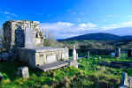 Leaving Tobar Columchille we went in search of St. Colm Cille's Church. As
you can see by now there are a variety of spellings of Colum Cille. Essentially
it is St. Colum and Cille, Kil or Kille is church in Gaelic. St. Colmcille
(meaning Dove of the Church) also known as
St. Columba got around
and traveled all over Ireland, eventually ending up in Scotland on the Island
of Iona. I am primarily using the spellings that are on Tim Robinson's
The Burren: A Two Inch Map of the Uplands of North-west Clare
as that was our primary reference. We drove a short distance up the road we
were on and turned around and went back to the intersection. We then turned
left to continue on the original road we arrived on. St. Colm Cille's Church
is a short distance down the road at a gate into a field. There are the remains
of a cross just inside the gate that you may be able to see from the road.
We parked in the nearest wide spot in the road and went through the gate,
closing it behind us. After a quick look around the field for unruly cattle
(we still have never had a problem despite dire warnings) we examined the
cross. There isn't much left except the main shaft, the cross pieces being
broken off long ago. Somewhere around this area is a stone with the mark of
St. Colmcille's fingers. We didn't manage to locate that. I believe it is
futher down the road. We walked across the field to the enclosed raised area
in the middle of the field. The grass was long, but the ground was fairly
smooth and not difficult to walk on. Across the field to the right, the Burren
dominates the skyline. A small gate leads into the church and graveyard. Not
much remains of the church unless the outer wall is part of the original building.
There are the usual variety of old and new headstones. The primary interest
are the views of the Burren and surrounding countryside.
Here is a 360 view from St. Colm Cille's church.
Leaving Tobar Columchille we went in search of St. Colm Cille's Church. As
you can see by now there are a variety of spellings of Colum Cille. Essentially
it is St. Colum and Cille, Kil or Kille is church in Gaelic. St. Colmcille
(meaning Dove of the Church) also known as
St. Columba got around
and traveled all over Ireland, eventually ending up in Scotland on the Island
of Iona. I am primarily using the spellings that are on Tim Robinson's
The Burren: A Two Inch Map of the Uplands of North-west Clare
as that was our primary reference. We drove a short distance up the road we
were on and turned around and went back to the intersection. We then turned
left to continue on the original road we arrived on. St. Colm Cille's Church
is a short distance down the road at a gate into a field. There are the remains
of a cross just inside the gate that you may be able to see from the road.
We parked in the nearest wide spot in the road and went through the gate,
closing it behind us. After a quick look around the field for unruly cattle
(we still have never had a problem despite dire warnings) we examined the
cross. There isn't much left except the main shaft, the cross pieces being
broken off long ago. Somewhere around this area is a stone with the mark of
St. Colmcille's fingers. We didn't manage to locate that. I believe it is
futher down the road. We walked across the field to the enclosed raised area
in the middle of the field. The grass was long, but the ground was fairly
smooth and not difficult to walk on. Across the field to the right, the Burren
dominates the skyline. A small gate leads into the church and graveyard. Not
much remains of the church unless the outer wall is part of the original building.
There are the usual variety of old and new headstones. The primary interest
are the views of the Burren and surrounding countryside.
Here is a 360 view from St. Colm Cille's church.
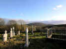
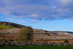
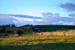
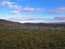
Leaving St. Colm Cille's Church we continued along the road towards
Mullaghmore. The area has many gates leading to grassy fields and we spotted
both cows and horses grazing. Again, it hardly felt like January except for
the air temperature. Along the way we saw both signs and map entries for Penitential
Stations. We found them, basically a long road leading up a hill. Evidently
there are stone cairns marking the stations of the cross along the way. We
were a bit tired at this point and the temperature was dropping so we elected
not to make the walk this time.
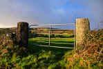
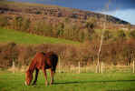
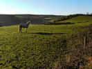
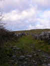
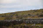
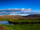
 Further down the road we neared
Mullaghmore. This areas has views of the Burren and Mullaghmore Mountain
against lakes, green fields and stone walls. The time of day was late afternoon
and the sun was turning the brown vegetation golden and casting a warm light
on the limestone. We really need to spend more time in this area as it is
more remote and very beautiful. There are walks around the Burren and the
Father Ted house is
in the area. There is a Mullaghmore
Walking Experience Center that we'll have to look into more.
Further down the road we neared
Mullaghmore. This areas has views of the Burren and Mullaghmore Mountain
against lakes, green fields and stone walls. The time of day was late afternoon
and the sun was turning the brown vegetation golden and casting a warm light
on the limestone. We really need to spend more time in this area as it is
more remote and very beautiful. There are walks around the Burren and the
Father Ted house is
in the area. There is a Mullaghmore
Walking Experience Center that we'll have to look into more.
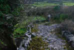
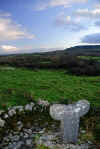 The road eventually led us back into Corofin. We headed back up towards Kilfenora
looking for the Tau Cross site along the way. The Tau Cross also known as
the Crois Inneenboy, is a t shaped cross of which there are only two in Ireland.
A face is carved on either end of the solid piece of limestone. Evidently
this design was more common on
croziers of the period.
The one we were looking for is alongside the road near Lemanagh Castle. There
is a short pathway out to the cross, which is a replica. The original is in
the Kilfenora Heritage Centre. The cross it interesting, but the view from
it's location is the real draw. It is located on a high point and offers a
sweeping vista across green fields. We hurried back to the
car as the air
temperature was dropping with the sun. Back in the
car we drove onward toward
Lemanagh Castle and made a stop as a nice view of the castle appeared along
the roadway. Again risking life and limb, I pulled over as far as I could
and stood in the road taking pictures of the castle glowing in the setting
sun. Having avoided becoming roadkill, we headed back to Kilfenora to get
some dinner and take a nap before the community night in
Linnane's pub kicked off about 10PM.
The road eventually led us back into Corofin. We headed back up towards Kilfenora
looking for the Tau Cross site along the way. The Tau Cross also known as
the Crois Inneenboy, is a t shaped cross of which there are only two in Ireland.
A face is carved on either end of the solid piece of limestone. Evidently
this design was more common on
croziers of the period.
The one we were looking for is alongside the road near Lemanagh Castle. There
is a short pathway out to the cross, which is a replica. The original is in
the Kilfenora Heritage Centre. The cross it interesting, but the view from
it's location is the real draw. It is located on a high point and offers a
sweeping vista across green fields. We hurried back to the
car as the air
temperature was dropping with the sun. Back in the
car we drove onward toward
Lemanagh Castle and made a stop as a nice view of the castle appeared along
the roadway. Again risking life and limb, I pulled over as far as I could
and stood in the road taking pictures of the castle glowing in the setting
sun. Having avoided becoming roadkill, we headed back to Kilfenora to get
some dinner and take a nap before the community night in
Linnane's pub kicked off about 10PM.
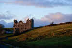
A wild community night in
Linnane's pub in Kilfenora kicked off with our arrival in a mostly deserted
pub. We were not deterred as we'd learned that Irish events rarely start on
time. We pulled up a stool at the bar and chatted with the girl serving us.
She was in to provide assistance for what was believed to be a busy night.
Linnane had gone home for a quick rest and would be back soon. The other end
of the bar was held up by four characters that were a interesting assortment
of regulars. Each was in a different stage of intoxication ranging from boisterous
to hanging on to the bar for dear life. Each was talking and occasionally
their words crossed paths into a comprehensible discussion. Topics ranged
from the economy to the words to the Davy Crockett TV show theme. They were
obviously trying to draw us into the conversation, but we were having a hard
time understanding them and talking politics with a drunken Irishman didn't
seem to be a good start to a community evening. Our girl behind the bar just
shook her head and made a comment about desperate men. Eventually Linnane
returned, a peat fire was lit, and the pub filled up with an assortment of
people of all ages. Drinks made their rapid way to hands and down throats
and eventually someone broke into song. A semi quiet hush descended and then
applause broke out at the conclusion. Stories were told, songs were sung and
the Guinness and Jameson flowed like water. Somewhere in the course of the
evening we were reacquainted with people we'd met in 2005. Of course they
remembered us, or so they said and we had a chat about the wedding that had
taken place (we'd been invited), the old guy we'd met in 2002 and many other
topics that don't come to mind now. Along the way the locals realized we were
there and took to buying us drinks. Karen declined but said that I'd be happy
to accept. It seemed every time I looked away or went to visit the bathroom,
my pint was full and as often as not is was kept company by a warming shot
of Jameson. I had been alternating between Bulmers and Guinness, but now it
seemed the my future involved only the black stuff. I sipped slowly, but that
didn't help as more drinks appeared next to the half empty ones. Bar snacks
began to make their way around and I desperately grabbed whatever came by
to provide some ballast for an empty stomach. Fried chicken bits were first,
followed by cheese sandwiches cut in quarters, then sausage rolls and perhaps
mozzarella sticks. These helped stopped the runaway train, but eventually
the long day, myriad of drinks, and the warm confines of the pub took their
toll. Things were winding down anyway and we took the opportunity to say our
goodbyes, thank yous and escape into the cold night air. The air helped clear
my head, but I don't remember much of the drive back to the cottage. I imagine
the locals back in the pub high fiving each other and saying "there's another
American down". Bed seemed like a good idea as it was about 1AM and we had
a busy day packing and heading out to Shannon.
|
TOP
| BACK
|
Kilfenora, Co. Clare
|
|
Saturday 1/12
Time to head out of Kilfenora and prepare for the trek
back home. We packed up with little excitement other than my stomach rejecting
the rather dubious contents from the night before. I wasn't really sick or
hungover, just wanting to be rid of a gallon or so of now sour Guinness and
Bulmers mixed with chicken fingers, cheese
sarnies, sausage rolls and Jameson. Once unencumbered I set to packing
the
car with a bit more gusto. We'd paid up the day before and once we'd given
the place a good cleaning, we made the drive up the hill and out through Kilfenora.
The town was also recovering from the night before and very little was stirring.
We waved goodbye to anyone who was watching and took the road to Ennis.
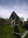 Along the way we couldn't resist a final foray to a graveyard. We'd passed
Inagh and spotted one right before Ennis on the N85 on a steep slope of a
hill. We did a quick u-turn an went back to the nearest side road which fortunately,
led right to it. This was
Kilnamona graveyard.
Kilnamona means something like Church of the Marshy Field or Bog. As it
was on a hillside, we were spared the bog slogging. There wasn't a lot to
see except the remains of a chapel wall and mostly newer headstones. The grey
sky started spitting rain and a cold wind came up. It pretty much fit with
our feeling about leaving. We managed a few pictures before our fingers and
toes started getting numb, and headed back to the
car. Back on the N85 we
made our way into Ennis city center.
Along the way we couldn't resist a final foray to a graveyard. We'd passed
Inagh and spotted one right before Ennis on the N85 on a steep slope of a
hill. We did a quick u-turn an went back to the nearest side road which fortunately,
led right to it. This was
Kilnamona graveyard.
Kilnamona means something like Church of the Marshy Field or Bog. As it
was on a hillside, we were spared the bog slogging. There wasn't a lot to
see except the remains of a chapel wall and mostly newer headstones. The grey
sky started spitting rain and a cold wind came up. It pretty much fit with
our feeling about leaving. We managed a few pictures before our fingers and
toes started getting numb, and headed back to the
car. Back on the N85 we
made our way into Ennis city center.
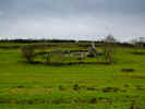
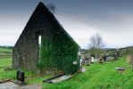
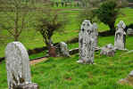
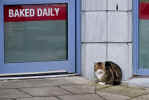 We picked up a few bits and bobs to round out any last minute shopping. It
was still early so Ennis was pretty quiet and other than a cat in front of
the deli by the car park, not much was happening. We kept hoping for some
off season deals, but nothing was leaping out at us. We checked our list of
people and made a few final purchases and headed off towards the Shannon Airport
and some last night accommodations. We did a bit of driving around the area
both to establish our route to the airport in the morning and to get the lay
of the land. Most of the area seemed to be newer housing in a kind of sprawling
patchy development style.
We picked up a few bits and bobs to round out any last minute shopping. It
was still early so Ennis was pretty quiet and other than a cat in front of
the deli by the car park, not much was happening. We kept hoping for some
off season deals, but nothing was leaping out at us. We checked our list of
people and made a few final purchases and headed off towards the Shannon Airport
and some last night accommodations. We did a bit of driving around the area
both to establish our route to the airport in the morning and to get the lay
of the land. Most of the area seemed to be newer housing in a kind of sprawling
patchy development style.
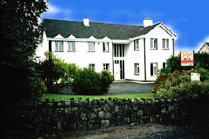 Fort
Lach B&B was a lucky find in Drumline near the Shannon Airport. This would
be a good stop either on arrival or before departure, or as a central area
to explore the Clare area. We had not prearranged a place and did a walkup
to the door. Fortunately they had a room and were accommodating to our dragging
in all the bags for rearranging and repacking. There are many options for
food in the area and we found
Newmarket-On-Fergus
to be the best option for shopping and restaurants. We drove into Newmarket-On-Fergus
and had dinner at The Weavers Inn. It looked like a traditional Irish pub
with a large fireplace. Strangely enough, it specialized in Indonesian food
which was quite good. Karen had a final Guinness, but I stuck to Orange Club
as I had not recovered to the violence done to my stomach by
Linnane's the night before. Fort
Lach B&B was a lucky find in Drumline near the Shannon Airport. This would
be a good stop either on arrival or before departure, or as a central area
to explore the Clare area. We had not prearranged a place and did a walkup
to the door. Fortunately they had a room and were accommodating to our dragging
in all the bags for rearranging and repacking. There are many options for
food in the area and we found
Newmarket-On-Fergus
to be the best option for shopping and restaurants. We drove into Newmarket-On-Fergus
and had dinner at The Weavers Inn. It looked like a traditional Irish pub
with a large fireplace. Strangely enough, it specialized in Indonesian food
which was quite good. Karen had a final Guinness, but I stuck to Orange Club
as I had not recovered to the violence done to my stomach by
Linnane's the night before.
|
TOP
| BACK
|
Shannon, Co. Clare to Dallas, TX
|
|
Sunday 1/13
In the morning our hosts were friendly and the
breakfast excellent. A final full Irish. We made it to the airport, returned
the
car and got on the plane without incident, but with the usual regrets
at leaving Ireland. Shannon is a much nicer airport to fly out of than Dublin.
More modern at the least. Sometimes old stuff isn't all that charming.
We had a reasonably nice flight, but as we approached Chicago it
was apparent the weather wasn't good. No problem getting into Chicago, but
getting out took awhile and put us behind schedule with an already tight connection
in Dallas.
Dallas was a painful excursion with an unintentional extended stay.
We spent a long time sitting on the tarmac while we watched the time tick
away. When we got off the plane we made a mad dash for the connecting flight.
Unfortunately, it was about as far across the airport as possible, and we
arrived at the desk to find the gate closed. No luck trying to talk our way
on. Seems to me that they should have known we were connecting and could have
held the gate for a few minutes longer. There were quite a few people who
missed the flight. We were told that we'd be provided accommodations for the
night, we should go down to the taxi area, and a van would pick us up. 45
minutes later, no van. It was late in the evening and we were tired and losing
patience. After a few phone calls back to the desk, I got the number of the
hotel. We were told the driver was on the way. Still nothing and more calls
were made. About 2 hours later the van arrived with a surly young man behind
the wheel. About seven people piled in and we were taken on a very long ride
to a remote hotel. Along the way we hit every pothole possible on both sides
of the road. Several people communicated their dissatisfaction to the desk
help with no particular luck, so we didn't bother. We collected a room key
and went to a dingy room that was large but in need of a good cleaning and
remodel. It was to late to go out for any food and we didn't want to face
a delivered pizza or its bearer, so we drank some water and ate some worn
and well aged snacks from our carry on and went to bed.
|
TOP
| BACK
|
Dallas, TX to Portland, OR
|
|
Monday 1/14
After an uncomfortable night in the no tell motel, we showered,
dressed and went to the complimentary breakfast area. A small back room had
cereal and some old fruit and an odd assortment of foods including waffle
batter and plastic sausage patties that came out of some kid's McDonalds happy
meal toy set. Most of it looked like it could be packed away for reuse tomorrow
and had been yesterday and probably the day before. We foraged for fresh bits,
ate a little, and headed back on a long ride to the airport. We arrived early
to avoid further issues and checked in and managed to complete the rest of
the trip without incident. We're looking forward to returning to Ireland,
but not Dallas in 201?.
|
TOP
|
BACK
|